
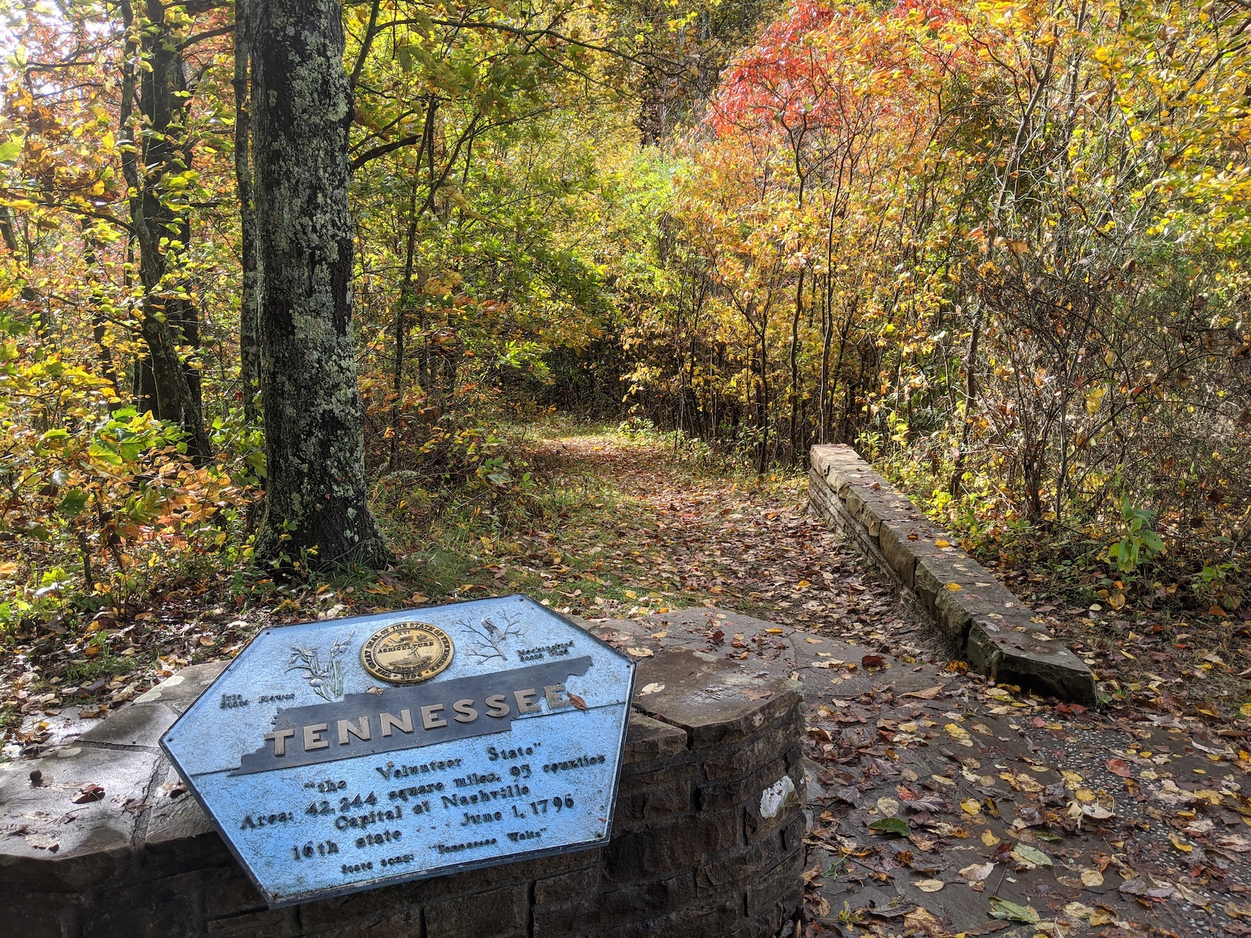
The Tennessee state line in Bristol
Let’s start with Tennessee’s borders.
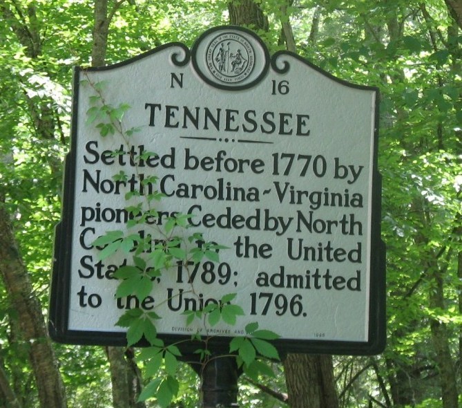
This sign at the border of Tennessee
and North Carolina which has Virginia
creeper growing on it
Eastern border
Most of Tennesee’s early settlers came from North Carolina, and at one time northeast Tennessee was part of North Carolina. Therefore, North Carolina can be thought of as Tennessee’s “mother state.”
Tennessee’s western boundary is defined in its constitution. It goes from mountain top to mountain top, crossing mountain peaks with names such as Stone, Yellow, Iron, Bald and Smoky.

The Tennessee-North Carolina border
Since people generally don’t build communities on mountain peaks, there hasn’t been a lot of controversy regarding Tennessee’s boundary with North Carolina over the years.
The most interesting thing about the border between North Carolina and Tennessee is how many people walk along it.
The Appalachian Trail runs 2,179 miles from Maine to Georgia. About 200 miles of the trail runs along the border between Tennessee and North Carolina.
So it is possible to walk along the trail for miles with one leg in Tennessee and the other in North Carolina!
Northern border
The place where Tennessee meets Virginia and Kentucky all meet is a beautiful place in October!
During colonial times, the King of England declared that the border between North Carolina and Virginia would be 36 degrees, 30 minutes north latitude. That same dividing line was continued west when Kentucky and Tennessee were created.
Surveyors laid out this border as best they could, using technology available to them at the time.
In 1749, the estimated location of this line of latitude in extreme northeast Tennessee was laid out by two surveyors — one of whom was Thomas Jefferson’s father. They used a magnetic compass and sextant (an instrument used to approximate ship position by the location of the stars). They laid out the border to about 10 miles east of the present location of Bristol.
In 1779, surveyors Daniel Smith and Thomas Walker started where Jefferson left off. They shifted the line two miles south, then took it hundreds of miles west, to where the Tennessee River flows north into Kentucky.
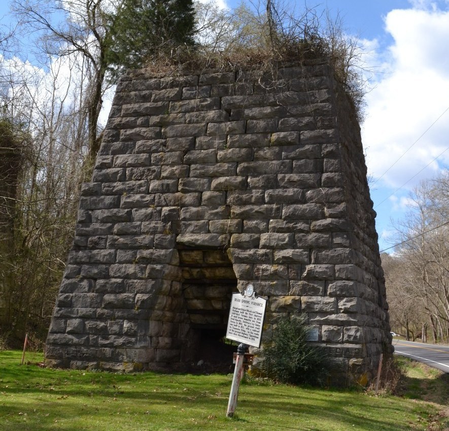
This furnace in Stewart County is one of
the remnants of its iron ore industry
Smith and Walker should have shifted the line a lot more than two miles south. Smith and Walker placed the boundary north of 36 degrees 30 minutes north latitude by a distance of somewhere in the range of 5 to 12 miles. The Tennessee-North Carolina border is actually closer to 36 degrees 35 minutes north latitude in East Tennesssee and 36 degrees 41 minutes north latitude in the Land Between the Lakes.
It is tempting to ridicule these early surveyors for this inaccuracy. However, it is important to understand the crudeness of their technology and the conditions under which they worked.

The Tennessee/Kentucky border in the area
of the Land Between the Lakes
Not long ago, surveyor and historian named Bart Crattie went along the Tennessee/Kentucky boundary in Stewart County, where the border shifts upward by a couple of miles. He used a magnetic compass to see what it must have been like for Smith and Walker. Among other things, Crattie found that the abundance of iron ore in the ground made his magnetic compass less reliable!
Land west of the Tennessee River didn’t become part of Tennessee until after the 1818 Chickasaw Purchase.
By that time, better surveying equipment was available, which is why the Tennessee/Kentucky border in West Tennessee is very close to 36-30.
Southern border
Now for the border that has made the most news in recent years.
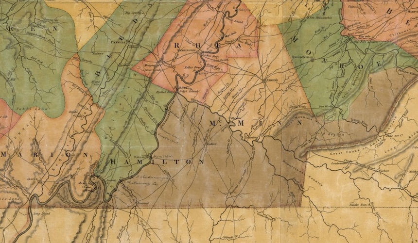
Matthew Maury’s 1832 map of Tennessee
When Congress voted to make Tennessee a state in 1796, it set 35 degrees north latitude as the boundary between Georgia and Tennessee (Alabama and Mississippi didn’t exist yet).
At the time, this line between Tennessee and Georgia was in Cherokee territory. It wasn’t until 1818 that the two states appointed a team of surveyors to lay out the border. They were led by University of Georgia professor James Camak and Tennessee mathematician James Gaines.
Like the surveyors who laid out Tennessee’s northern boundary, Camack and Gaines had magnetic compasses and sextants that were primarily used for maritime navigation. Considering the accuracy of their equipment and the terrain in which they operated, they did a remarkably good job. However, we now know that they placed the border about a mile south of 35 degrees north.
That border was later continued west, in a straight line, all the way to the Mississippi River.
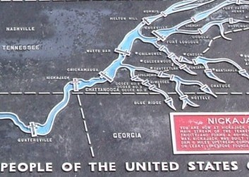
As you can see from this TVA map, the Tennessee River doesn’t miss Georgia by much.
This tiny surveying error is interesting when you consider what is near this border — namely, the Tennessee River. Had Camack and Gaines surveyed an accurate boundary line, the state of Georgia would have access to the one of the largest sources of freshwater in the southeast United States.
Atlanta has historically had a water problem because the city does not contain a large river. A few years ago, the Georgia legislature asked the state of Tennessee to consider the idea of moving the border to the actual location of 35 degrees north.
The governor of Tennessee politely declined.
Western border
Today you can barely see the Mississippi River
from Fort Pillow
You might think that Tennessee’s western boundary would be the simplest of all. After all, the state’s western boundary is the Mississippi River — right?
Wrong.
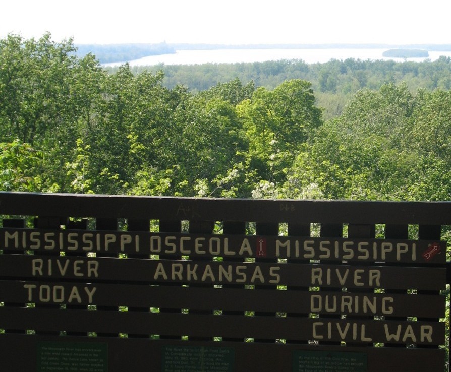
After the Chickasaw Purchase of 1818, the Mississippi River became Tennessee’s western boundary. Problem is, the Mississippi River occasionally moves, because that’s what rivers do.
Perhaps the most vivid example of this movement has to do with the Civil War garrison known as Fort Pillow.
During the Civil War, Fort Pillow was located on top of a bluff overlooking the Mississippi River.
Today, Fort Pillow is several miles from the river.
The fort hasn’t moved. The river has.
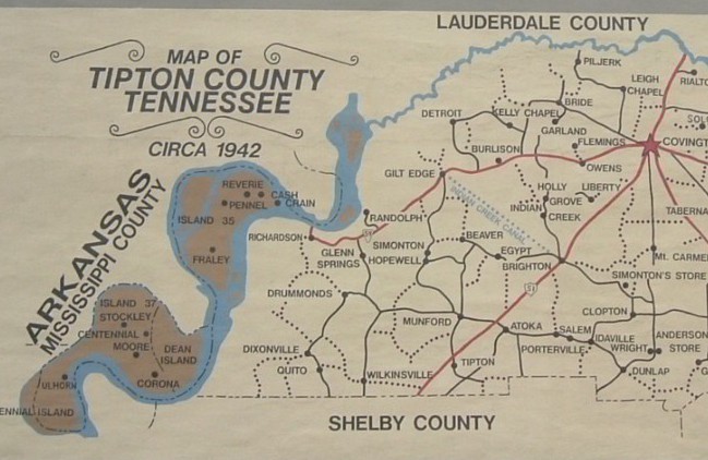
In this mural map of Tipton County, the areas
that are in the county but west of the Mississippi River are shown in brown.
Because of the movement of the Mississippi River, there has been lots of confusion about where the boundary is. The U.S. Supreme Court has heard at least nine cases about the controversy.
So what’s the best way to put it?
Tennessee’s boundary with Arkansas is where the channel of the Mississippi River was in 1836, when Arkansas became a state.
Tennessee’s boundary with Missouri is where the channel of the Mississippi River was in 1821, when Missouri became a state.
Click here for the next chapter.