
Flying over Nashville, one can easily identify places where entire neighborhoods have just been built.
One might think that Tennessee’s rivers, mountains and counties have always looked like this.
That would be wrong.
Tennessee didn’t used to look anything like this.
Ever since explorers and settlers crossed the Appalachian Mountains into Tennessee, people have changed the Tennessee landscape in countless ways.
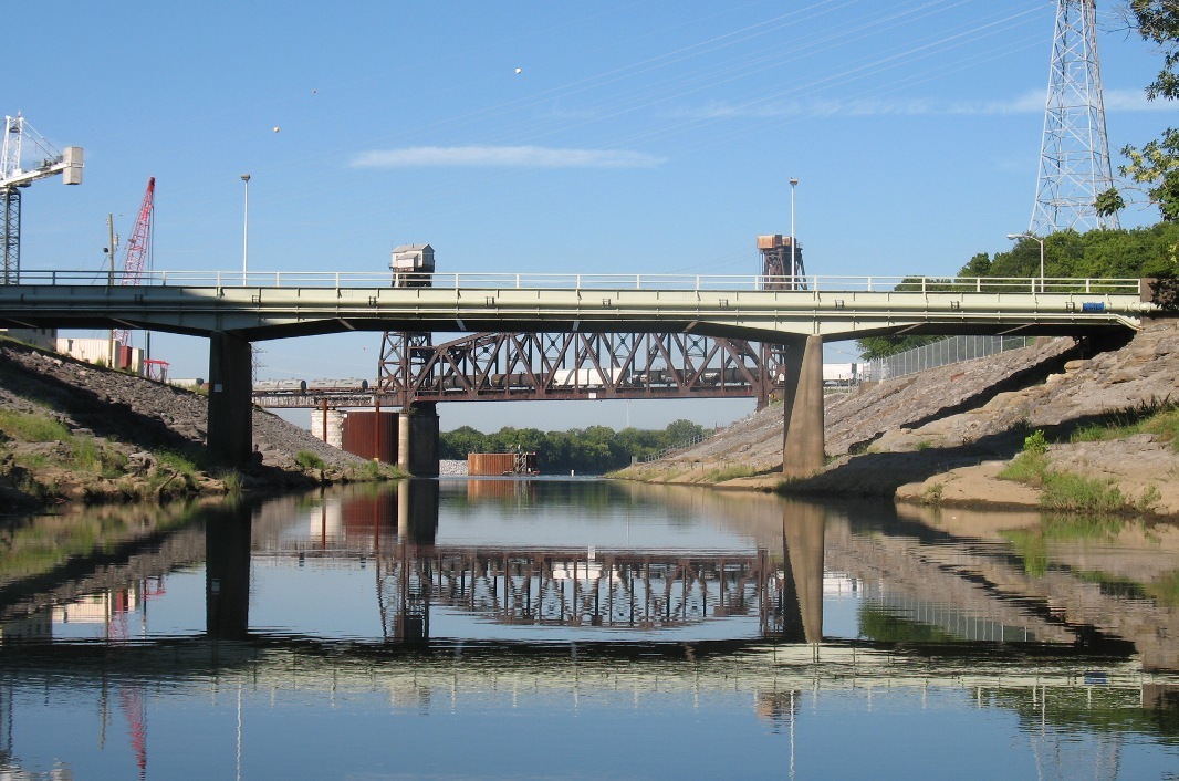
The view from Chickamauga Creek toward its
confluence with the Tennessee River,
near Chattanooga
They have dammed up rivers and created lakes where land used to be. They have cut down hundreds of thousands of trees and created farmland where forest used to be.
They have flattened hills and created highways through where they used to be.
They have even introduced new plants that completely change the way the forest used to look.
Here are some specific examples of how the geography of Tennessee has been changed since the explorers:
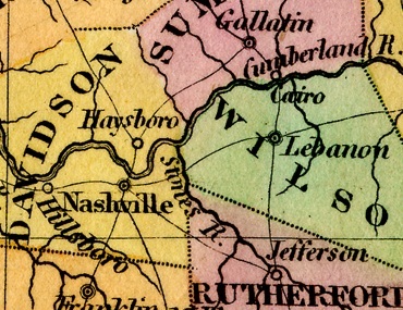
In this 1831 map, you can see that the Cumberland and Stones rivers were just that — rivers …
Man-made lakes
When explorers and settlers first came to Tennessee, all of its rivers were wild. The Tennessee and Cumberland rivers flowed uncontrollably through their banks and, sometimes, flooded over their banks.
In the winter and spring, rivers were deeper wider and faster than they were in the summer and fall.
There were a couple of sections of the Tennessee River where the river descended so fast that boats couldn’t get through.
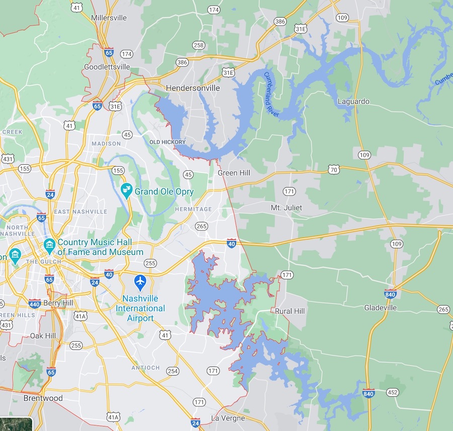
On this google map, you can see how the rivers have become lakes
But starting in the early 1900s, power producers such as the Tennessee Electric Power Company began building dams along rivers in Tennessee, mainly to generate electricity.
The process of building dams along the rivers was eventually taken over by government entities such as the Army Corps of Engineers and the Tennessee Valley Authority.
From the 1930s through the 1970s, these two organizations built dam after dam along the Tennessee and Cumberland rivers to help control flooding, improve navigation and generate power.
The end result of all these massive construction projects is a series of man-made lakes such as Kentucky Lake, Chickamauga Lake, Tellico Lake, Old Hickory Lake and many others.

This placid section of the Tennessee River used to contain roaring rapids
Because of these changes, the Tennessee and Cumberland rivers are not wild like they once were.
Just downstream from Chattanooga, the Tennessee River used to speed up and go through a series of rapids, twists and turns with names like the Suck, the Boiling Pot, the Skilled and the Frying Pan. When Hales Bar Dam was completed in 1912, these legendary sections of the river were forever buried and silenced under deeper water.
Deforestation

Unbroken forest, perhaps like what the settlers found
When explorers first found Tennessee, it was an endless, unbroken forest from one end of the state to the other. The only major breaks in this forest appear to have been in the Central Basin of Middle Tennessee, where there were open fields here and there.
Settlers changed this by cutting down trees and creating farmland.
By the end of the 19th century, it had gotten to the point where, there weren’t many trees left in certain parts of Tennessee.
If you look at photographs of the state taken in the late 1800s, you immediately notice that, in many places, there weren’t very many trees any more.
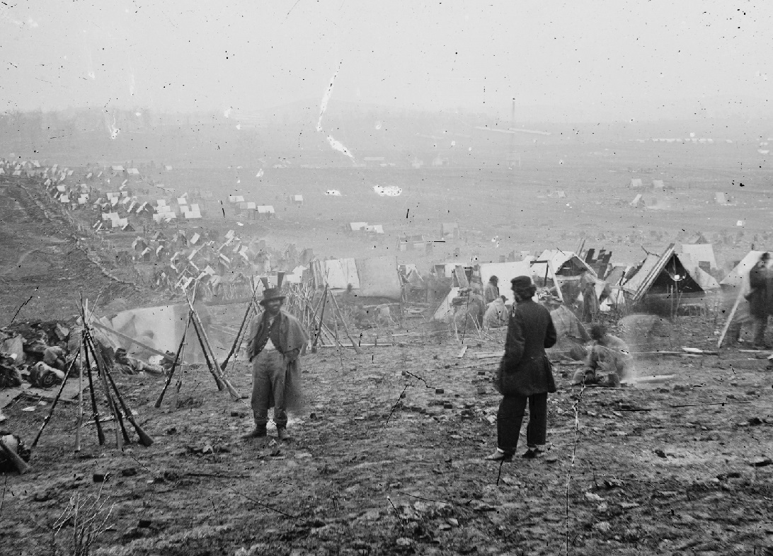
This photo was taken in Nashville during the Civil War. Interesting question: Why have all the trees been cut down?
PHOTO: Library of Congress
Much of the deforestation has been reversed in the last half century, as some farmland has become overgrown and begun returning to forest. But it is hard for us to imagaine what Tennessee would have looked like in the late 18th and early 19th centuries.
Another thing that happened along with the deforestation changed Tennessee forever.
In their drive to survive, the need to protect their farmland and livestock, and their overzealous urge to conquer nature, Tennessee’s early settlers drove certain species of animals practically out of the state.
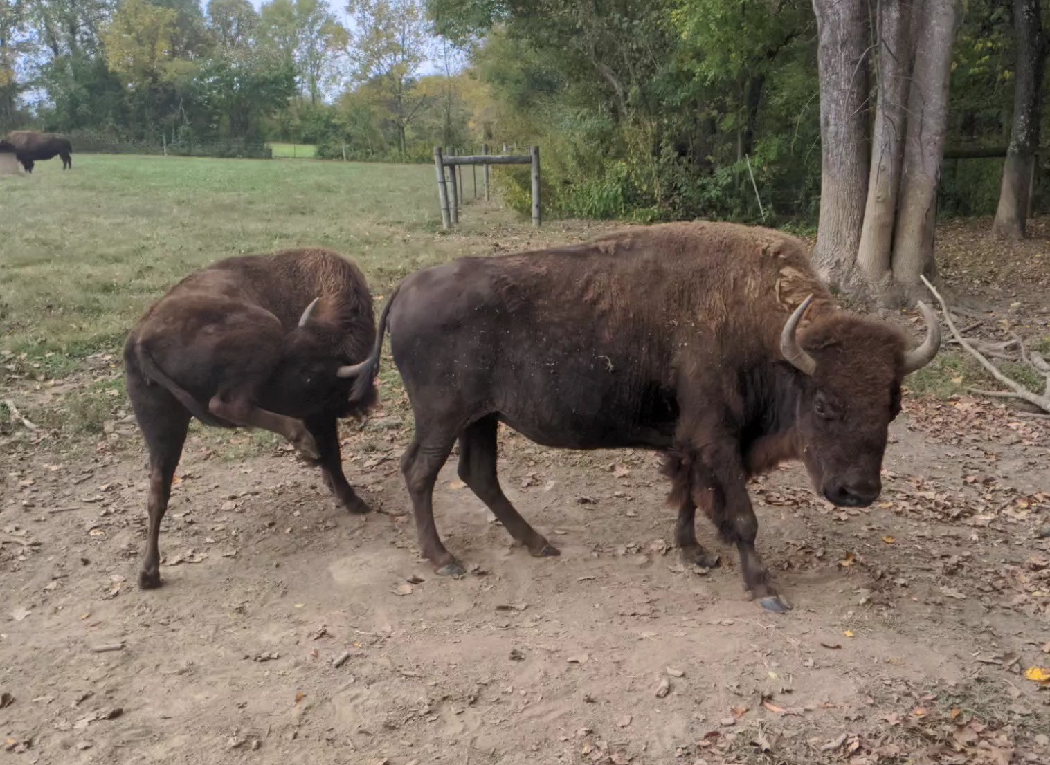
Bison at Wilderness Road State Park in Virginia
When the longhunters were roaming around Middle Tennessee in the 1760s, there were large herds of bison grazing naturally all over Middle Tennessee. Those bison were completely gone by 1820.
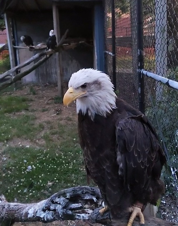
A bald eagle at Reelfoot Lake State Park
When David Crockett moved to Gibson County in the 1830s, there were so many black bears there that he (reportedly) killed more than a hundred of them in a six-month period. Today, most people in Gibson County have never even seen a black bear in the wild.
Today, some of the species that left Tennessee have begun to slowly return. A good example of this is the bald eagle, which can be seen in places such as Reelfoot Lake and Fort Donelson.
Ghost towns
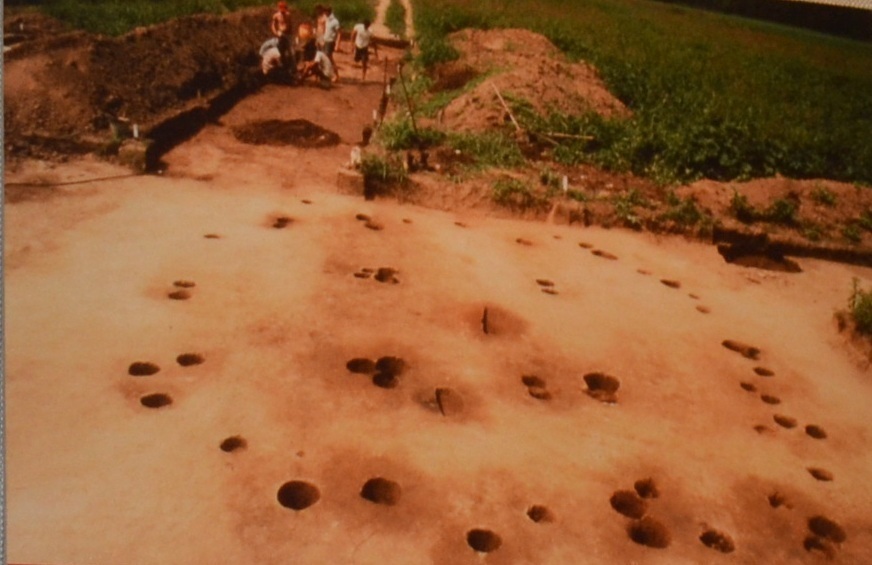
The archaeological remains of the winter house at Chota, shown before Tellico Lake flooded the site
PHOTO: McClung Museum
It is also important to remember that human communities come and go.
Southeast Tennessee used to contain dozens of Cherokee villages with names such as Tanase, Tomotley, Chota, and Settico. You can see some of these places on old maps of Tennessee.
When Native Americans were forced to leave Tennessee during the Indian Removal of 1838, these villages were abandoned. The land on which most of these villages was located has since been flooded by man-made lakes.
A town need not to have been Native American to have been abandoned.
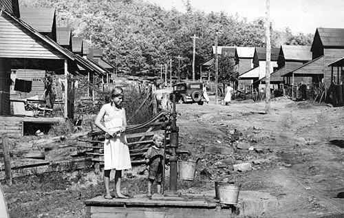
Wilder in the 1930s. Today, the area
shown by this photo is woods.
PHOTO: Kendall Morgan
All throughout the Cumberland Plateau and Highland Rim are abandoned coal mining towns, the most famous of which is Wilder. (Click here to read more about this on the Fentress County web page.)
There was once a important town called Port Royal on the eastern edge of Montgomery County. No one lives there anymore except the manager of the Port Royal State Historic Park.
And, in West Tennessee, the city of Memphis originally had a rival upstream called Randolph. The town of Randolph once had homes, hotels, a school and a regular newspaper.
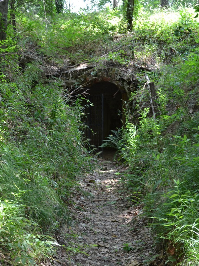
This is all that’s left of Randolph
Today, nothing is left of Randolph except for an underground gunpowder magazine, left behind by the Confederate Army.
And now for chapter 10 of the Advanced Geography section — a compilation of things about Tennessee Geography that most people find hard to believe. Click here.