Teacher’s Guide to Around the World
Welcome to the teachers’ guide to the Tennessee History for Kids booklet Around the World.
Please do NOT copy the booklets. That is a violation of our copyright and makes it difficult for us to continue to exist. The reason we sell them for only $2.50 is so teachers will not be tempted to copy the booklets. We print these booklets on non-glossy paper because we want students to write in their booklets and keep them.
If you would like answers to the quiz questions in the booklet, email Bill Carey at bill@tnhistoryforkids.org.
 Chapter One: Peninsulas and Plateaus
There is a lot of content in this chapter, especially for a third grader. I realize that. I think photos are the key to helping students understand and remember what these terms mean.
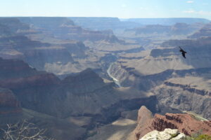
Click on the photo on the right to see another photo of the Grand Canyon. If you look closely, you can see the Colorado River, flowing at the bottom of it. Also, do you see the large bird flying on the right of the screen?
THFK photo
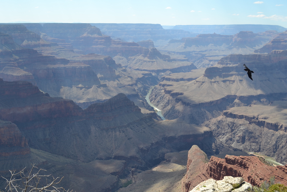
To the left (click on the photo) is a plain. True to its name, a plain is very plain. By the way, this particular photo of a plain was taken in West Tennessee, Dyer County to be precise.
NASA image
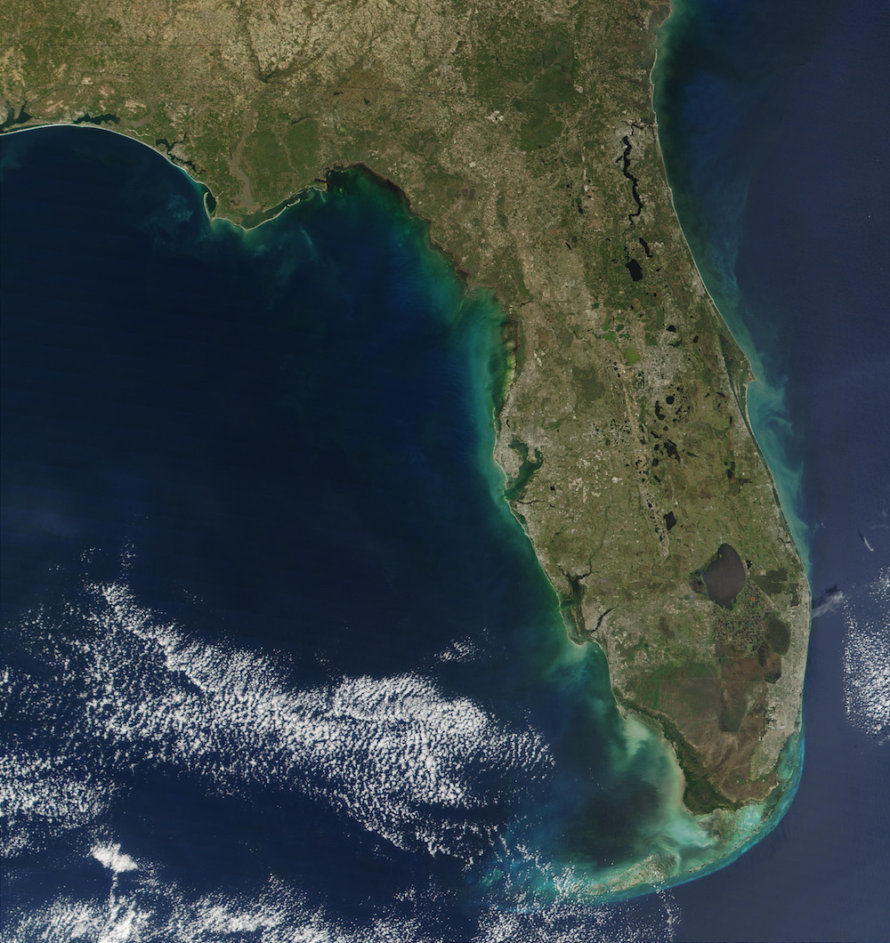
On the right is a satellite image of the peninsula of the state of Florida. Your students should be able to see Tampa Bay (chapter 2) and many lakes (also chapter 2).
THFK photo
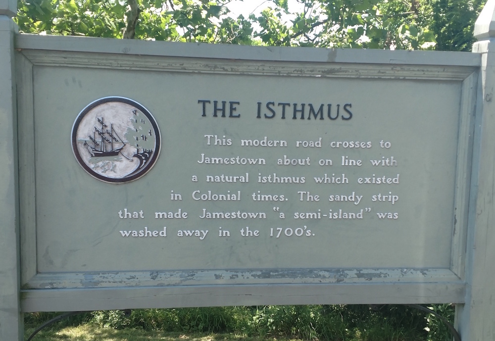
On the left is a photo of a sign that I saw when I was visiting the Jamestown, Virginia, historical attractions. Since I knew that the word isthmus is a favorite with third grade teachers (not to mention third grade students), I just had to take a photo of it!
Chapter Two: A Wet Planet
THFK photo
We can show you many photographs of rivers and lakes. Here are four of my favorites:
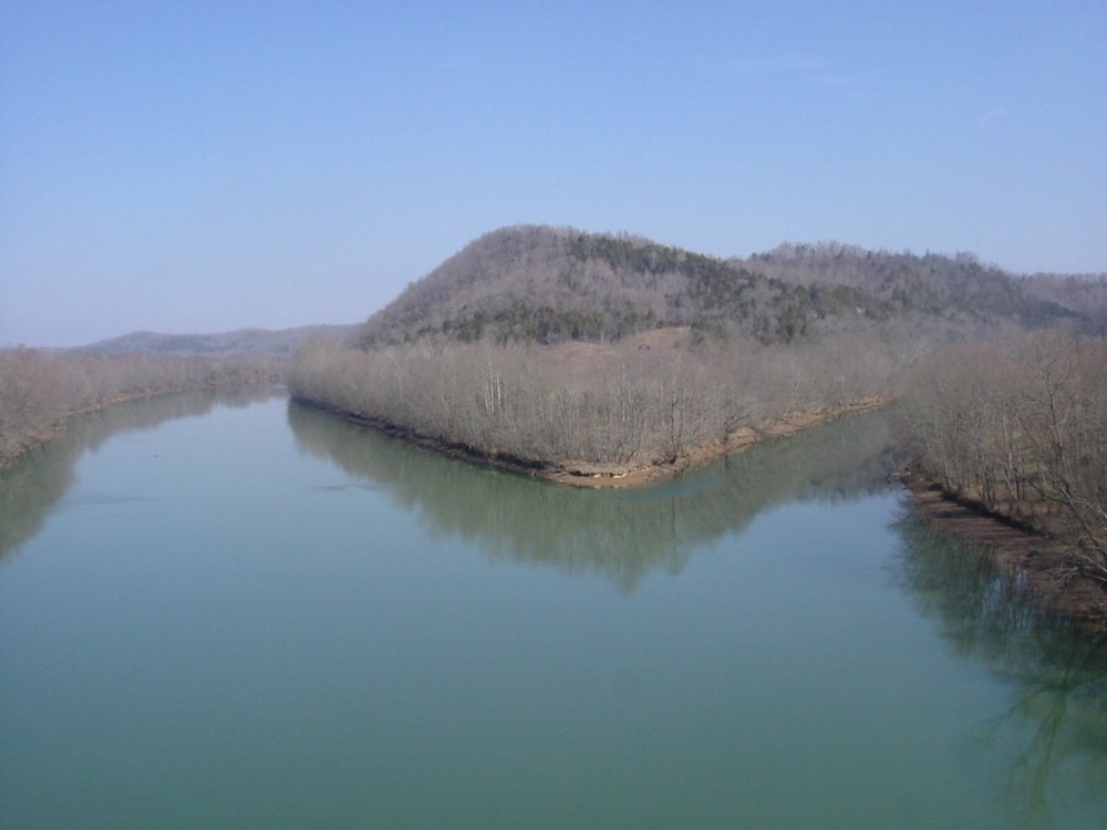
* On the top left, the Cumberland River is joined by the Obey River in Clay County.

THFK photo
* On the right is a photo of the Hiwassee River in Bradley County–a photo that makes you want to go rafting!
THFK photo
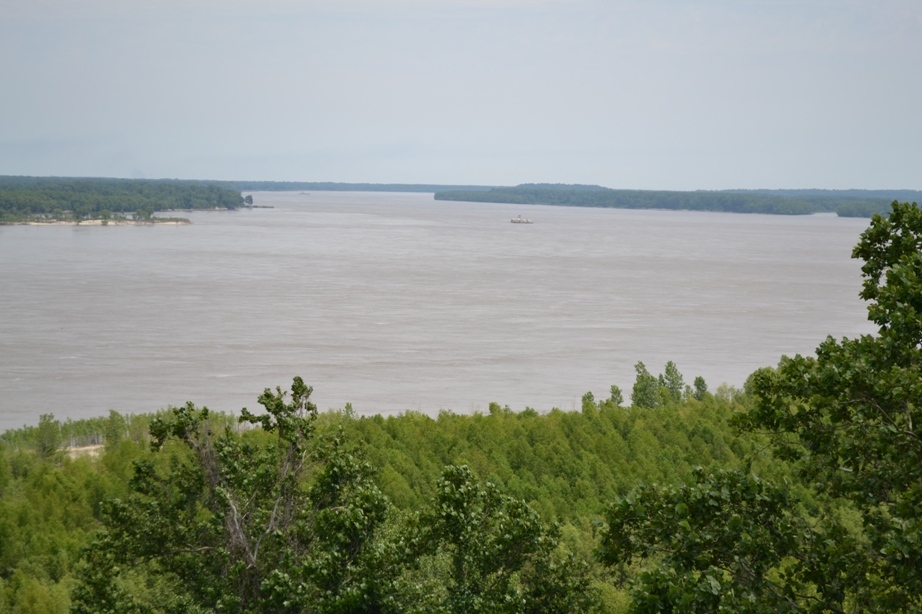
* To the left is a photo of the Mississippi River. Since the Cumberland and Tennessee Rivers are controlled by dams, many people are surprised to see how fast the Mississippi River flows, especially between November and April. It is not to be trifled with!

Brian Wilcox photo
* Finally, our friend Brian Wilcox (one of the teachers who has helped us edit our booklets over the years) took this remarkable photograph of the Tennessee River, where it passes through what is known as the “Grand Canyon of Tennessee,” west of Chattanooga.
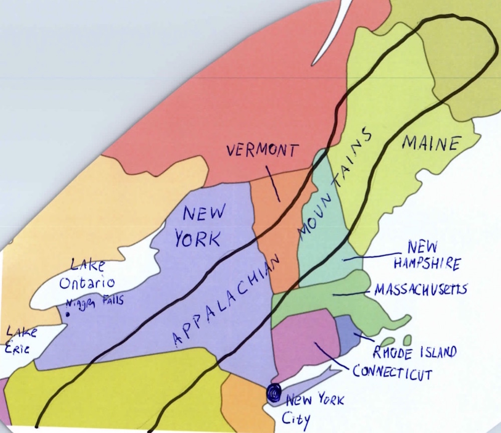
Chapter Three: Boundaries and Bridges
There is a lot of very content in chapter 3 which might get your students thinking, or talking, and might be the basis of a follow-up lesson.
THFK photo
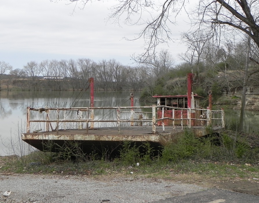
On page 14, for instance, I mention the importance of bridges. In the year 2019, in Tennessee, we take bridges for granted. As recently as 50 years ago, Tennessee had more than a dozen ferries which took people and cars from one side of a river to another, because there weren’t enough bridges. Now almost all of those ferry services are gone.
However, on the side of a highway in Smith County (photo to the right), you will find an abandoned ferry.
Click here to read a column I wrote about the history of ferries in Tennessee.

1832 Rhea Map
On page 14 we also mention canals, and of course the most famous canals in the world are ones such as the Panama Canal, the Erie Canal and the Suez Canal.
Tennessee doesn’t have any famous canals. But we nearly did. Click on this image on the left and look closely at it.
When this map was made, in 1832, there was talk of a canal that would have connected the Hiwassee to the Conasauga Rivers–which would have meant that boats could have floated all the way from the Tennessee River to Mobile Bay! However, the canal was never created.
Click here to read a column about this topic.
Deborah Carey photo
Chapter Four: Pinpointing a Globe
The photograph on page 17 shows third grade students playing with an earthball-sized inflatable globe. I’m a big fan of inflatable globes. I think there are many lesson plans to be created where the students stand in a circle, and the teacher tosses around an inflatable globe, asking them questions about world geography and latitude and longitude. Kinetic learning, I suppose.
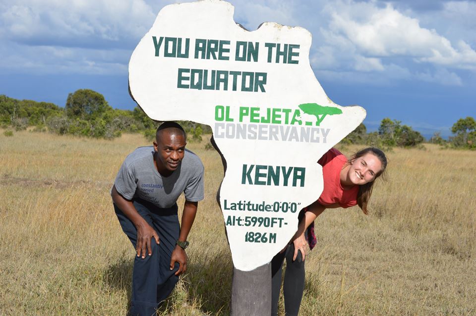
Latitude and longitude are difficult concepts to show in photographs. Fortunately, there are some pretty cool markers all over the world that have latitude and longitude information, the Equator, etc. On the right, for instance, is a photograph of my niece Deborah Carey, in Kenya.

Bill Carey photo
The naval flight officer pictured on page 22 is none other than me (Tennessee History for Kids founder Bill Carey). One of my navy buddies took this photograph of me, sitting in my workstation, on a P-3 Orion airplane in 1990. A lot of what is in front of me is my old navigational instruments–a lot of which is now hopelessly outdated.
You can see my latitude and longitude in front of me. Here is an interesting assignment: (I’m at about 31 minutes, 33 degrees North; 140 minutes, 25 degrees West.) Also, I’m heading west. Get out a globe, find out where I was, and see if you can guess why I was smiling.
Chapter Five: Our Home Planet
 Click on the image on the right for a larger version of the map on page 27.
Ezioman/Wikipedia photo
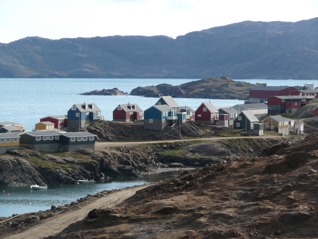
On the left is a photo of Tasiilaq, a town in Greenland. You might ask your students what conclusions they can draw about life in this town in Greenland from looking at this photo.
Chapter Six: Land of Small States
 Our designer, Angie Jones, was not amused by my plan to hand-write the names of the states and the bodies of water onto the template maps. “Those are going to look terrible,” she told me, and she insisted on doing (professionally) the maps shown on page 30.
Click on the map on the right and see the one I originally wanted to use. You think she was too harsh on me?
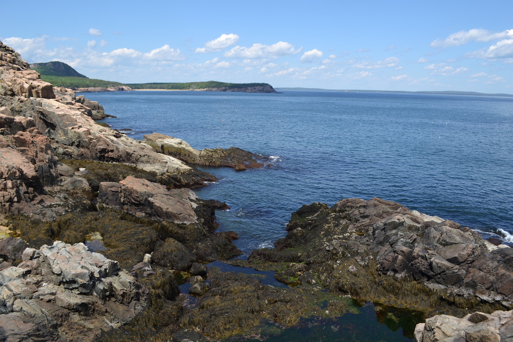
THFK photo
Finally, there are many photos in this booklet that make you want to see the world. (And there is NOTHING wrong with that, is there?) In any case, the photo on the left is one that I took on a visit to Acadia National Park, in Maine.
Click on it and see if it makes you want to go there.
Chapter Seven: The Mid-Atlantic
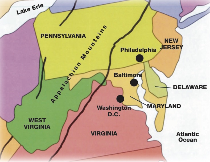 Click on the image on the right to see the page 34 map.
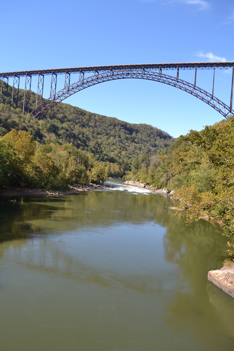
THFK photo
On the left is a different photo of the New River Gorge Bridge, shown on page 33. This bridge, one of the highest in the United States, was featured on the West Virginia quarter in 2005.
Chapter Eight: Midwest
 Click on the image on the right to see the page 39 map.
Chapter Nine: The Southeast
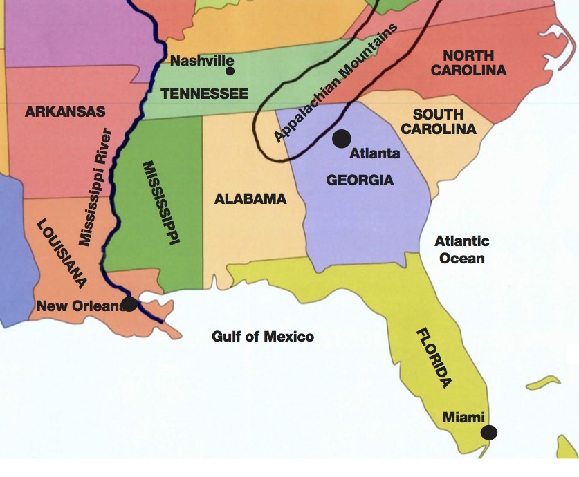 Click on the image on the left and right to see larger versions of the maps in this chapter..

CNN photo
One of the more unusual places in the Southeast is the Everglades, the largest remaining subtropical wilderness in the United States. The best place to see this place is at the Everglades National Park, and the best way to see it is by boat. On the left you can see what parts of the Everglades look like.
Chapter 10: Mountains, Plains
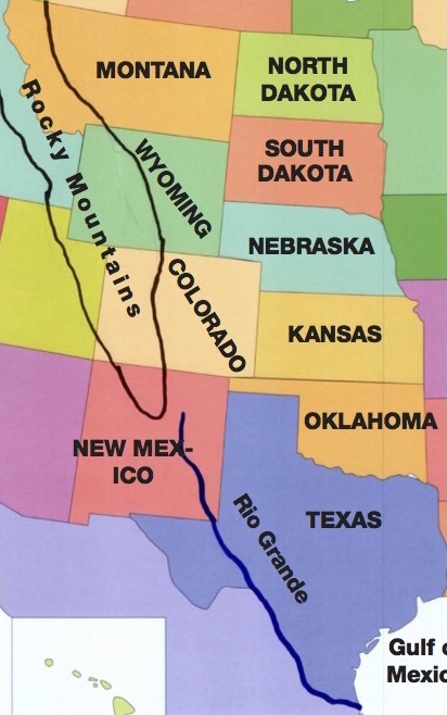 Click on the image on the right to see the page 47 map.
THFK photo
The Mountains and Plains states are interesting because they contain the flattest parts of the continental United States, and the most mountainous parts of the continental United States. However, Kansas is deceptively flat. As you drive across it, it feels as flat as a pancake. However, you are slowly climbing as you drive from east to west in Kansas; the east edge of the state has an elevation of about 850 feet, while the western edge of it has an elevation of about 4,000 feet!
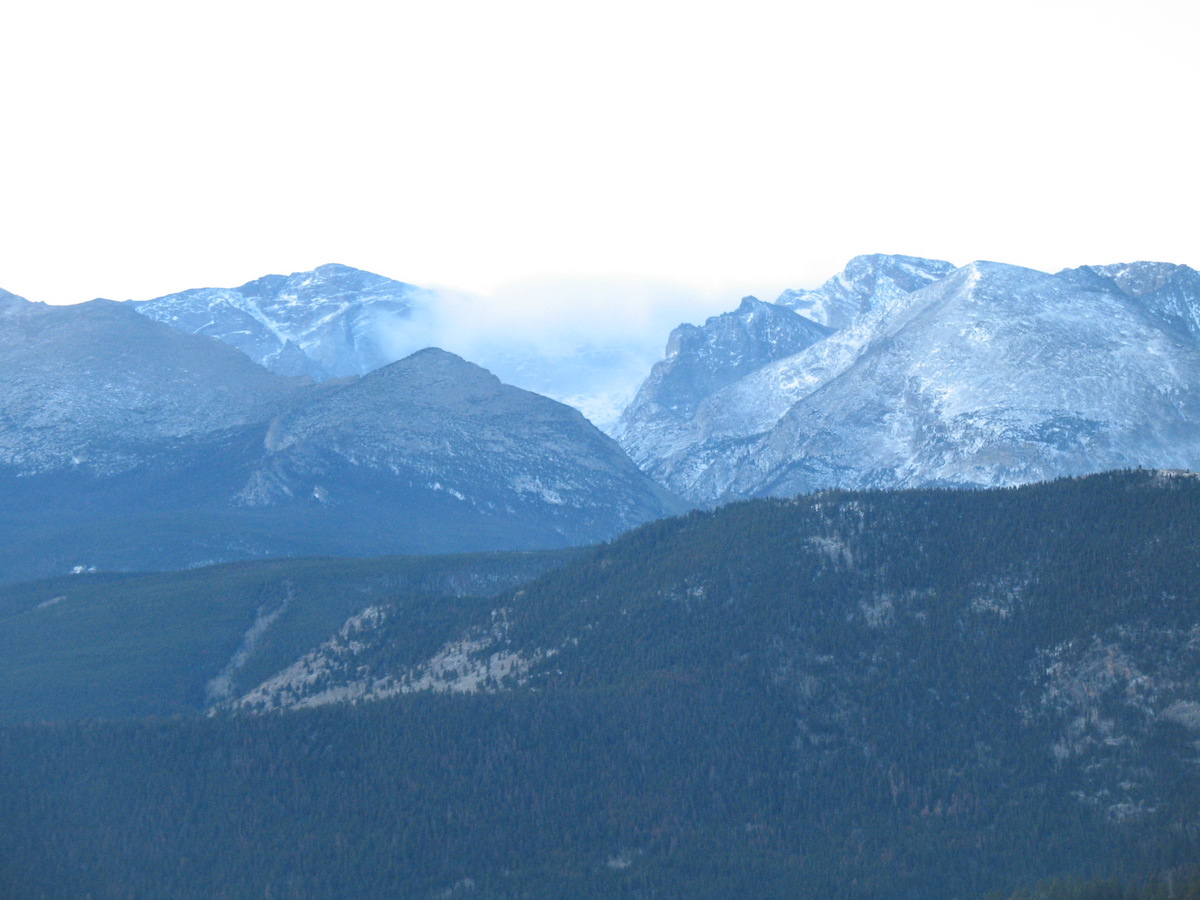
Colorado is one of the states in the Mountains and Plains region. Parts of Colorado are as flat as can be, but parts of it contain huge mountains. Click on the left for a great photograph taken at the Rocky Mountain National Park, in Colorado.
Chapter 11: The Pacific West
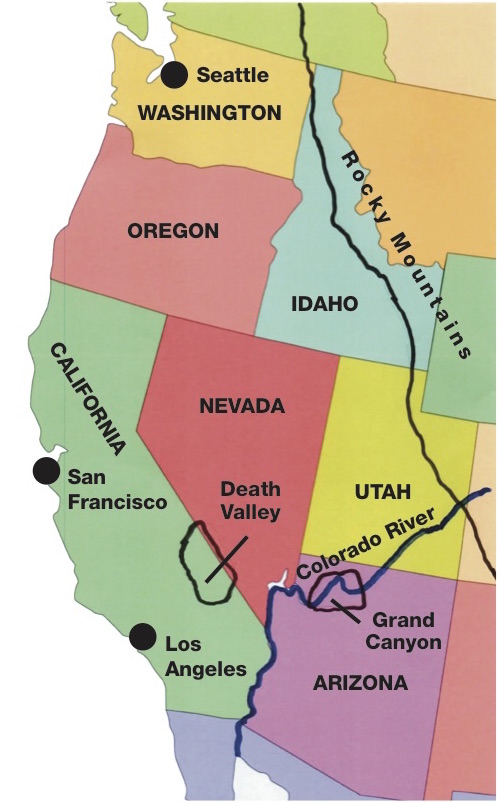 Click on the image on the right to see the page 51 map.
THFK photo
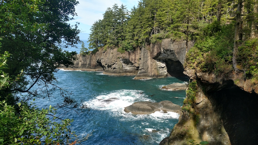
I actually took the photograph of Cape Flattery, shown on page 49. Look this up on a map to see where this is. It is the furthest northwest point in the mainland USA! I have to tell you, it is one of the most beautiful places I’ve ever been, and I practically had the whole place to myself when I was there.
Click on the image to the left to see another photo I took there.
THFK photo
Chapter 12: Southern Neighbors
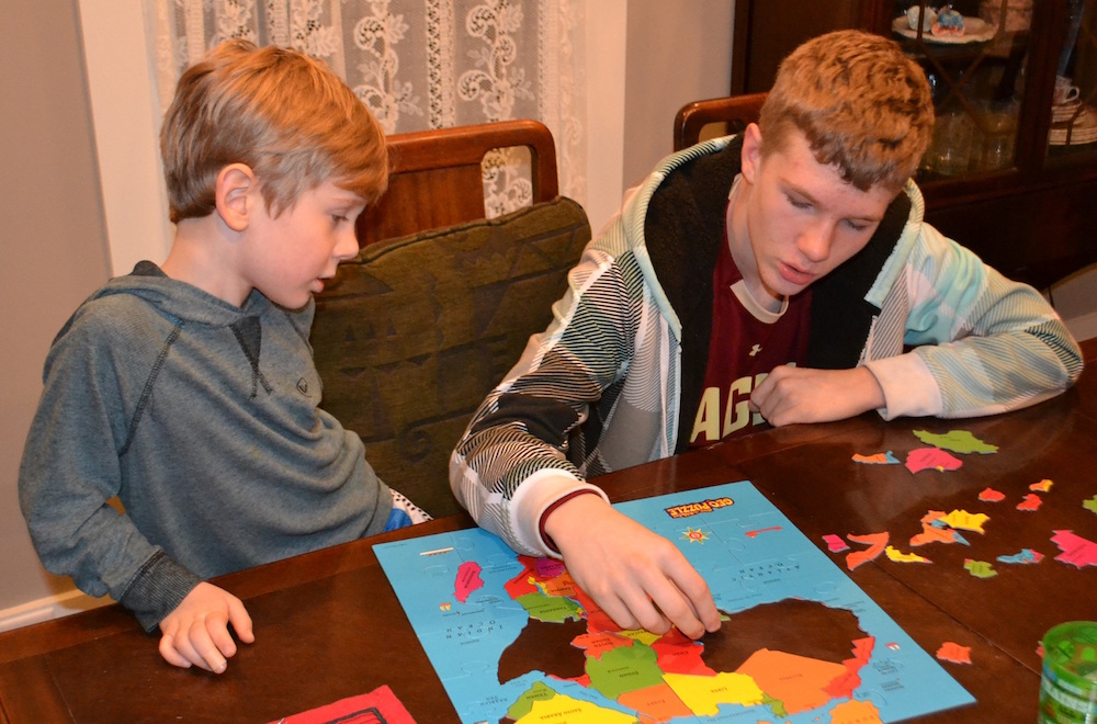
 Third grade students have a lot to learn, and third grade teachers have a lot to cover. I wonder if one way to help students learn all these states and all these countries is to use jigsaw puzzles. Here are a couple of boys learning about the geography of a continent using jigsaw puzzles.
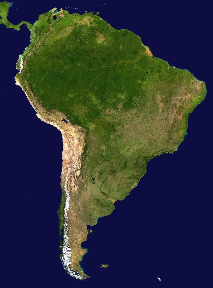
To the left you will see a satellite image of South America. These are incredibly instructional because you can see the Amazon rainforest, the Atacama Desert, and the snow-covered mountains that lie near the border between Argentina and Chile. In the Southern Hemisphere, the temperature gets colder as you get further South, which may be obvious to us but it might not be obvious to third graders.
 Chapter 13: Small Only in Size

Click on the image to right to see a larger version of the map on page 62.
If you have traveled to Germany, you probably know that the castle on page 58 is Neuschwanstein Castle. Students may recognize this castle from the movie Chitty Chitty Bang Bang (or do they not watch that movie anymore?).
Sidebar: “Never Seen the Ocean”
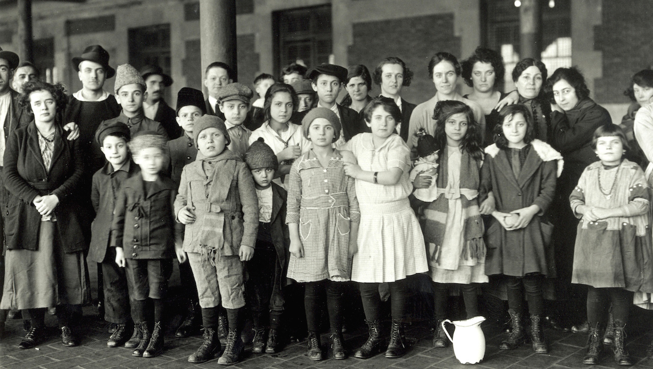
National Archives image
When we revised this booklet in 2018, we very nearly deleted this sidebar about immigrant children and Ellis Island. But the photograph on page 66-67 kept me from doing it.
Every child in America should see this photo. Click on it, to the right, to show your students. Notice the way the children are dressed; the expressions on their faces; and notice that one of them is carrying a doll.
NASA image
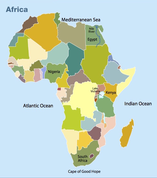
Chapter 14: Desert and Savanna
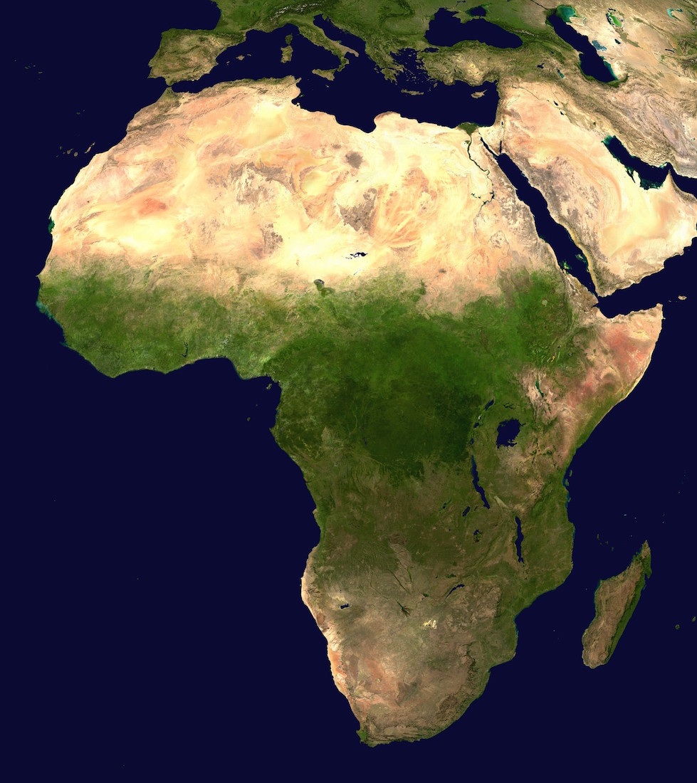
 Africa consists of large amounts of desert, savanna and rainforest. Click on this satellite image (on the right) to see what it looks like from space.
You may notice that I’ve spelled savanna one way here and another in the early editions of the booklet. Which one is correct? Well, both of them, actually. It is becoming more common now to spell the word without the “h,” but British spelling still calls for the “h”. (Apparently, I was late in getting the memo.)
NASA image
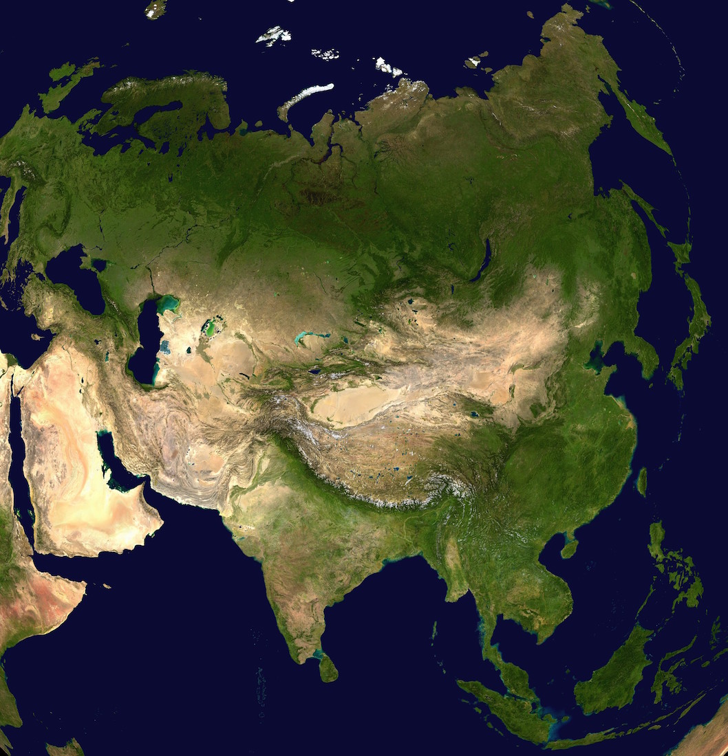
Chapter 15: The Largest Continent
Severin.stalder/Wikipedia
Click on this satellite image (on the right) to see what Asia looks like from space. You can clearly see the desert of the Arabian peninsula, the tundra of Siberia, the Himalayas and the Mongolian Plain.
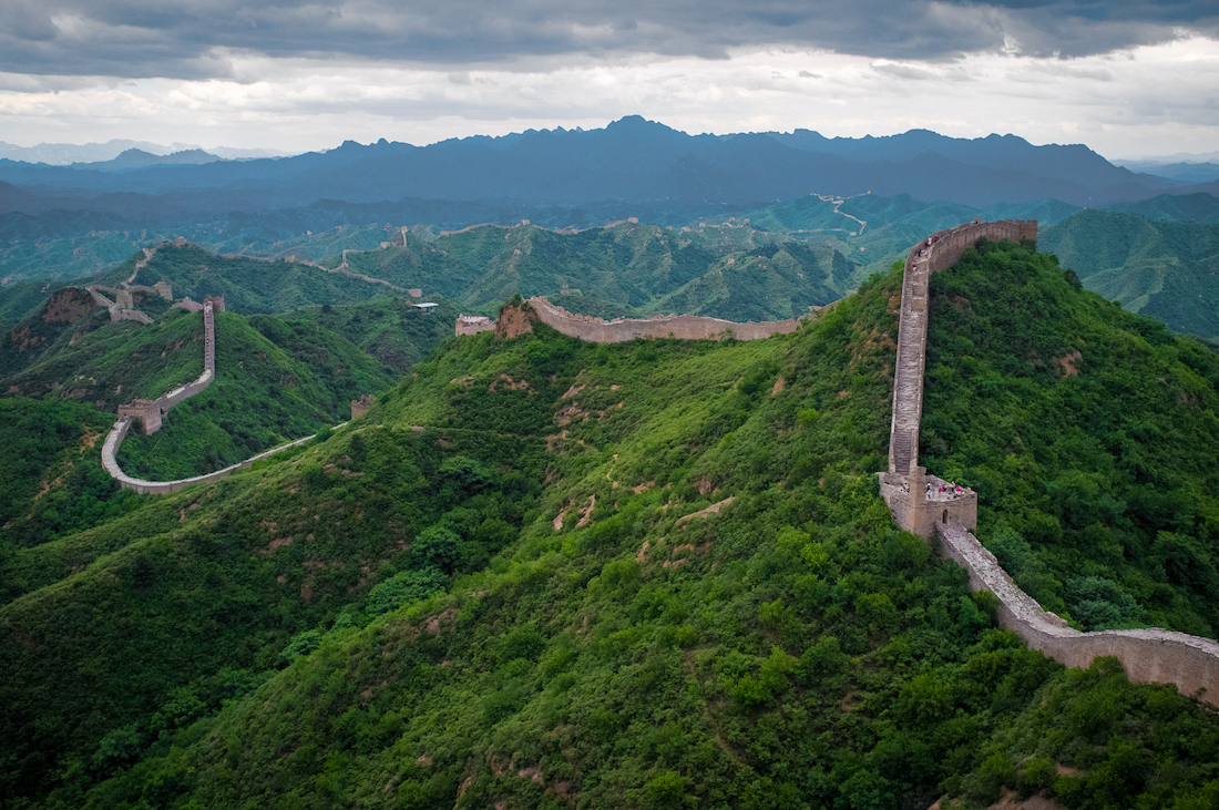
On the left is another photo of the Great Wall of China. Your students will be interested to know that the Great Wall of China took more than 2,000 years to build and stretches 12,000 miles!
NASA image
Chapter 16: Land Down Under
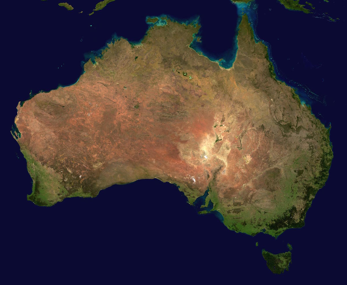
Click on the image to the right to see the satellite image of Australia.
Page 80 features a wonderful photo of someone scuba diving along the Great Barrier Reef. I’m sorry to report that the Great Barrier Reef is seriously endangered. If you look this up on the internet, you will find many articles about this.
Schultz photo
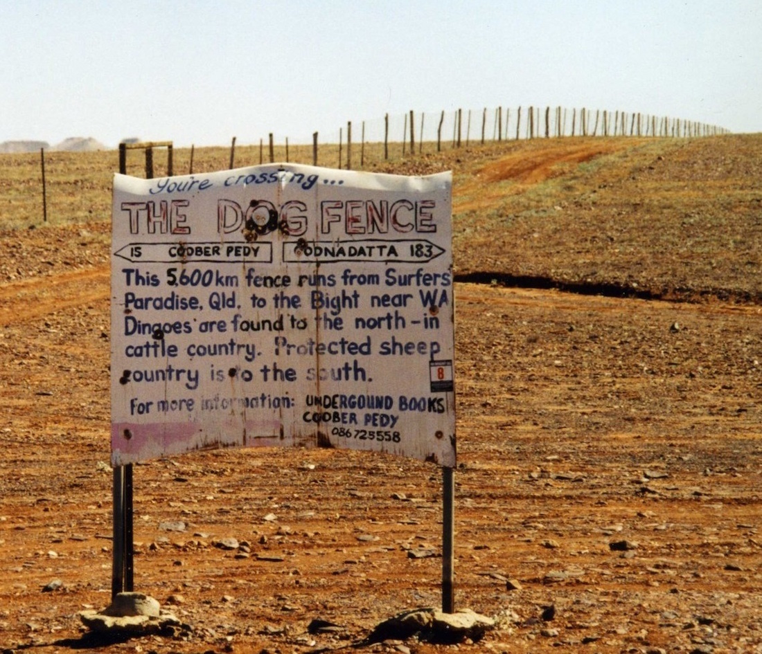
Finally, on page 96 is a photo of the dog fence in Australia. Click on this image to the left to see a larger version of this photo, which will allow you to read the sign. And you thought we were making it up!
Chapter 17: Ice Continent
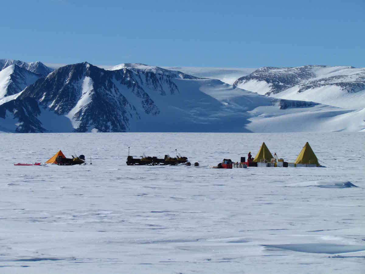
Antarctic Search for Meteorites program
Many of the inhabitants of Antarctica are scientists who have websites which are easy to find. If you look for some of them you will find wonderful photos from there.
One of the best ones that we have found is the Antarctic Search for Meteorite Program. These professors go to Antarctica and look for meteorites!