Teacher’s Guide to Long March to Tennessee (2019 edition)
Welcome to the teacher’s guide to the 5th grade Tennessee History for Kids booklet Long March to Tennessee. This web page contains further information about the information contained in the booklet.
Rather than buying a single classroom set, please consider buying one for every student. TN History for Kids sells these booklets for $2.50 and print them on non-glossy paper because we want students to write in their booklets and keep them.
Please do NOT copy the booklets. That is a violation of our copyright and makes it difficult for us to continue to exist. The reason we sell them for only $2 is so teachers will not be tempted to copy the booklets.
If you would like the answers to the quiz questions in the booklet, please email us at bill@tnhistoryforkids.org and tell us your name and the school at which you teach.
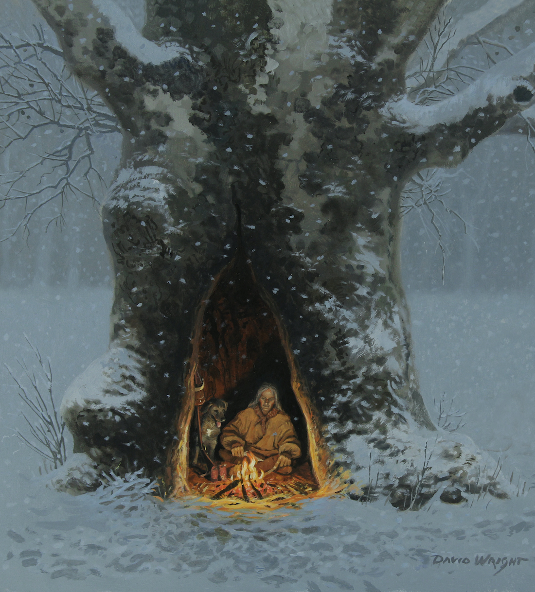
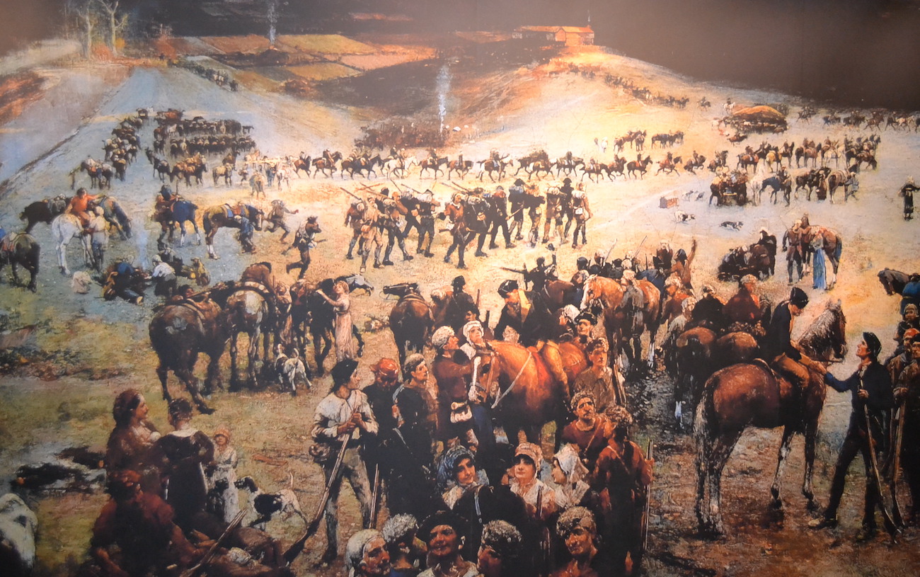
David Wright painting
Chapter One
There are a couple of videos that might help bring this chapter to life for your students. Click here to see one called “Journey Through The Gap” and here to see one called “Trek Across Tennessee.”
Click here to be taken to the Jackson County history page, where you can read about Fort Blount.
Tennessean, Jan. 14, 1962
There is a wonderful geography section of this website. Click here for part of it that makes reference to some of the same concepts that appear in this chapter.
I’ve written many Tennessee Magazine columns about the content in this chapter. These columns weren’t necessarily written at a fifth grade level, but your students might enjoy them anyway. Click here to read one of them, about Nickajack Cave, The Suck and Joseph Brown.
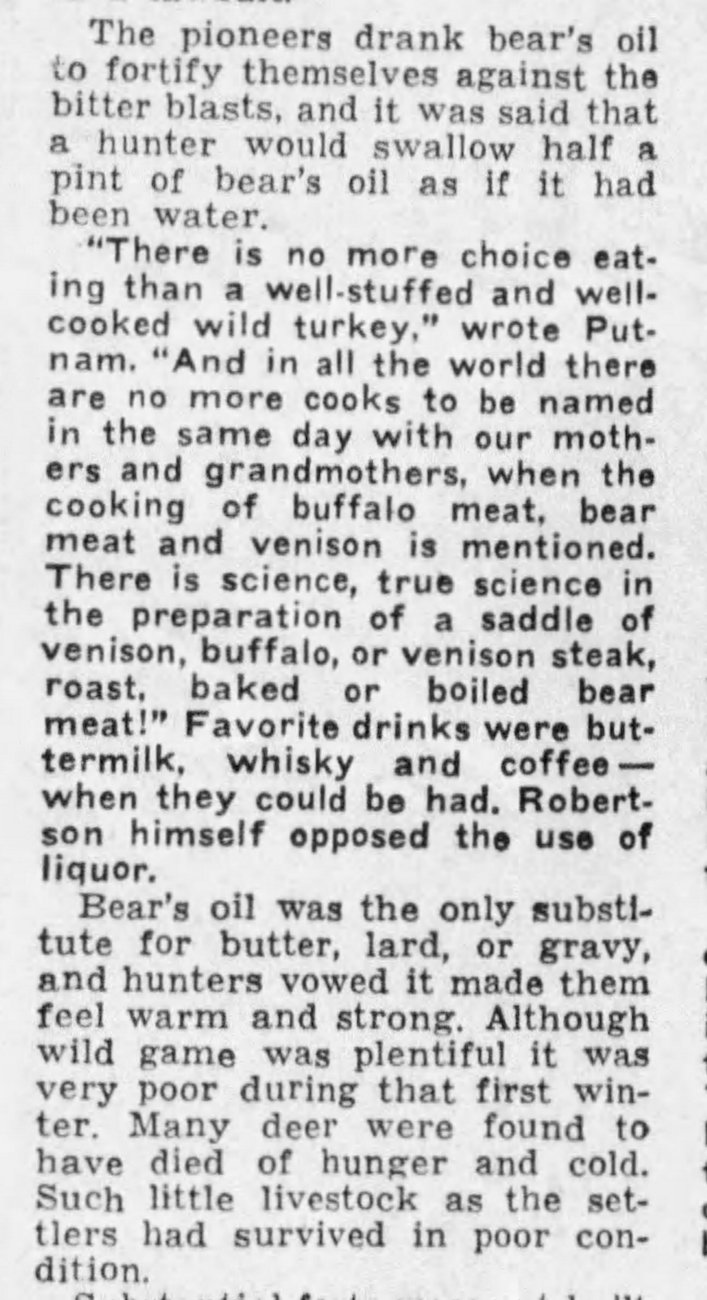
Finally, on page 3 there is a reference to the use of bear oil as an insect repellant and lamp fuel. Longhunters would have also drank bear oil, as this clipping (on the left) from a 1962 history column by Hugh Walker points out.
Chapter Two
First of all, we need to give credit to archaeologist Aaron Deter-Wolf of the Tennessee Division of Archaeology for his assistance in writing and fact-checking the content of this chapter.
Speaking of Aaron Deter-Wolf, he makes an appearance in a video we did for this chapter called “Digging Up Old Garbage.” Click here to see it.
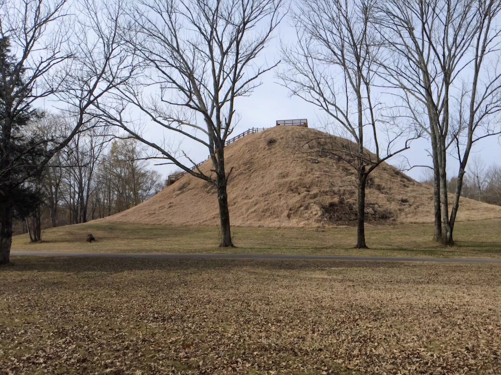
Saul’s Mound at Pinson Mounds (THFK photo)
Also, it needs to be pointed out that there is not universal agreement within archaeologists and textbooks about the various prehistoric time periods. The Archaic Period came at different times in different parts of the world, and therein lies part of the confusion. With this chapter, we went with the dates and eras as explained by Deter-Wolf.
On this website you will find many virtual tours about the sites mentioned in this chapter. Click here for a virtual tour of Old Stone Fort; here for a tour of Sellar’s Farm; and here for a tour of Pinson Mounds.
Chapter Three
THFK photo
The video “Three Sisters and the Little Brother of War” goes great with this chapter. Click here to see it.
The most important Cherokee sites in Tennessee are generally located in Monroe County. Click here to see some of them.
Sidebar: Yuchi, Cherokee and Tanase
I consulted at length with Dr. Jason Jackson at Indiana University and with Mary Linn at the Smithsonian Center for Folklore and Cultural Heritage before I wrote this content. Both are experts on the very specialized topic of the Yuchi language (which, by the way, is a “critically endangered language.”)
Chapter Four
THFK photo
Click here for a Tennessee History for Kids webpage “In Search of de Soto.”
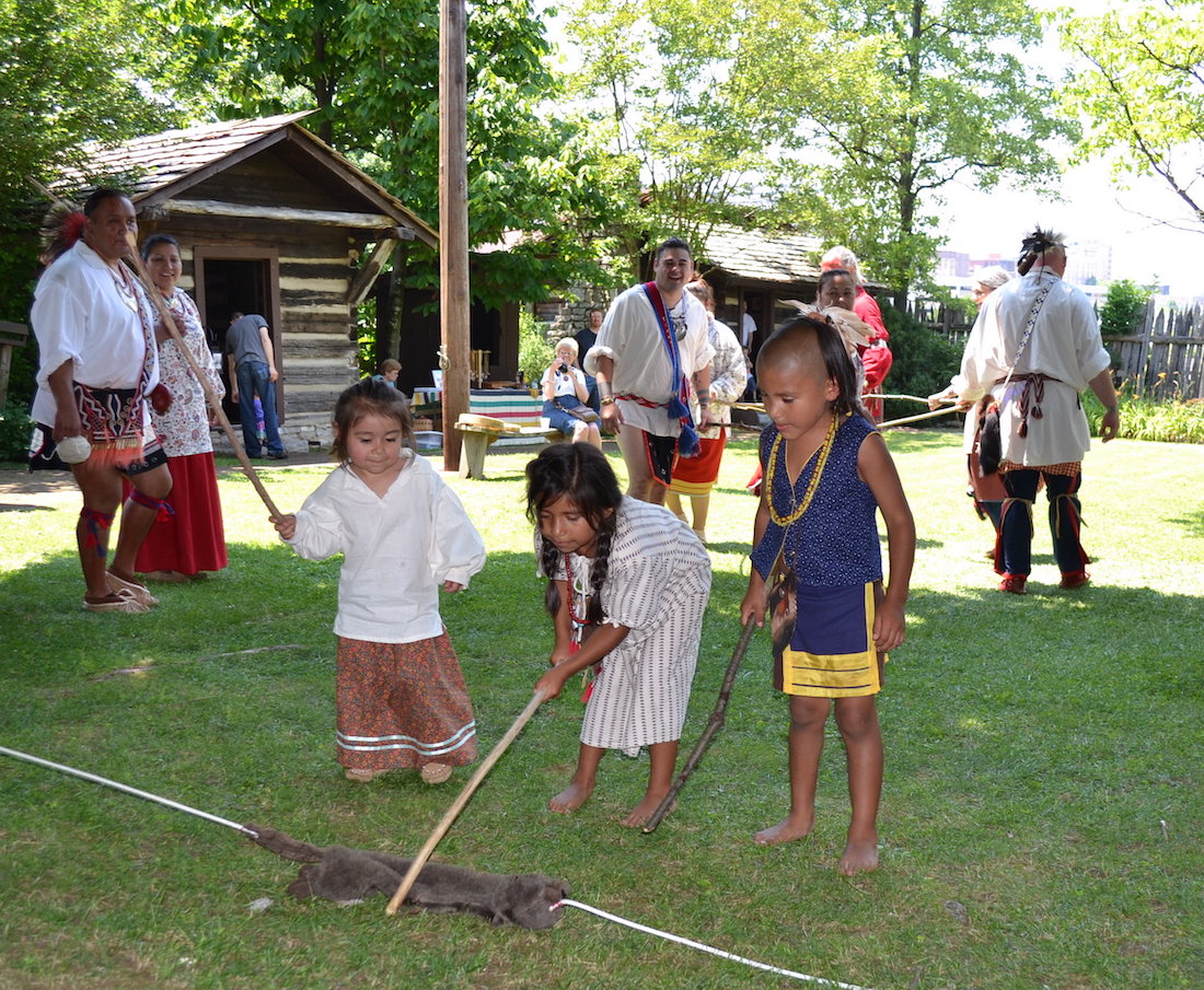
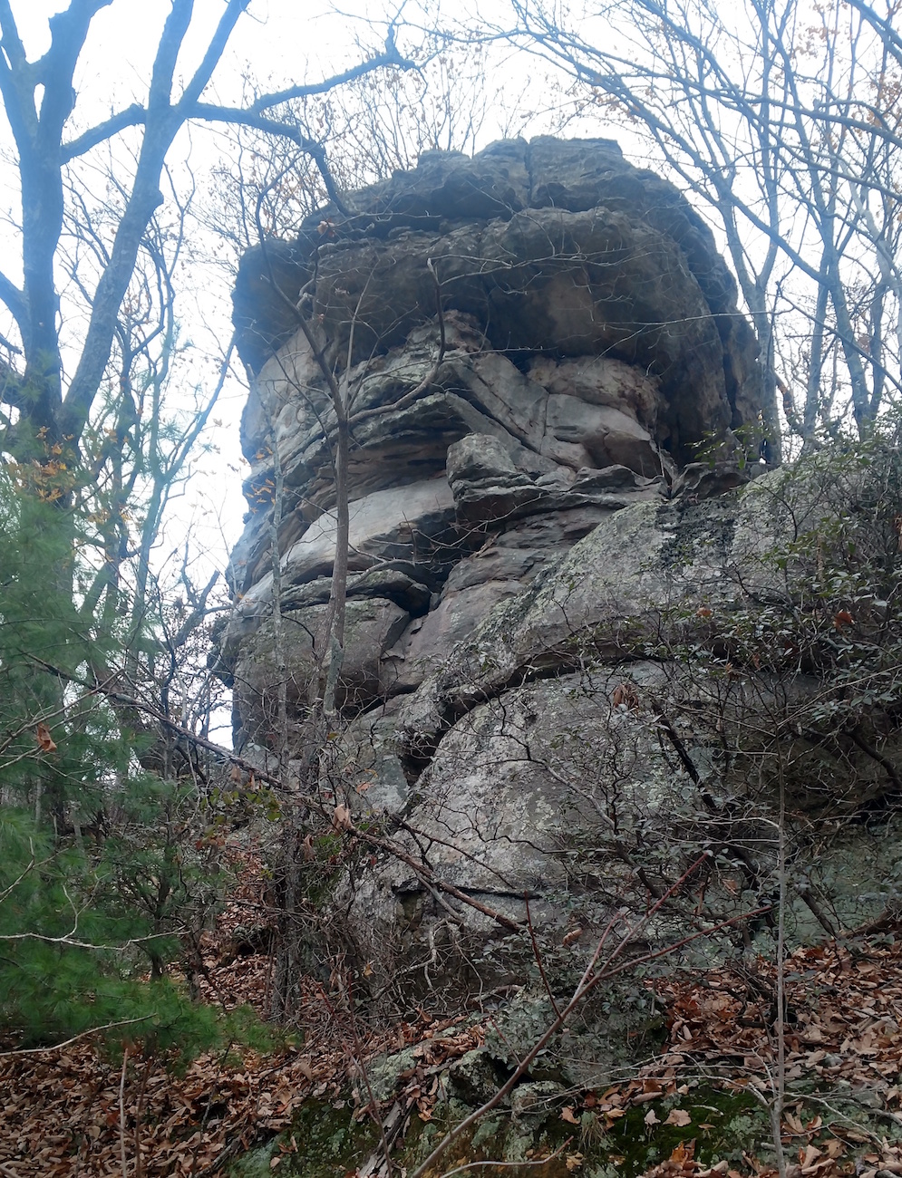
Longhunters are a fascinating subject within the world of Tennessee history–especially in light of the popularity of “survival skills” shows such as “Man versus Wild” and “Dual Survival.” I will also admit that Thomas “Big Foot” Spencer is of special interest because of the stories about him, because there is a creek a few yards from my office named for him, and because this rock in Cumberland County is supposedly where he was killed.

THFK photo of the Cumberland Gap
Click on the image to the right, and show it to your students on a big screen. Is it just me, or does the rock LOOK LIKE a man’s face?
Also, click here for a virtual tour of Cumberland Gap National Park, which is truly one of the most overlooked historical and natural wonders in Tennessee. It was at this national park, of course, where we filmed this video.
Chapter Five
Fort Loudoun is mentioned in the (U.S. history) 4th grade standards and the (U.S. history) 8th grade standards, but not in the (Tennessee history) 5th grade standards. Nevertheless, what happened at Fort Loudoun is important background for this chapter. Click here to see a pretty good video on this subject.
Click here for a journey “In Search of Henry Timberlake.”
Click here for the Monroe County website, which talks a bit about Chota.
Chapter Six

Harold Jerrell’s remarkable photograph
The photograph on page 28 is the one of the best reenacting photographs of the colonial era that I have ever seen. Thanks to Harold Jerrell for taking it and letting us use it!
Click here for a virtual tour of Sycamore Shoals State Park, which was the scene of many of the events described in this part of Long March to Tennessee.
Chapter Seven
 A big thank you to artist David Wright for letting us use images of his paintings, such as the one on page 33.
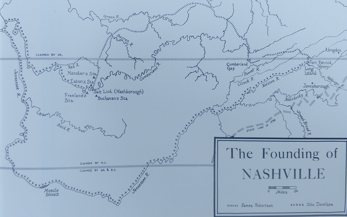
In my view, the Donelson Party journey is the greatest single story in all of Tennessee history. In this booklet, because of space constraints, I was not able to do it justice. Click here to read a column I wrote on the subject in 2006.
The map on page 34 is difficult to read in the booklet. Click here (to the right) to make it bigger, so you can show it to your class.
The Donelson Party is covered on the Sullivan and Davidson County history pages.
In 2017, a photographer named John Guider retraced the Donelson Party’s journey using a 14-foot rowboat/sailboat and later published a book about his adventure. Click here to read about this remarkable story.
Lloyd Branson’s wonderful painting
Chapter Eight
Click on the left for a much larger version of the wonderful Lloyd Branson painting that appears on page 38. I understand that the original painting was destroyed in a fire. Very sad!
Click here for a TN History for Kids style virtual tour of Kings Mountain battlefield.
Also, click here to see out a remarkably entertaining and accurate video about the Battle of Kings Mountain which is shown at Kings Mountain National Military Park.
THFK photo
Chapter Nine
Click here for a Tennessee History for Kids tour “In Search of the Lost State of Franklin.”
There is a lot of supplemental information from the website that goes with this chapter, including on the Knox and Sullivan County websites.
Also, William Blount and the matter of statehood appear in the virtual tour of historic Philadelphia, found here.
Chapter 10

THFK photo
Nickajack Cave and the area around it should be turned into a state historical site, with a full-time staff, interpreters and living history events. For now, it is owned and overseen by the Tennessee Wildlife Resources Agency.
The Nickajack Expedition is extremely well documented. There are several other first-person accounts of the Nickajack Expedition in Paul Clement’s huge collection called Chronicles of the Cumberland Settlements, which you should be able to find on the second-hand book market.
Click here for the Marion County history page, which tells you more about the content in this chapter.
Sidebar: Not Much of a State

Bureau of American Ethnology Map
This map (on the right) is not included in the Long March to Tennessee booklet, but is a remarkable map which illustrates the point made in this sidebar.
When Tennessee first became a state, it consisted entirely of the blue parts and the green part shown on the map. The orange sections of the map were all still Cherokee or Chickasaw territory!
THFK photo
Chapter 11
Look for more information for this chapter on the Roane, Jackson and Cumberland County history pages.
Also, click here for a Tennessee Magazine column I wrote on this subject in January 2017.
Chapter 12
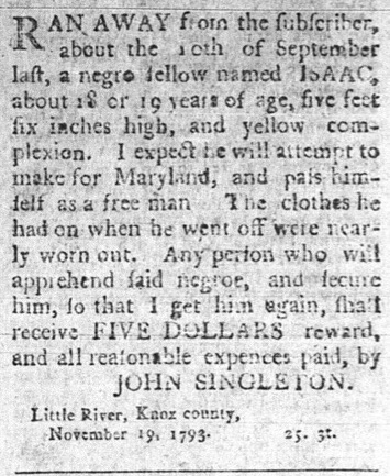
An ad in the October 19, 1793, Knoxville Gazette
This chapter covers some pretty serious material. Please take care in making your lesson plans for it.
This website contains a 28-minute KidsInar that covers some of the material covered here. When I made it I had 8th grade students in mind, but I do recommend that all teachers who cover the topic of slavery watch it as well. Click here to see it.
Tennessee History for Kids has a remarkable data base of newspaper advertisements related to slavery, published in every part of the state. If you’d like to see what we have for your part of the state, click here and I’ll send you one from your area.
Chapter 13
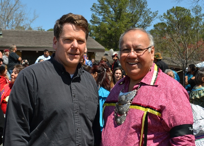
History Bill with the Chief of the Muskogee Indian nation
Click here for a virtual tour of Horseshoe Bend, in Alabama, and here for a tour of Chalmette Battlefield, near New Orleans.
On the 200th anniversary of the Battle of Horseshoe Bend, History Bill was the only person from Tennessee who was actually AT the battlefield. I was there along with several hundred Muskogee (Creek) Indian visitors from Oklahoma, and it was a powerful day.
Chapter 14
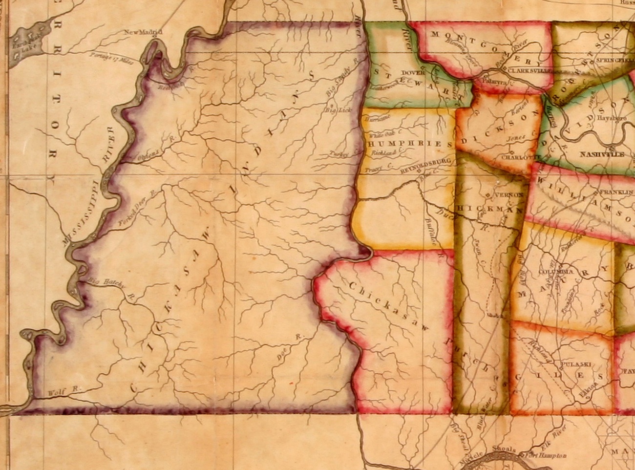
1818 Melish Map
Again… there are times when you have to see a map in more detail. Click on this image to the right to see the 1818 Melish map of West Tennessee more clearly.
Click here for a virtual tour “In Search of the New Madrid Earthquakes.”
Click here for a virtual tour of Randolph, Tipton County’s “ghost town” on the Mississippi.
Click here for the Shelby County history page.
Chapter 15
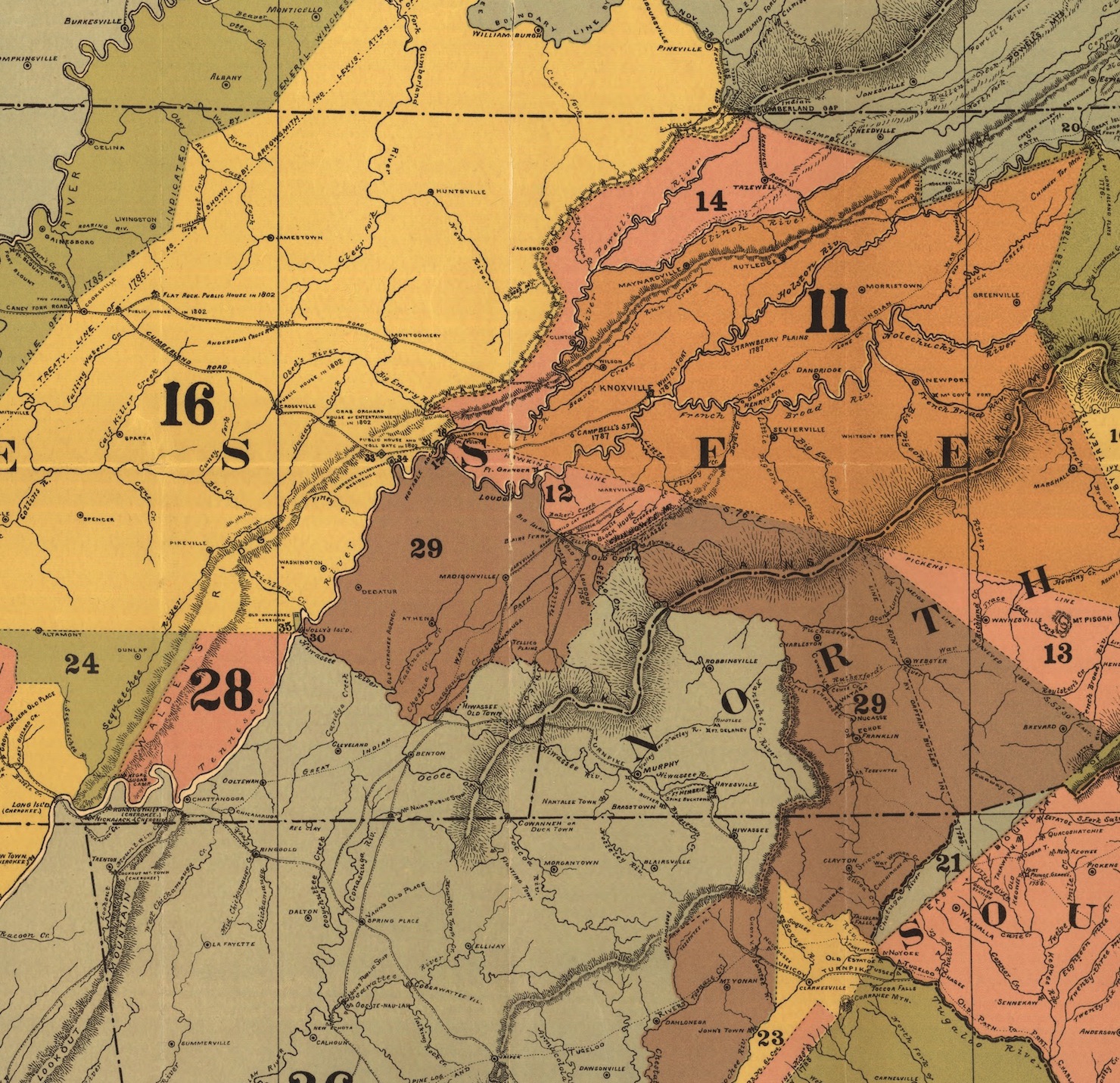
C.C. Royce map, 1884
There are two virtual tours on the Tennessee History for Kids website that cover material in this chapter–the Red Clay tour and the New Echota tour.
Also, this map (to the right), though very complicated, can be used to illustrate just how many treaties there were between the Cherokee nation and the U.S. government, and how each treaty resulting into the taking of Cherokee land. Each number on the map (12, 16, 28, etc) indicates land that went along with a particular treaty.
Chapter 16
When it comes to Andrew Jackson and James K. Polk, it is important to remember that both were born in the Carolinas, migrated west, and moved throughout their lives. To understand their stories, you have to go to various homes, battlefields, to the Tennessee State Capitol, and even to Washington D.C.
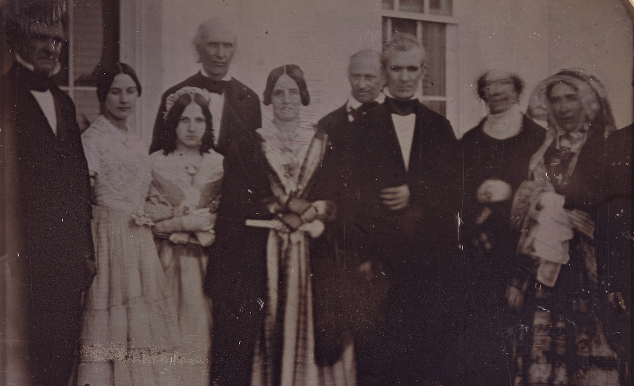
PHOTO: George Eastman House, International Museum of Photography and Film
Click here for a virtual tour “In Search of Andrew Jackson” and here for a tour “In Search of James K. Polk.”
Click here for a video filmed at The Hermitage called “Encounter with Old Hickory.”
Also, I wrote an entire column about the fascinating photograph shown on page 76. Click here to read it.
Chapter 17

Library of Congress photo
Read more about how railroads changed the Tennessee landscape on the Franklin, Rhea and Obion County history pages.
The Library of Congress photograph on page 80 that shows a train depot in Nashville during the Civil War merits a closer look. (Click on the right to see it in more detail.)
Your students may find this photo fascinating. How many locomotives can they find in this photo? How many people? Can the students see the Tennessee State Capitol in the photo?
Chapter 18
Click here for a Tennessee History for Kids virtual tour “In Search of Dred Scott.”