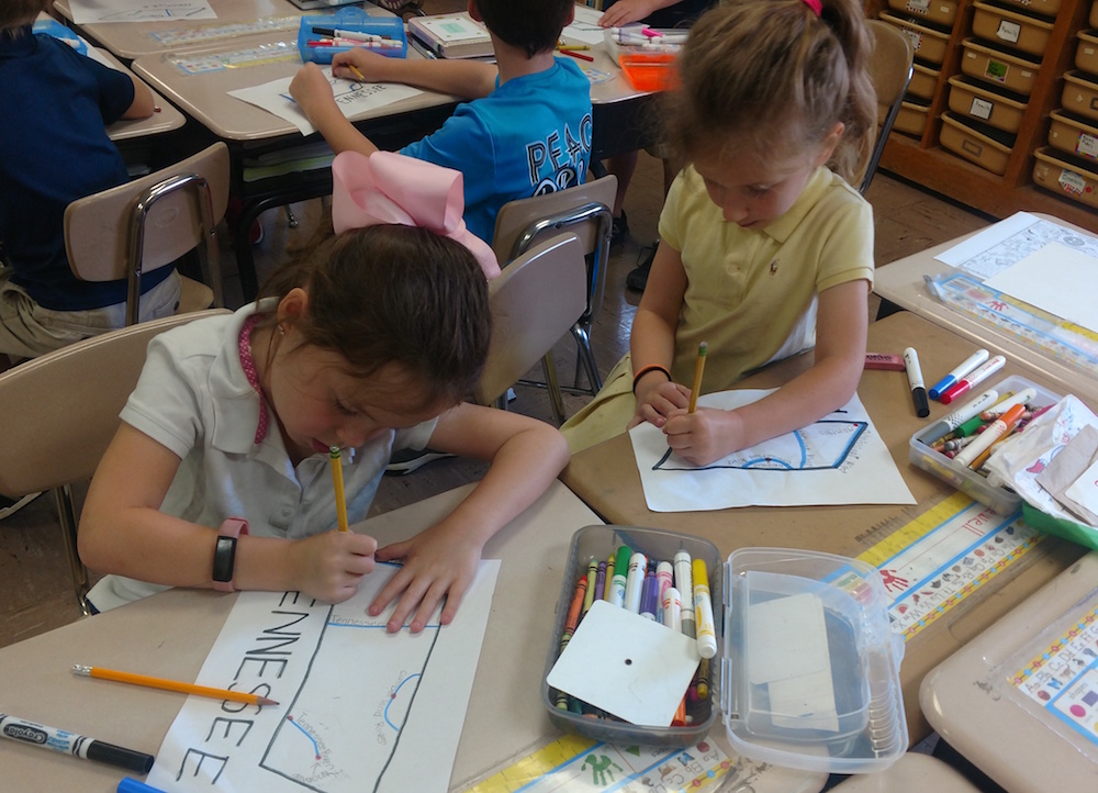
We’re going to make a map of Tennessee.
It is easier than you think. All you need to do is draw a funny box, four lines and four dots.
Get out a sheet of paper and three crayons: one black, one blue, and the third whatever color you want. We’ll use red as our third color.
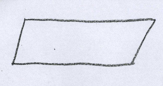
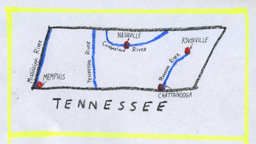
The first thing we want you to draw is a funny sideways box — longer from side to side than it is from top to bottom (like the one pictured here).
By the way, this “funny sideways box” has a name that you will learn in math class one day. The map of Tennessee looks very much like a parallelogram.
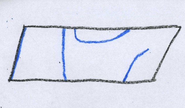 Next we want you to draw FOUR BLUE LINES, like the ones you see here.
The first blue line runs along the far left side of the funny box.
The second blue line goes from top to bottom and is about a third of the way from the left to the right side of the box.
The third line forms a “U” shape on the top of the box, in the middle.
And the fourth line is on the right side of the box, from the lower right hand corner to about half way up.
Now for the DOTS.
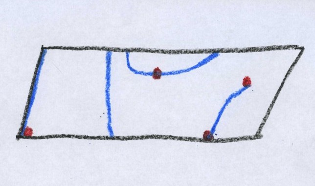 The first one is in the lower left corner.
The second one is about half way along the “U” blue line on the top part.
The third one is where the blue line ends on the right side.
The fourth one is where the blue line meets the black line in the lower right corner.

Congratulations on having drawn your first map of Tennessee!
What it all means
The lines and dots you just drew are symbols (remember that word?)
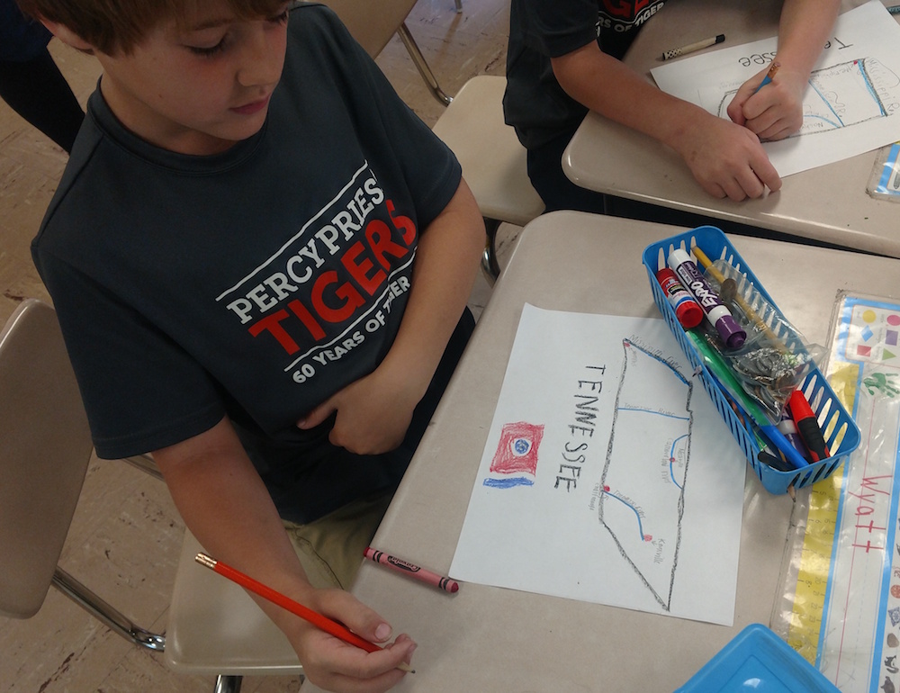
Let’s label what you just drew. The funny box is the boundaries of Tennessee. Like most maps, this one has the north at the top and the west on the left.
 The blue lines represent rivers. The blue line along the left side of the box is the Mississippi River.
Rivers, as you know, flow from one direction to another, as they leave high ground and move toward low ground. The Mississippi River, as it moves along Tennessee’s western boundary, flows north to south (top to bottom on your map).
The blue line that forms a “U” in north central Tennessee is the Cumberland River. It flows east to west through Tennessee (right to left on your map).
Now for the really tricky one. The other two lines are THE SAME RIVER — the Tennessee River.
On the east side of Tennessee (right side of the map) the Tennessee River flows north to south. Then the river moves into Alabama, and then turns north back into Tennessee.
So on the west side of Tennessee, the Tennessee River flows south to north.
If you think this is confusing to you, just imagine how much it baffled the early explorers!
Go ahead and label the Mississippi, Cumberland and Tennessee rivers.
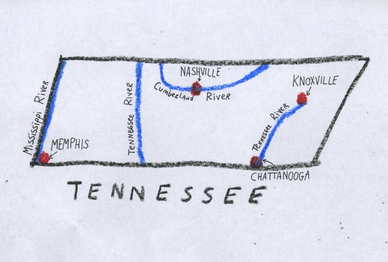 Now for the dots. As you can see from the drawing, they represent the cities of Memphis, Nashville, Knoxville and Chattanooga.
Go ahead and label your four dots.
Anyone else notice that the dots are all located on blue lines? There’s a reason for this. When cities were being formed, roads weren’t very good, and railroads didn’t exist yet. Rivers were the main ways of getting around, so cities formed along them.
We’ve worked pretty hard on this map, so feel free to add some finishing touches. You might add a star, or flowers, or a picture of a raccoon, who knows?
 Now we’re going to learn about the Grand Divisions of Tennessee.
Click here.