Teacher’s Guide to Across the USA (2027 edition)
Welcome to the teacher’s guide to the FIFTH GRADE TN History for Kids workbook Across the USA.
This workbook was written to meet the 2027 Tennessee social studies standards. It is the third workbook for 5th grade — the other three being Long March to Tennessee, Work for Freedom and Around the World.
If you click on the images here, you can them show your students larger versions using your projector.
Chapter One: Peninsulas and Plateaus

Photographersnature/Wikipedia photo
Standard 5.32: Identify common features on maps and globes and analyze the relationship between: Equator, Hemisphere, Latitude, Longitide, North Pole, South Pole, Prime meridian, Region and Time Zones.
Standard 5.35: Examine major physical features on globes and maps, including: Water Features (bay, canal, delta, gulf, ocean, river, sea, strait and stream) AND Land Features (basin, canyon, desert, island, isthmus, mountain, peninsula, plain, plateau and valley).
The primary purpose of the TN History for Kids workbooks is to help teachers teach and students learn the required social studies standards. However, an important purpose of the fifth grade geography booklets is to tell students that there’s a wonderful world out there.
Click on the image on the right to show the students a larger version of the Death Valley photo from page 5.
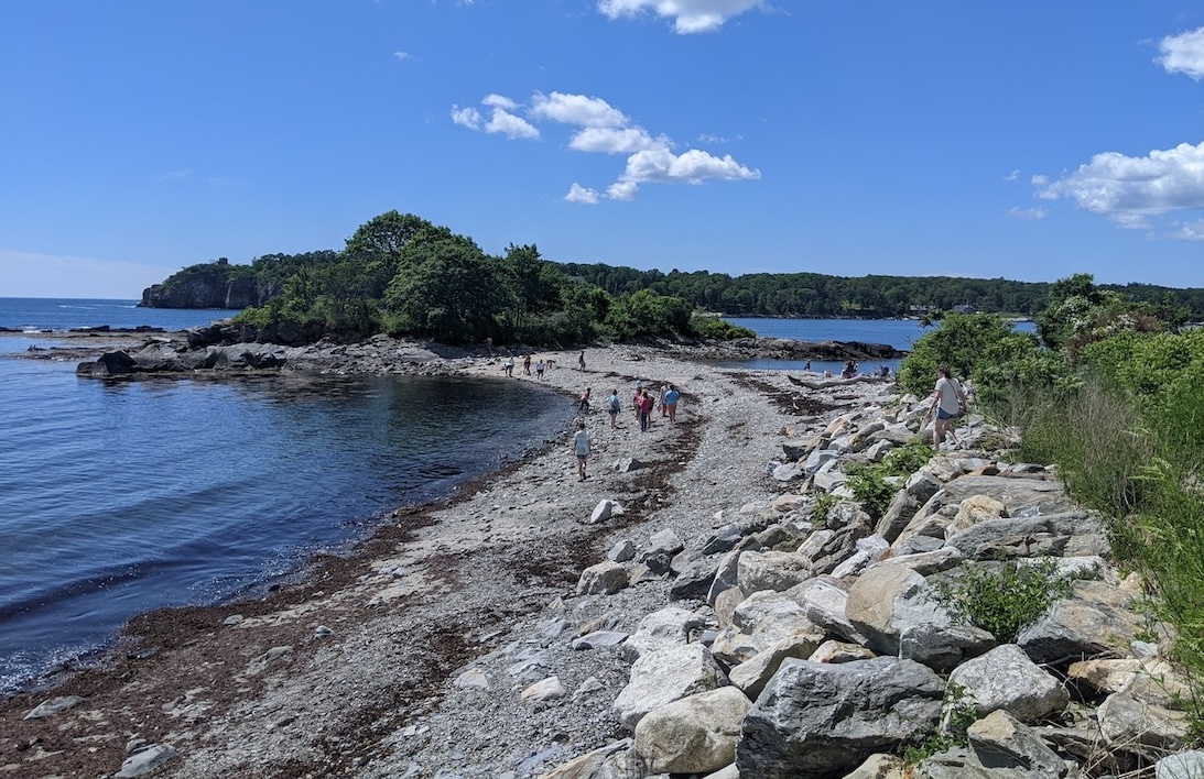
 Click on the image on the left to see the isthmus photo I took in Peaks Island, Maine, in October 2023.
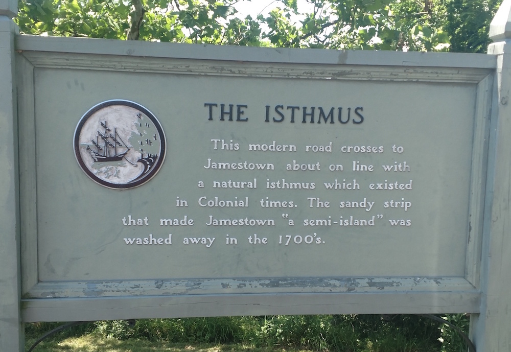
And speaking of the word ISTHMUS, I saw this sign (on the right) when I visited Jamestown, Virginia. I knew I had to take a photo of it, because I have a feeling that there is no sign that says the word ISTHMUS in the entire state of Tennessee!
Chapter Two: Wet Planet
Standard 5.35: Examine major physical features on globes and maps, including: Water Features (bay, canal, delta, gulf, ocean, river, sea, strait and stream) AND Land Features (basin, canyon, desert, island, isthmus, mountain, peninsula, plain, plateau and valley).
U.S. Navy photo
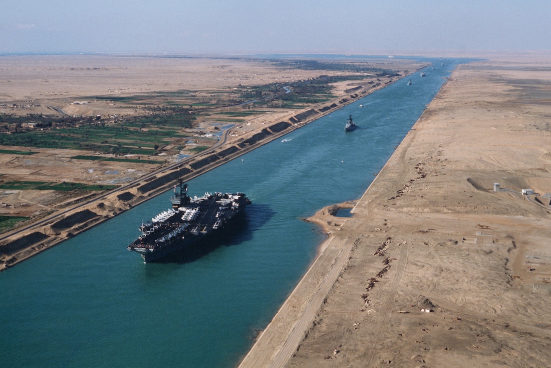
Click on the right to see the wonderful photo on page 9, and click on the left to see a photo of the USS America aircraft carrier going through the Suez Canal.

If you click on this image — Matthew Rhea’s map of 1832 — you can see where the Conasauga River canal might have gone
Regarding quiz question 5 on page 12: YES, there was at one time a major canal project proposed in Tennessee. It would have connected the Tennessee River system to Alabama’s Coosa River system, which means that products floated down the Tennessee River in East Tennessee would have reached the Gulf of Mexico a lot quicker than via the Tennessee, Ohio and Mississippi Rivers. However, the canal was never built.
Click here to read more about this on the Bradley County history page.
Chapter Three: Boundaries and Bridges

Calvin Sneed photo
Standard 5.36: Examine major human features on globes and maps, including transportation, political boundaries and cities.
Click here a CBS Sunday morning story about a free public library on the border between Canada and the U.S. — where the border between the two countries goes through the room.

Calvin Sneed photo
Click here to read a “History Bill”-written column in Tennessee Magazine about how bad the state’s roads were before the 1920s — one stretch of road between Marion and Hamilton Counties in particular.
Click here to read a cover story about Tennessee’s biggest old bridge enthusiast — Calvin Sneed of Chattanooga. Photos of him photo-bombing bridges can be seen on the right and left. Sneed is one of our occasional presenters at after-school intervices on Zoom.
Click here to be included on our email newsletter list, so you will be informed the next time we have Calvin as a presenter.
Chapter Four: Pinpointing the Globe

Does this naval flight officer look familiar? It’s “History Bill,” in 1990, flying and navigating in his plane!
Standard 5.33: Use cardinal directions, intermediate directions, map scales, grids, latitude and longitude to locate absolute and relative locations.
Standard 5.34: Examine various ways people communicate geographic information (e.g., maps, aerial photographs, GPS, graphs/diagrams).
I recommend that teachers who have to teach latitude and longitude invest in several inflatable globes.
Have your students get in a circle and toss an inflatable globe around and ask students what cities are at various latitudes and longitudes. They will love it!
SIDEBAR: Time Zones
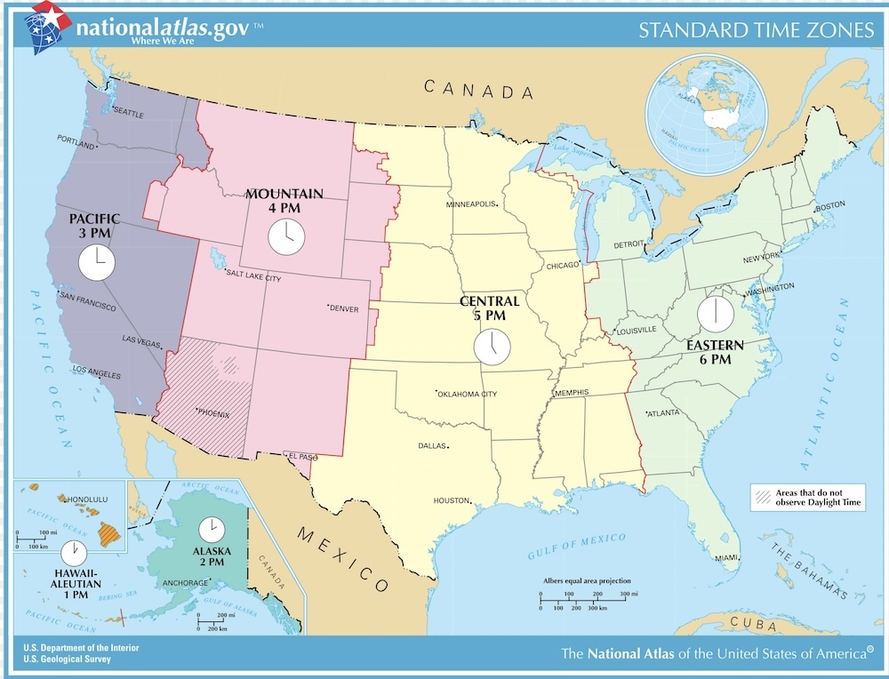
Standard 5.32: Identify common features on maps and globes and analyze the relationship between: Equator, Hemisphere, Latitude, Longitide, North Pole, South Pole, Prime meridian, Region and Time Zones.
Click on the image of the right to see a map of time zones in the United States.
Not everyone knows this, but time zones were originally adopted because of railroad timetables. Click here to read a “History Bill”-written column about this topic.
Chapter Five: Giving Direction
Standard 5.33: Use cardinal directions, intermediate directions, map scales, grids, latitude and longitude to locate absolute and relative locations.
Standard 5.34: Examine various ways people communicate geographic information (e.g., maps, aerial photographs, GPS, graphs/diagrams).
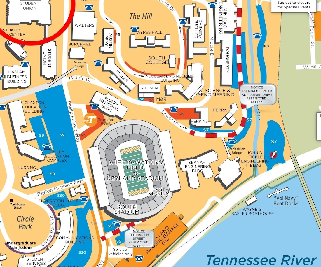
To the right is the University of Tennessee campus map on page 27. You might show it on the wall and ask your students more absolute and relative and directions questions from it, such as:
ONE: Using RELATIVE direction, how would you describe the location of the Neyland Parking Garage?
TWO: Using ABSOLUTE direction, how would you describe the location of the Alumni Memorial Building in relation to Neyland Stadium?
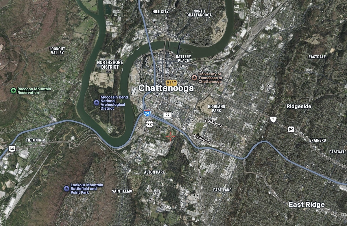
On the right column, near the top, are the 1832 Rhea map of Bedford County on page 28, the aerial image of Chattanooga on page 29 and the population density map of Tennessee on page 30.
Click HERE to see an “alternative” quiz for your students about this chapter, which may help them prepare for standardized tests. (The answers are C, C, A and C.)
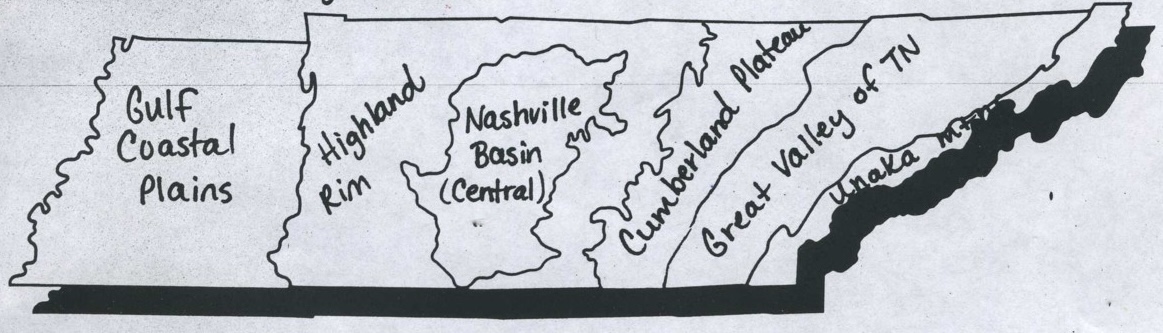
Chapter Six: Physical Regions of Tennessee
Standard 5.42: Identify on a map and compare the six physical regions within the three grand divisions of Tennessee (i.e. Gulf Coastal Plains, Nashville/Central Basin, Highland Rim, Cumberland Plateau, the Great Valley and the Great Smoky Mountains.
 Click here for TN History for Kid’s award-winning video of the Six Physical Regions of Tennessee (Okay, it didn’t win any awards, but should have!)
A view of the Unaka Mountains physical region
Click on the left to see the map on the bottom of page 33, which was created by a wonderful teacher named Sherri Collie, of Wayne County Schools.
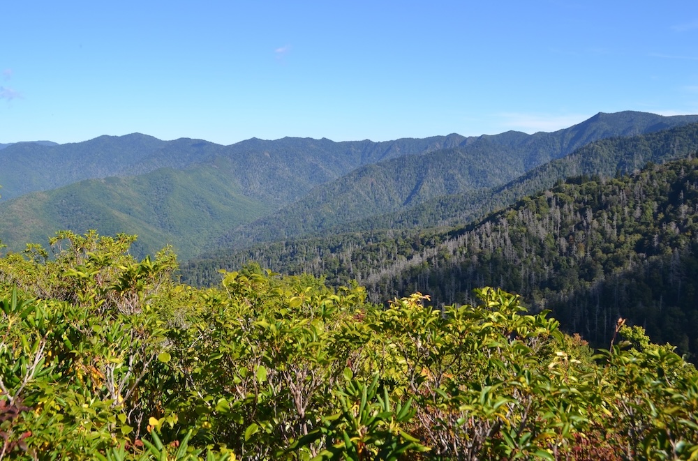
Click on the right to see the photo on page 36. For trail enthusiasts, this photo was taken from Trillium Gap.
Chapter Seven: Southeast
Standard 5.38: Identify and locate the fifty states of the United States.

Space and Rocket Center photo
Standard 5.39: Identify major physical features of the United State, including: Rivers (Mississippi, Ohio, Colorado, Missouri, Rio Grande); Mountains (Appalachian, Alaska Range, Rockies, Sierra Nevadas); Bodies of Water (Great Lakes, Gulf of Mexico, Great Salt Lake); Landforms (Coastal Plain, Mississippi River Basin, Grand Canyon, Great Plains).
Standard 5.40: Compare and contrast regions of the United States (i.e., Southeast, Northeast, Midwest, Southwest and West) in terms of climate, physical features, states, major cities, and population size.

Satellites.pro image
Click on the image on the right column to see the blank map of the Southeastern states, so your students can use it.
The image on the left is the satellite image of Louisiana. You can the the Mississippi River snaking all the way from Baton Rouge, through New Orleans, on the way to the Gulf of Mexico. You can also see many LAKES and BAYS on this image.
This is, as the standard says, the Mississippi River Delta.
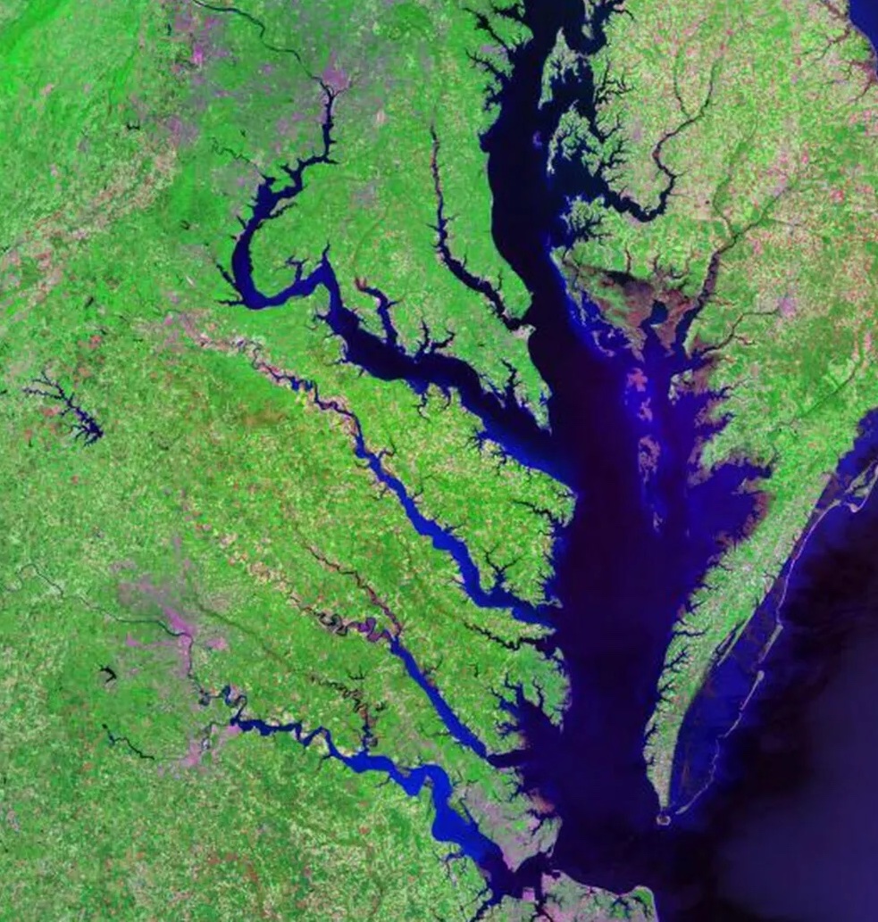
Chapter 8: Mid-Atlantic
Standards: Same as Chapter 7
Click on the image on the right to see the satellite image of Chesapeake Bay, which is on page 43.
In the quiz on page 47 is a blank map of the Mid-Atlantic states. Click on the same map, above and on the right column, to show your students the same map.
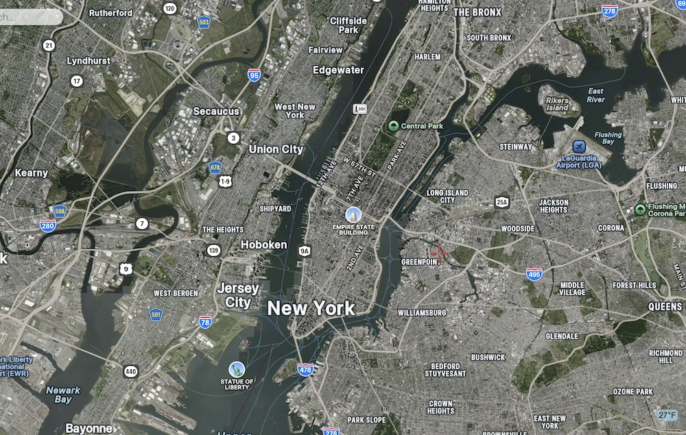
Chapter 9: Land of Small States
Satellite.pro image
Standards: Same as Chapters 7 and 8
Click on the right to see an image of New York City from space. If you project this image on your classroom wall, you should be able to find boroughs such as Bronx, Harlem, Queens; rivers such as the Hudson and East Rivers; and landmarks such as Central Park, Statue of Liberty, the Empire State building and LaGuardia Airport.
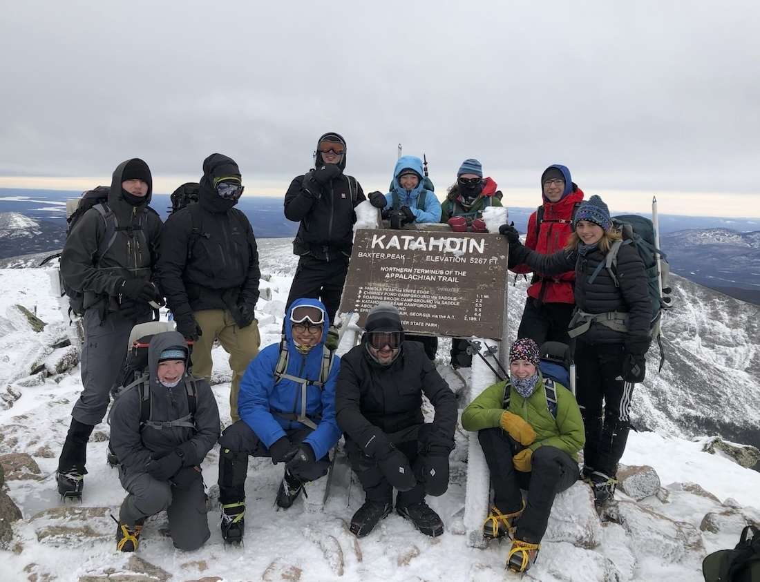
Acadia Mountain Guides Climbing School photo
You can see on the right column the blank map of the Northeastern states (which also appears in the page 52 quiz).
Meanwhile, to the left is the photo of the crazy people in Maine who hike to the top of Mount Katahin in the middle of winter.
Chapter 10: Midwest
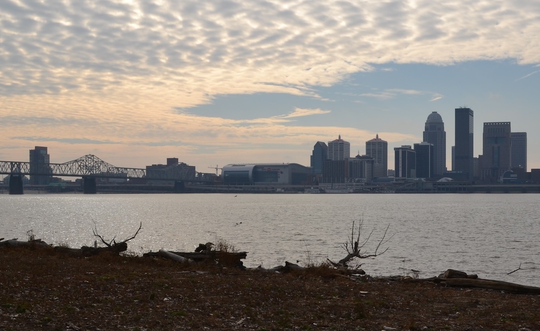
The Ohio River in the foreground; the city of Louisville, Kentucky, in the background.
Standards: Same as Chapters 7-9
Click on the image to the right to see a photo of the Ohio River and of Louisville, Kentucky.
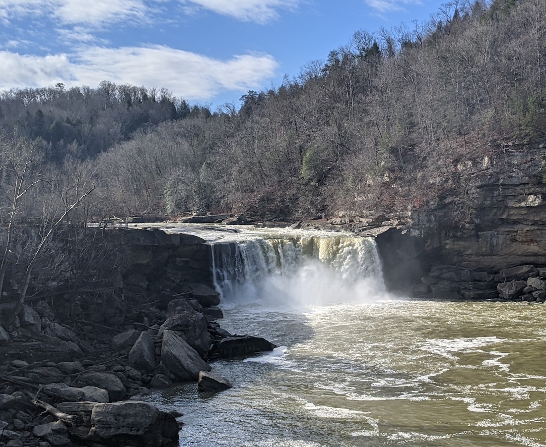
Kentucky’s Cumberland Falls
The Cumberland River flows through Nashville, but started in southeastern Kentucky. The river goes over a dramatic waterfall called Cumberland Falls near Corbin, Ky. — a waterfall so large that it used to be known as the “Niagara Falls of the South.” Click on the image on the left to see a photo of Cumberland Falls.
Chapter 11: Mountains and Plains
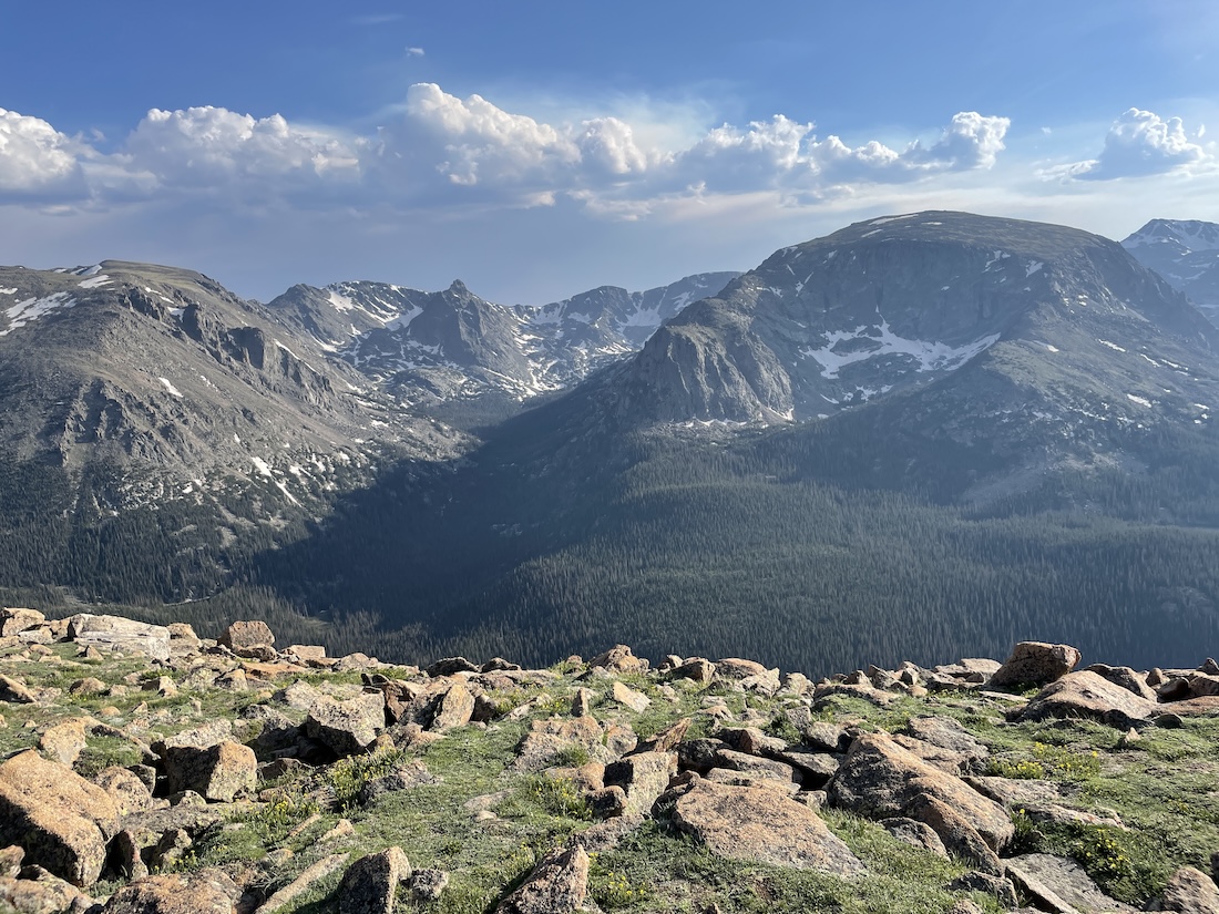
The view of Forest Canyon in the Rocky Mountain National Park (Dough4872/Wikipedia photo)
Standards: Same as Chapters 7-10
There were too many great photos of the Rocky Mountains for show them all in the workbook. Click on the image on the right to see another one.
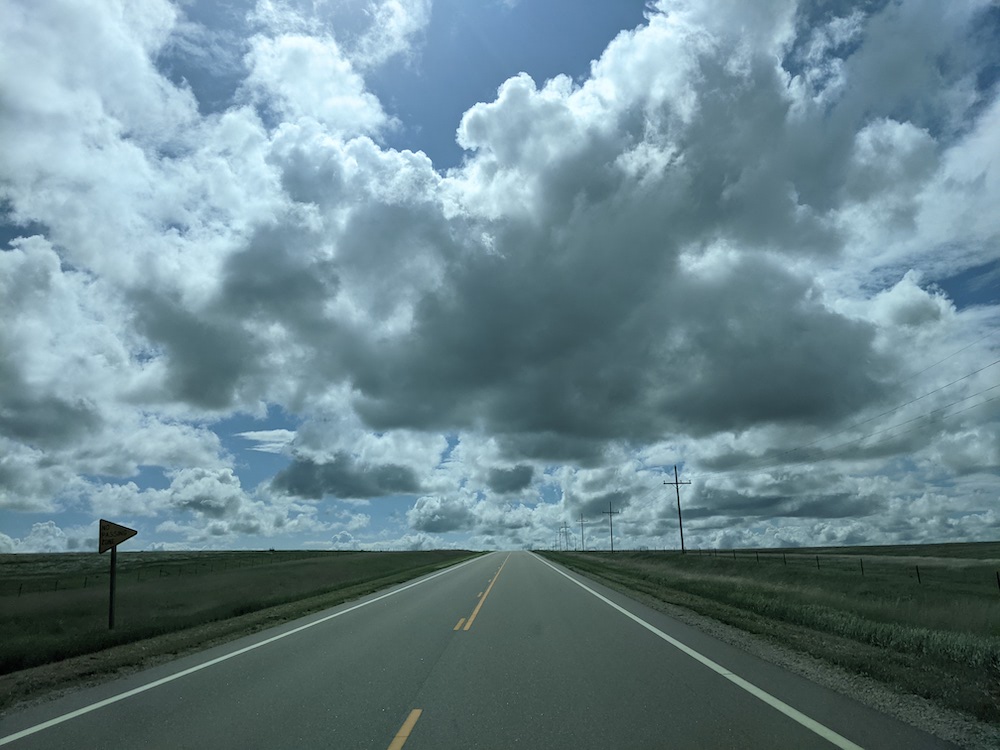
It’s a long drive across the Great Plains.
Click on the image on the left to see what it looks like to drive across Kansas. (This photo came from the “In Search of” Exodusters virtual tour — click here to take it.)
Chapter 12: Pacific West
DaveMeisterMoab photo/Wikipedia
Standards: Same as Chapters 7-11
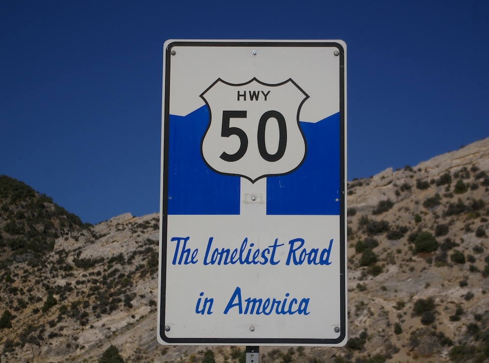
If you want further proof that Highway 50 through Nevada is known as the “Loneliest Road in America,” see this sign, on the right.
 I have driven this road from one end of Nevada to the other. If I ever get to drive it again, I will take a lot of water and food in case my car breaks down!
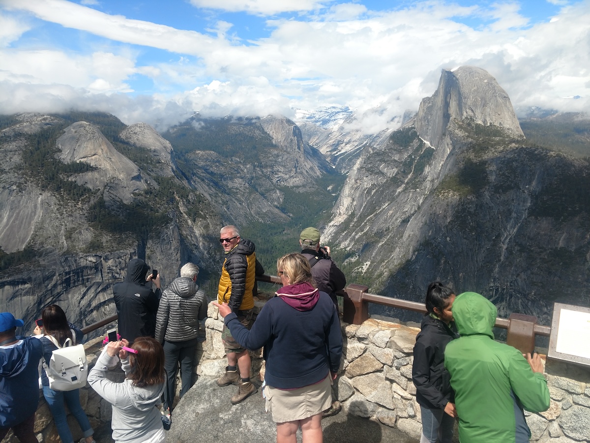
And speaking of photos that I didn’t have room for in the printed workbook: To the left is a photo I took at California’s Yosemite National Park… in June!
Eric Gaba image
Chapter 13: Alaska and Hawaii
Standards: Same as Chapters 7-12
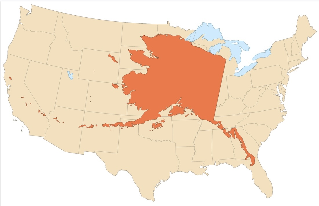
Click on the image to the right to show your students a larger version of the map on page 67.
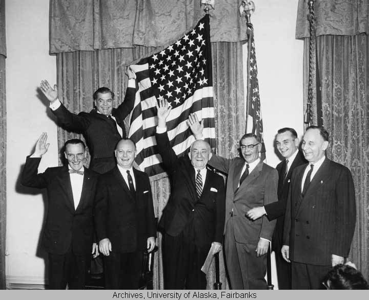
Alaska officials celebrate becoming a state with the new (official) American flag with 49 stars (Alaska’s Digital Archive)
A bit of American flag trivia:
From July 4, 1959, to July 3, 1960, the American flag officially had 49 stars. What’s odd about this is that when Tennessee became the 16th state in 1796, the U.S. government did NOT add a 16th star. The American flag only had 15 stars when it flew over Fort McHenry and inspired Francis Scott Key to write the lyrics of the “Star Spangled Banner.”
It wasn’t until 1818 that the official flag was altered to have 20 stars, for the 20 states at that time.
That’s why Alaska flies a flag with 49 stars on its statehood day, but Tennessee doesn’t fly a flag with 16 stars on its statehood day!
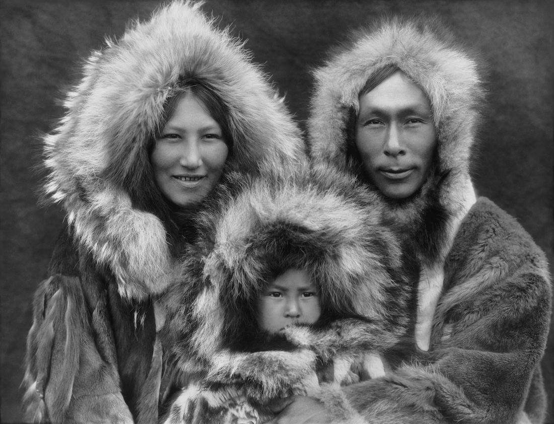
Edward Sheriff Curtis photo, 1929
Chapter 14: How People Live
Standard 5.41: Analyze the regions of the United States and the locational effects of life, including food, clothing, shelter, transportation and recreation.

Millersville Sweet Corn Festival
I love all the photos in this chapter, so I’ve uploaded all four for you students to see.
The page 72 photo of the Inuit family was taken by Edward Sheriff Curtis. Click here to see many of the other photos he took of Native Americans.

VisitAnchorage.com photo
Click here to be taken to the website of the Millersport Sweet Corn Festival.
Click here to visit the website of the Iditarod.
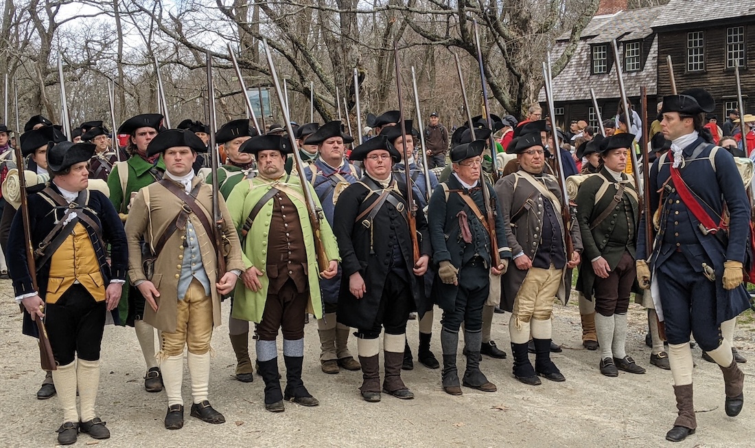
TN History for Kids photo
The page 75 photo of colonial re-enactors was taken at the April event at the Minuteman National Historic Park in Concord, Massachusetts. I’ve been to many re-enactments, but this was the largest and best I’ve ever witnessed, by far. Click here to be taken to the official website of the Minuteman National Historical Park.

And if you looking for proof that “History Bill” was welcomed by the colonial re-enactors, see this photo on the right.
SPECIAL PROJECT:
Every corner of Tennessee has some event that reflects the climate, food or culture of that part of the state. Columbia’s Mule Day Festival, Marshall County’s Fainting Goat Festival, Jonesborough’s Storytelling Festival, Bellbuckle’s Moonpie Festival and Hickman County’s Banana Pudding Festival come to mind.
Have your class research the origins of your the festival near you, and give bonus points to the students who attend a Tennessee festival!
If you would like the answers to the questions that appear in this workbook, email us at orders@tnhistoryforkids.org using your school email address.
Field Trips
Fifth grade is a great time to take students on a field trip.
Among the field trip destinations your students will love, and that will increase their interest and knowledge of the subjects presented in this workbook are these:
Bicentennial Capitol Mall State Park (where there is a huge granite of Tennessee that your students can walk on), Davidson County
Tennessee Aquarium (which has a lot of information about the Tennessee River system), Hamilton County
Tennessee River Museum, Hardin County
Here are some of the maps that appear in this workbook:
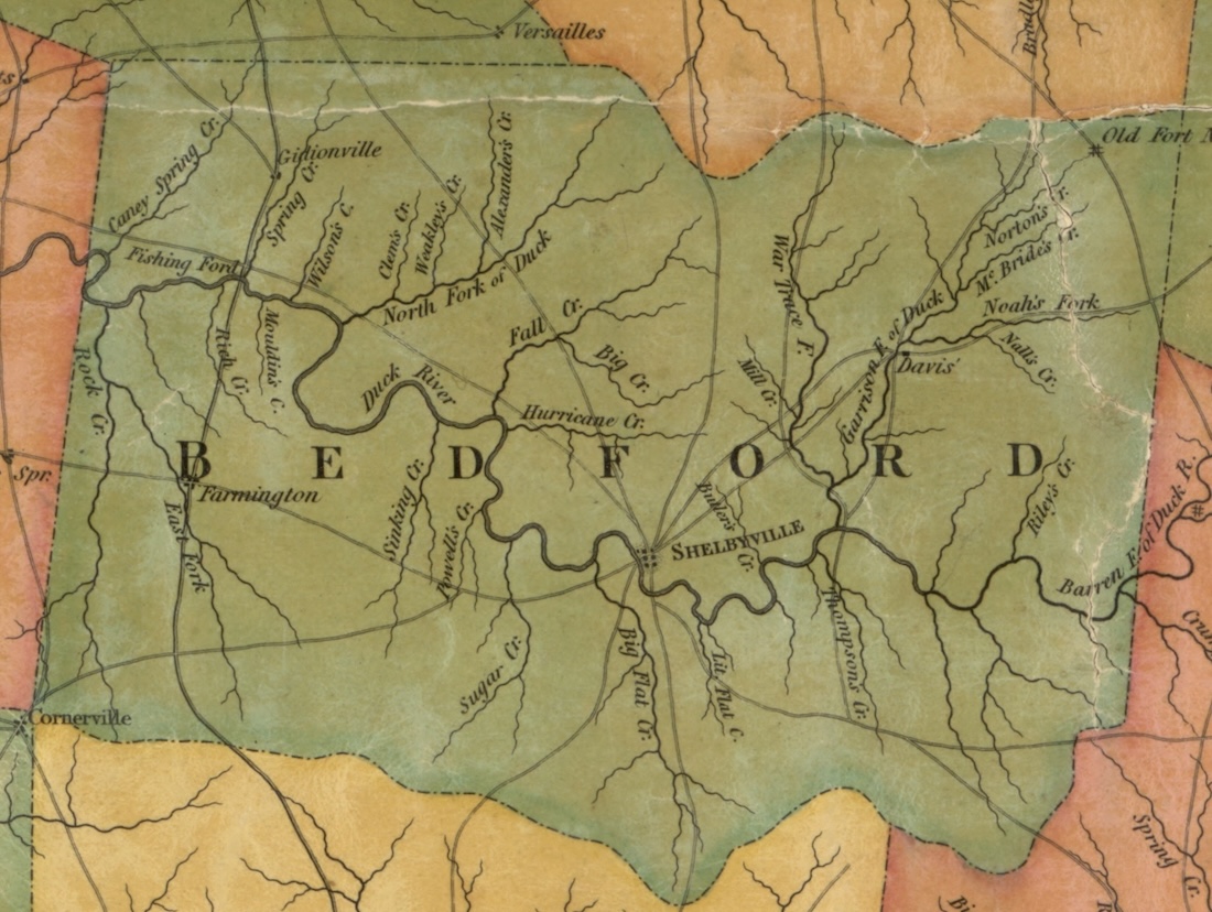
Matthew Rhea map 1832 (TN State Library and Archives)
Google image
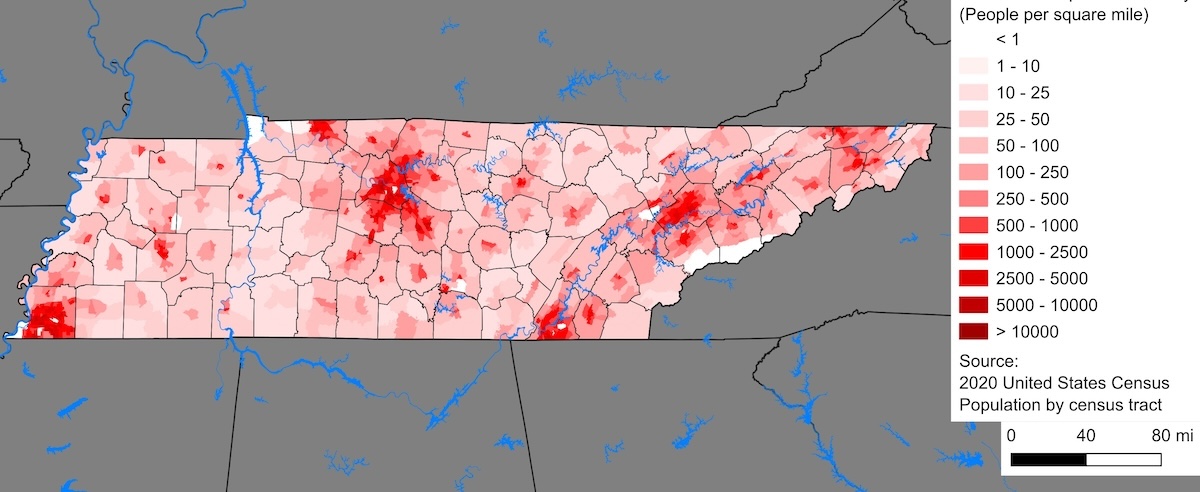
Population density map of Tennessee (Crossover1370/Wikipedia)
The Southeast United States
The Mid-Atlantic United States
The Northeast United States
The Midwest
The Mountains and Plains states
The Pacific West states