Teacher’s Guide to Journey Downriver: A History of Tennessee — Pages 2-42
Welcome to the teacher’s guide to the consumable textbook Journey Downriver: A History of Tennessee. This book was written for the high school elective class in Tennessee history.
Teachers, if you would like the answers to the quiz questions in the booklet, please email us at orders@tnhistoryforkids.org, using your school email address, and we will send them to you.
Page 2: Divisions, Rivers, Mountains
Tennessee History for Kids has a separate geography section, and the ADVANCED geography section was created with high school students in mind. Click here to see it.
Click on the right column to see all the maps on pages 2-4 larger.
Page 6: Wild and Free/Digging in the Dirt
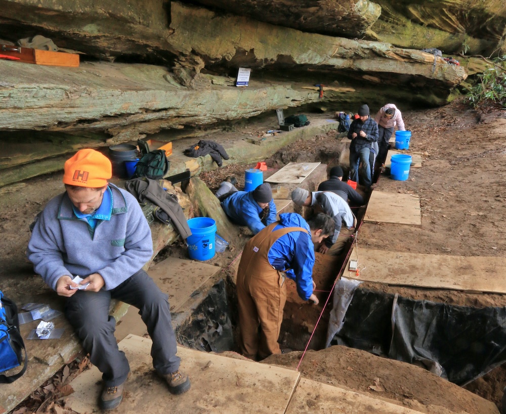
Alan Cressler photo
TN.02: Describe changes in life in the Tennessee region from the late ice age through the Archaic period.
TN.03: Compare and contrast features of life in the Tennessee region during the Woodland and Mississippian periods.
First of all, we need to give credit to archaeologist Aaron Deter-Wolf of the Tennessee Division of Archaeology for his assistance in writing and fact-checking the content of this chapter.
Speaking of Aaron Deter-Wolf, he appears in a video we did for this chapter called “Digging Up Old Garbage.” Click here to see it.
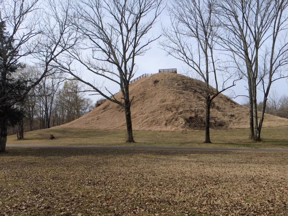
Saul’s Mound at Pinson Mounds (THFK photo)
Also, it needs to be pointed out that there is not universal agreement within archaeologists and textbooks about the various prehistoric time periods. The Archaic Period came at different times in different parts of the world, and therein lies part of the confusion. With this chapter, we went with the dates and eras as explained by Deter-Wolf.
On this website you will find many virtual tours about the sites mentioned in this chapter. Click here for a virtual tour of Old Stone Fort; here for a tour of Sellar’s Farm; and here for a tour of Pinson Mounds.
Page 10: Summer House and Stickball/Things in Common
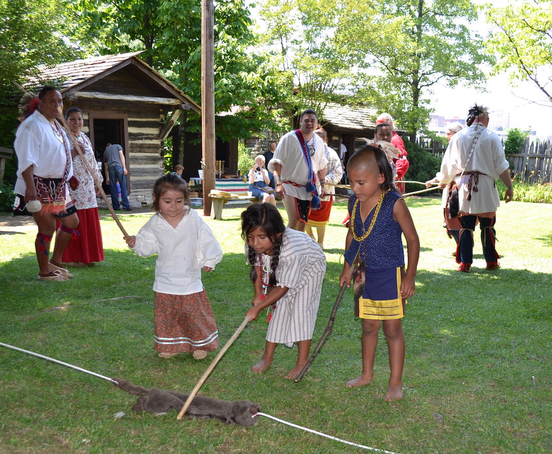
THFK photo
TN.04: Analyze the customs and traditions of American Indians present in the Tennessee region prior to European contact, including Cherokee, Chickasaw, Creek, Iroquois and Shawnee
The video “Three Sisters and the Little Brother of War” goes great with this chapter. Click here to see it.
Click here for a virtual tour of the Museum of the Cherokee Indian in Cherokee, North Carolina.
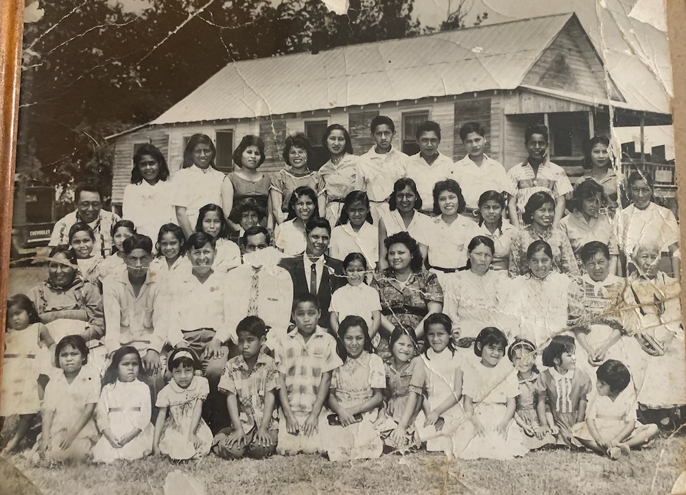
Members of the Choctaw community of Lauderdale County in 1962 (Cubert Bell photo)
The most important Cherokee sites in Tennessee are in Monroe County. Click here to see some of them.
Click here to see a virtual tour “In Search of the Chickasaw Nation.”
Not a lot of people know this, but there is a very small Choctaw Indian Reservation in Lauderdale County. Click here to read a column by “History Bill” about it and here to see a virtual tour in search of Tennessee’s Choctaw community.
Page 13: Longhunters and the Gap

THFK photo of the Cumberland Gap
TN.04: Analyze the customs and traditions of American Indians present in the Tennessee region prior to European contact, including Cherokee, Chickasaw, Creek, Iroquois and Shawnee
TN.05: Describe the impact of European exploration in the Tennessee region, including the significance of Christopher Columbia, Hernando de Soto and Juan Pardo.
TN.06: Describe the influx of British and French settlers and fur traders in the Tennessee region and their impact on American Indian tribes.
Click here for a Tennessee History for Kids webpage “In Search of de Soto.”
Click here for a virtual tour of Cumberland Gap National Park, which is truly one of the most overlooked historical and natural wonders in Tennessee. It was at this national park, of course, where we filmed this video (starring Wayne Milton as Daniel Boone).
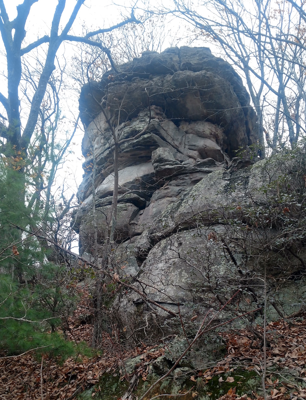
Spencers Rock can be seen from Interstate 40 in Cumberland County.
Longhunters are a fascinating subject within the world of Tennessee history–especially in light of the popularity of “survival skills” shows such as “Man versus Wild” and “Dual Survival.” I will admit that Thomas “Big Foot” Spencer is of special interest because of the stories about him, because there is a creek near my house named for him, and because this rock, shown on the left, in Cumberland County is supposedly where he was killed.
 Click on the image and show it to your students on a big screen. Is it just me, or does the rock LOOK LIKE a man’s face?
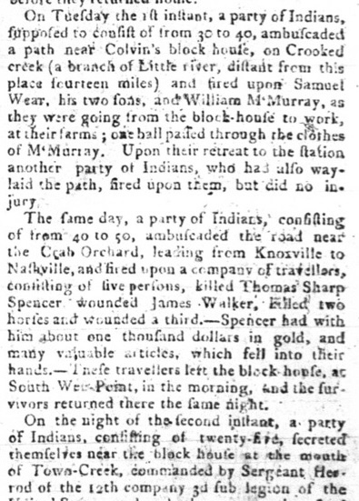
Meanwhile, click on the article on the right from the Knoxville Gazette; April 10, 1794. This is where it was reported that Thomas Spencer had been killed along the Fort Blount Road (more on that in Chapter 10).
Page 15: Deerskins for a Pistol
TN.05: Describe the impact of European exploration in the Tennessee region, including the significance of Christopher Columbia, Hernando de Soto and Juan Pardo.
TN.06: Describe the influx of British and French settlers and fur traders in the Tennessee region and their impact on American Indian tribes.
TN.08 Describe the effects of migration into the Tennessee region, including the development of the Watauga and Cumberland settlements.
If you wish to see the map on page 11 bigger, scroll up, look at the right column and click on the map to show it bigger. By the way, all the maps in chapter1 1 through 16 are featured on this online teacher’s guide.

Fort Loudoun State Park photo
What happened at Fort Loudoun is important background for this chapter. Click here to take a virtual tour of Fort Loudon and here to go “In Search of Henry Timberlake.”
And if you want you students to be thoroughly amused (as well as informed), click here to see “History Bill” on a visit to Fort Loudon in 1758.
Page 17: Bloody Ground
TN.05: Describe the impact of European exploration in the Tennessee region, including the significance of Christopher Columbia, Hernando de Soto and Juan Pardo.
TN.08: Describe the effects of migration into the Tennessee region, including the development of the Watauga and Cumberland settlements.
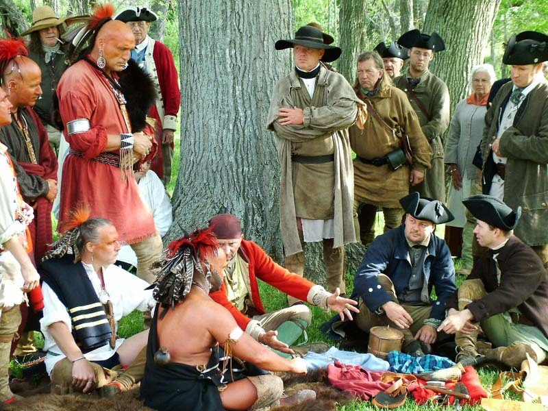
A reenactment that shows what the Transylvania Purchase might have
looked like. (Harold Jarrell photo)
TN.12: Describe the conflicts between early Tennessee settlers and American Indians.
Question 1 on page 19 is best answered if you read Dragging Canoe’s entire speech. Click here to read it.
The photograph on page 13 is the one of the best reenacting photographs of the colonial era that I have ever seen. Click on the right to see it, and thanks to Harold Jerrell for taking it and letting us use it!
Click here for a virtual tour of Sycamore Shoals State Park, which was the scene of many of the events described in Journey Downriver: A History of Tennessee.
Page 20: Journey Downriver
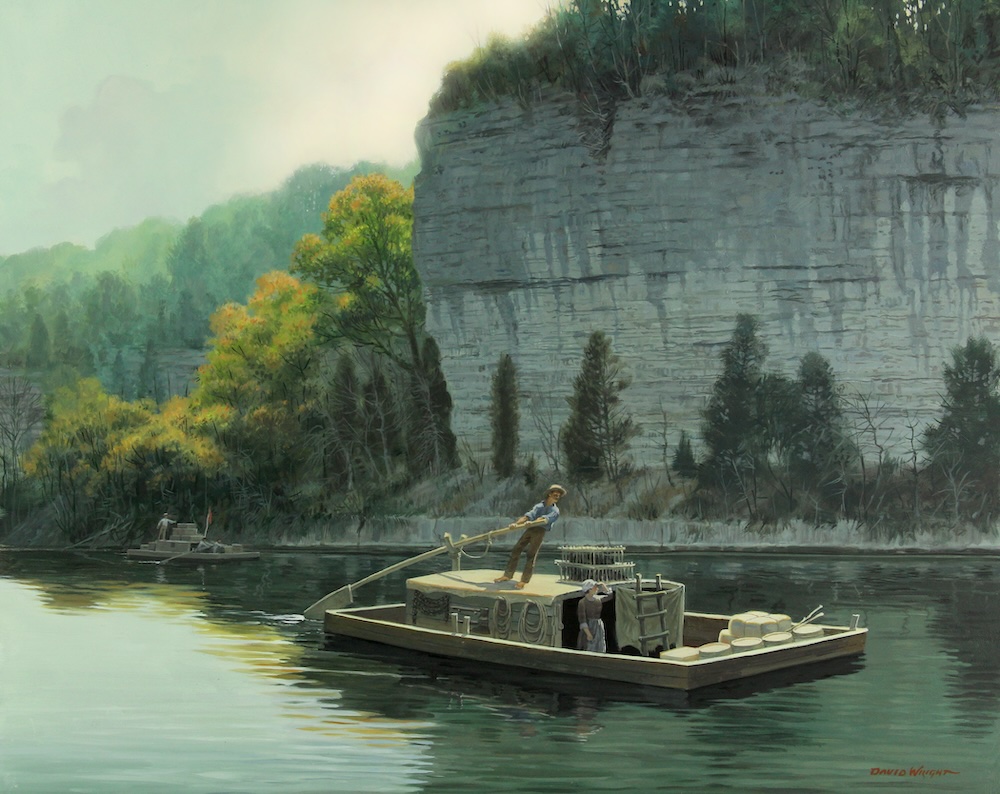
David Wright painting
TN.08: Describe the effects of migration into the Tennessee region, including the development of the Watauga and Cumberland settlements.
TN.11: Analyze the effects of land speculation on settlement in the Southwest Territory (i.e., the Territory South of the River Ohio).
TN.12: Describe the conflicts between early Tennessee settlers and American Indians.
Click on the right for the wonderful painting by David Wright featured on page 18 and on the cover of Journey Downriver: A History of Tennessee.
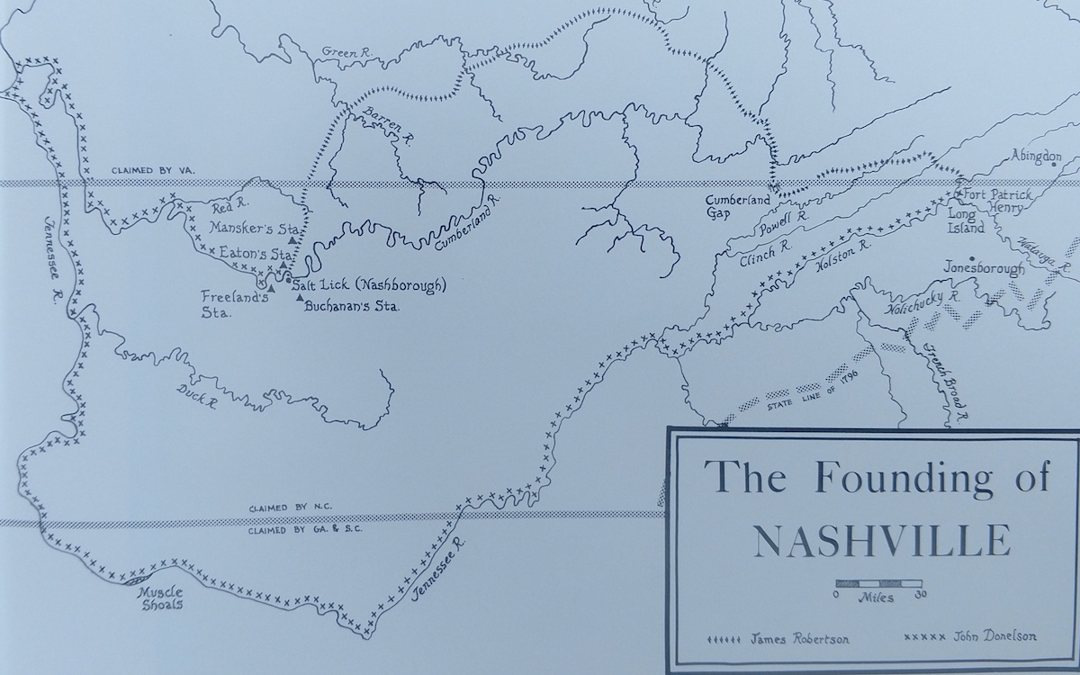 Click on the left to see a map that shows the route taken by the Donelson Party. Then scroll up and look at the right column to see the map on page 18.
In my opinion, the Donelson Party journey is the greatest single story in all of Tennessee history. In this booklet, because of space constraints, I was not able to do it justice. Click here to read a column I wrote on the subject in 2006.
The Donelson Party is mentioned on the Sullivan and Davidson County history pages.
And if you wish to read John Donelson’s original journal, click here.
In 2017, a photographer named John Guider retraced the Donelson Party’s journey using a 14-foot rowboat/sailboat and later published a book about his adventure. Click here to read about this remarkable story.
Page 23: King Mountain Turns the Tide
TN.09: Identify episodes of fighting that occurred in the Tennessee region during the American Revolution (e.g. Battle of King’s Mountain) and the effects of American victory in the area.
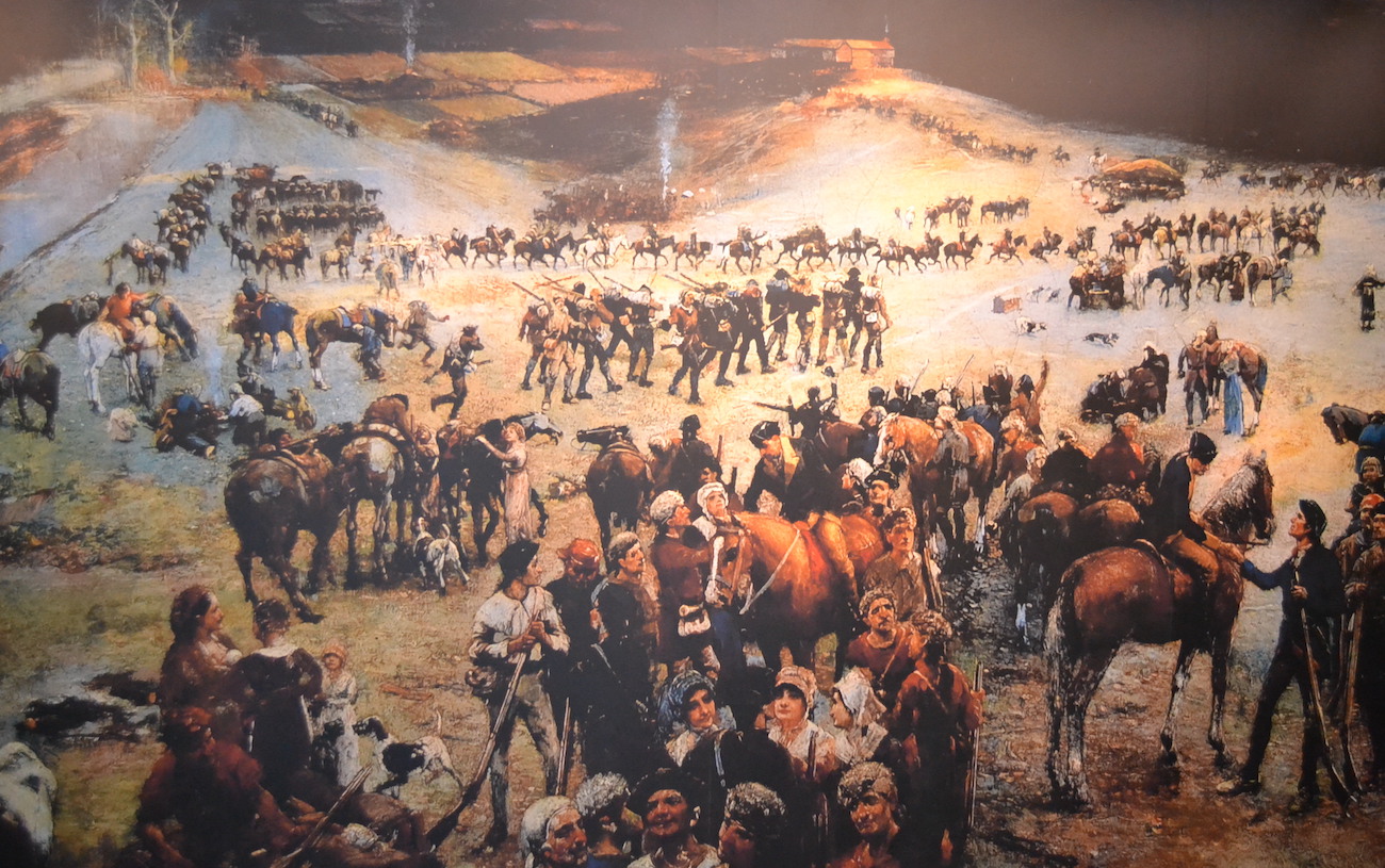
Lloyd Branson’s wonderful painting
Click on the right for a much larger version of the wonderful Lloyd Branson painting that appears on page 19. Click here for a fascinating and detailed blog about the painting, written by Michael Lynch.
Click here for a TN History for Kids style virtual tour of Kings Mountain battlefield.
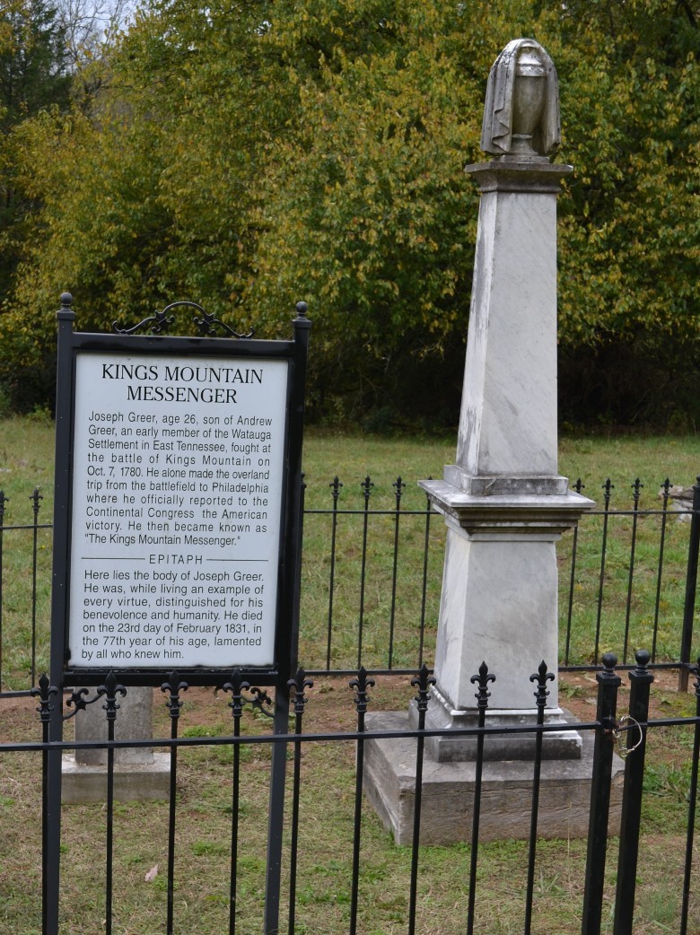
Joseph Greer’s grave in Lincoln County
Click here to see Lincoln County’s connection to the Battle of King’s Mountain. It turns out that the person who volunteered to deliver the news of the victory of Kings Mountain was named Joseph Greer, and he got a land grant after the war in what is now Lincoln County. Greer was, and is known as the “Kings Mountain Messenger.”
Also, click here to see out a entertaining and accurate video about the Battle of Kings Mountain that is shown at Kings Mountain National Military Park.
Page 25: Lost State of Franklin
 TN.10: Identify reasons for the foundation and failure of the independent state of Franklin in 1784
Click here for a Tennessee History for Kids tour “In Search of the Lost State of Franklin.”
Click on the right column to see the map of Tennessee shown on page 22, of the Southwest Territory phase.
There is a lot of supplemental information from the website that goes with this chapter, including on the Knox and Sullivan County websites.
William Blount and the matter of statehood appear in the virtual tour of historic Philadelphia, found here.
Page 27: Sixteenth State
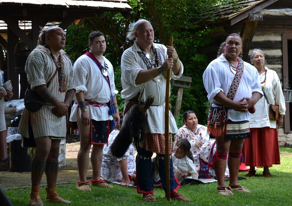
A reenactment of the negotiations at White’s Fort
TN.11: Analyze the effects of land speculation on settlement in the Southwest Territory (i.e., the Territory South of the River Ohio).
TN.13: Describe the events leading to Tennessee’s achievement of statehood in 1796.
TN.14: Describe major features of the Tennessee Constitution of 1796.
Click on the right column to see the map on page 24 that shows the result of the Treaty of the Holston.

Nickajack Cave, which is downstream from
Chattanooga
Nickajack Cave and the area around it SHOULD be turned into a state historical site, with a full-time staff, interpreters and living history events. For now, it is owned and overseen by the Tennessee Wildlife Resources Agency, which — last time I checked — only occasionally shows up to empty the trash can there.
The Nickajack Expedition is extremely well documented. There are several other first-person accounts of the Nickajack Expedition in Paul Clement’s huge collection called Chronicles of the Cumberland Settlements, which you should be able to find on the second-hand book market.
Click here for the Marion County history page, which tells you more about the content in this chapter.
And click here for a Tennessee Magazine column about the history of Nickajack Cave — which involves, among others, Johnny Cash!
Page 30: Dirt Roads
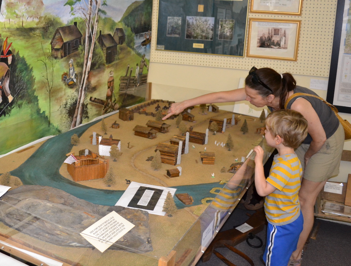
You can see a model of Fort Blount at the Jackson County History Museum in Gainesboro.
TN.12: Describe the conflicts between early Tennessee settlers and American Indians.
TN.22: Explain the importance of transportation, technology and geography in Tennessee’s growing involvement in the national economy after the War of 1812, including the significance of the Natchez Trace.
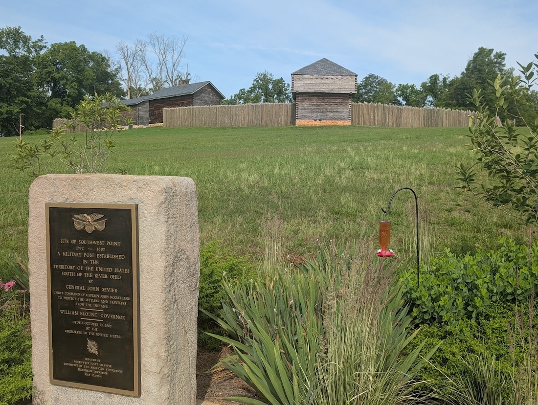
Fort Southwest Point is now a STATE HISTORIC PARK. Stay tuned to this website for the virtual tour!
Look for more information for this chapter on the Roane, Jackson and Cumberland County history pages.
Also, click here for a Tennessee Magazine column I wrote on this subject in January 2017.
By there way, there is debate among historians as to what the first road in Tennessee was. The Department of Transportation claims is was Highway 70 and there are people who claim it was the Emery Road.
I maintain that the first road in Tennessee was the one that left Abington, Virginia, and headed southwest in the direction of towns such as Jonesborough and Greeneville.
Page 32: Vols Win at New Orleans
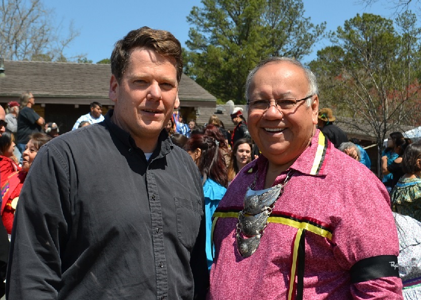
History Bill with the Chief of the Muskogee Indian nation
TN.20: Analyze the War of 1812’s impact on Tennessee, including American Indian peoples; Andrew Jackson; Felix Grundy; and Tennessee Volunteers.
We didn’t have space in the workbook to devote to the Battle of Horseshoe Bend, but click here for a virtual tour of Horseshoe Bend, in Alabama. On the 200th anniversary of the Battle of Horseshoe Bend, History Bill was the only person from Tennessee who was actually AT the battlefield. I was there along with several hundred Muskogee (Creek) Indian visitors from Oklahoma, and it was a powerful day.
Click here for the tour of Chalmette Battlefield, near New Orleans.
Page 34: Land of Hardwood and Cotton
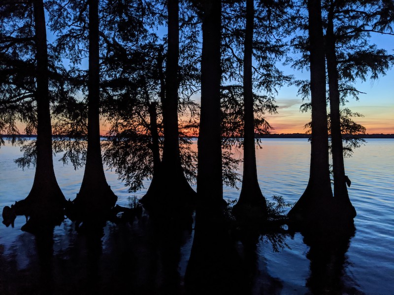
Reelfoot Lake
TN.18: Describe the economy of Tennessee in the early 19th century
TN.19: Describe the New Madrid Earthquakes of 1811-12 and the resulting effects on the land and culture of Tennessee.
TN.21: Describe the significance of the Mississippi River, the Jackson Purchase and the introduction of cotton in the rapid growth of Memphis and West Tennessee.
Click on the right column to see the 1818 map of West Tennessee.
Click here for a virtual tour “In Search of the New Madrid Earthquakes.”
Click here for a virtual tour of Randolph, Tipton County’s “ghost town” on the Mississippi.
Click here for the Shelby County history page.
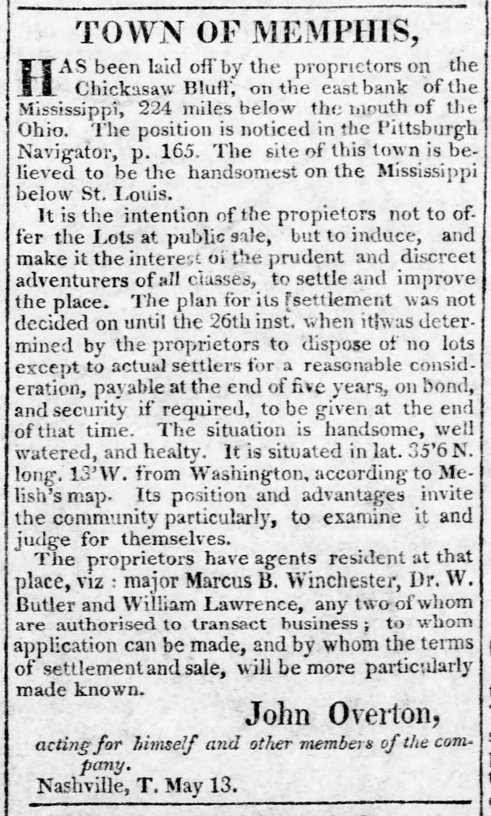
Pittsburgh Gazette, July 24, 1818
Meanwhile, if you read the ad on page 32 (and on the right) for the creation of the “town of Memphis,” you may notice something odd: Memphis’ longitude is listed as 13 degrees west, “from Washington.”
Why is this?
Today, longitude lines are measured west from Greenwich, England. However, longitude lines on American-made maps used to be measured from Washington D.C. If you don’t believe me, go to the TN State Library and Archives and look at the 1796 Harris map, the 1818 Melish map, the 1832 Rhea map, and the 1851 Mitchell map. All these maps have Knoxville at about 7 degrees west longitude and Nashville about 10 degrees west longitude.
The reason American maps didn’t measure things west from Greenwich England in the early 1800s, as best I can tell, is because Americans still hated the British!
American maps didn’t switch to the Greenwich longitude system about when the U.S. began adopting standard time zones in the 1880s. That’s why the 1888 Rand McNally map of Tennessee has longitude lines labeled west from Washington at the top of the map and longitude lines labeled west from Greenwich at the bottom.
Page 37: 1834 Constitution

The Tennessee State Capitol
I wrote a detailed column for Tennessee Magazine about the long, bitter argument under which the legislature chose Nashville to be the permanent capital. Click here to read it.
Page 39: Red Clay to Trail of Tears
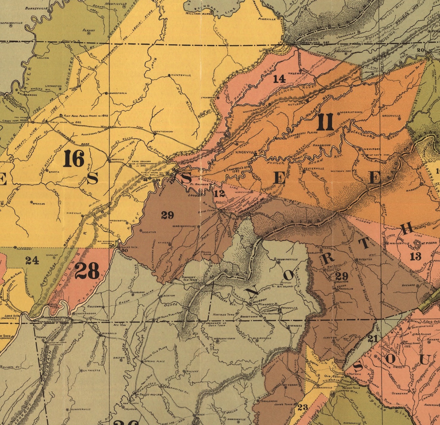
C.C. Royce map, 1884
TN.24: Analyze the impact of the Indian Removal Act and the Trail of Tears on Tennessee.
TN.25: Discuss the contributions of important figures during Tennessee’s “Golden Age,” including Sequoyah
There are two virtual tours on the Tennessee History for Kids website that cover material in this chapter–the Red Clay tour and the New Echota tour.
Also, this map (on the right) can be used to illustrate just how many treaties there were between the Cherokee nation and the U.S. government, and how each treaty resulting into the taking of Cherokee land. Each number on the map (12, 16, 28, etc) indicates land that went along with a particular treaty.
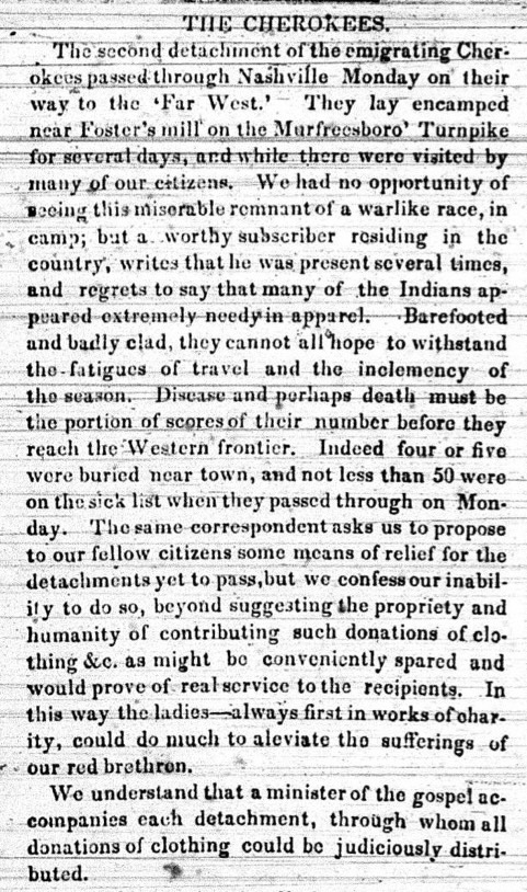
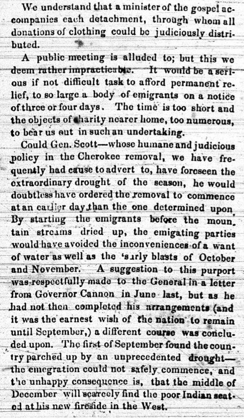 Meanwhile, I have a remarkable first-person account of the Trail of Tears to share.
Click on the newspaper article I pulled from the October 24, 1838, Nashville Whig (on the left and right). This is a detailed account and description of the Cherokee Indians as they migrated through Nashville on their way west.
Page 41: Tennessee’s Golden Age
Knoxville Whig; June 18, 1845
TN.23: Describe the influences of Presidents Andrew Jackson and James K. Polk on American history.
TN.24: Analyze the impact of the Indian Removal Act and the Trail of Tears on Tennessee.
TN.25: Discuss the contributions of important figures during Tennessee’s “Golden Age,” including John Bell, Newton Cannon, William Carroll, David Crockett, Ephraim Foster, Sam Houston, Hugh Lawson White.
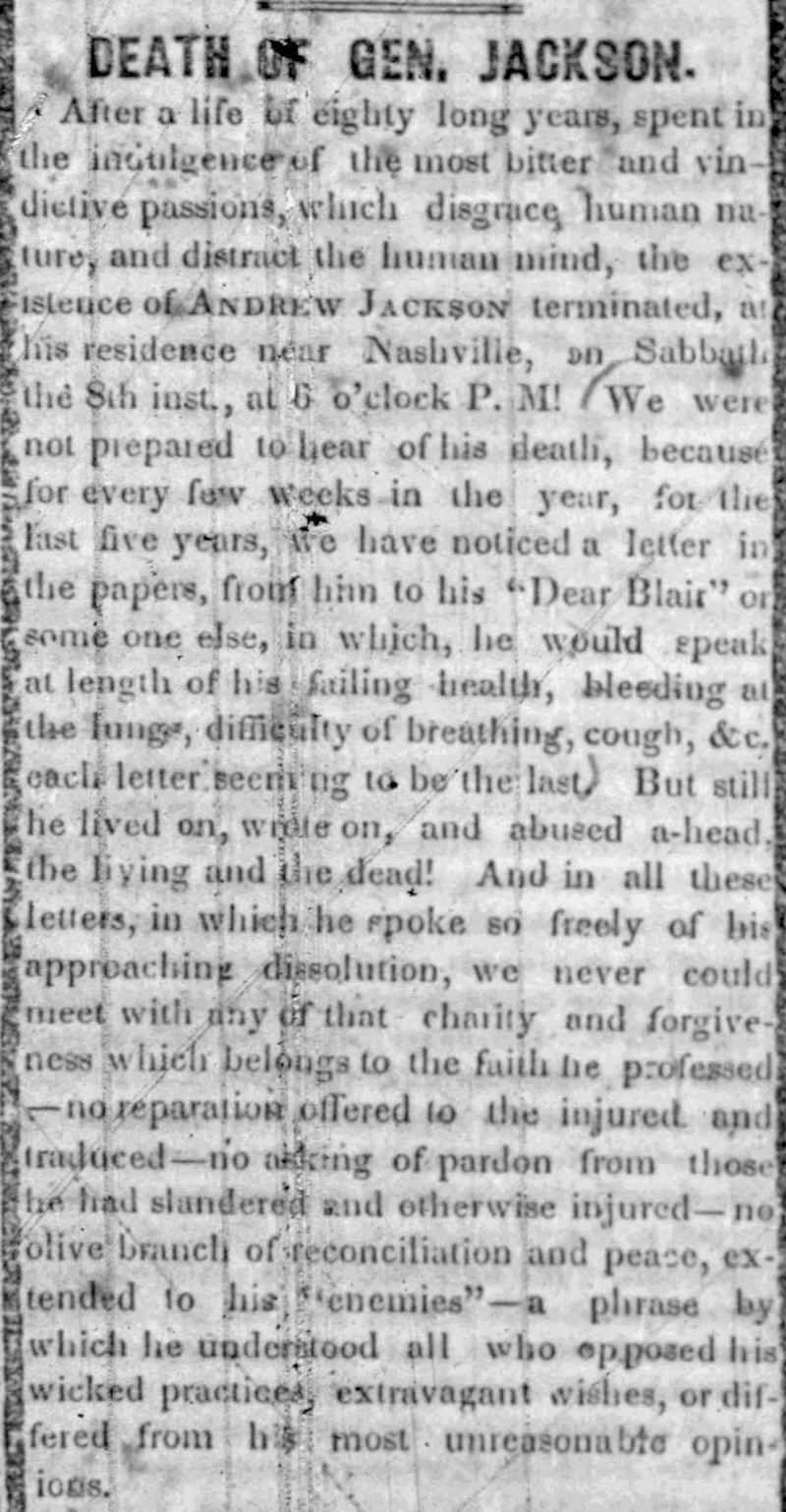
Just to amplify the fact that there were Tennesseans who hated Andrew Jackson, click on the right to see an editorial in the Knoxville Whig — written by William Brownlow — which condemned Jackson the week he died. We will talk more about Brownlow, who later became Tennessee’s governor, in Chapter 25.
When it comes to Jackson and Polk, it is important to remember that both were born in the Carolinas, migrated west, and moved throughout their lives. To understand their stories, you have to go to various homes, battlefields, to the Tennessee State Capitol, and even to Washington D.C.
Photograph Courtesy of George Eastman House, International Museum of Photography and Film
Click here for a virtual tour “In Search of Andrew Jackson” and here for a tour “In Search of James K. Polk.”
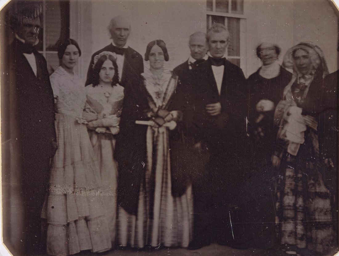
Also, I wrote an entire column about the fascinating photograph shown on the left — which features two presidents, three First Ladies, and the model for all vampires on stage and screen. Click here to read the column.
Click here to be taken to the online teacher’s guide for chapters 17-32 of Free and Independent State.
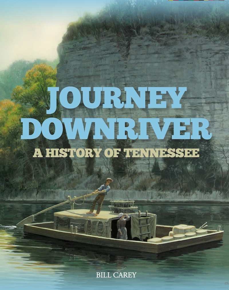
This workbook was written for students taking the high school elective on Tennessee history, and this web page contains further information about the events and names contained in the first 16 chapters of the workbook.
The ‘I” referred to in this teacher’s guide is the author, Bill Carey, who is also the founder of Tennessee History for Kids.
For the online teacher’s guide to pages 43-84 click here; for the online teacher’s guide to pages 85-130, click here.
Here are the maps from pages 2-4:
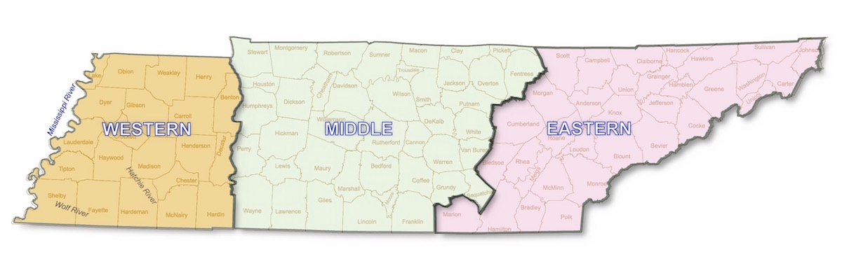
TN Department of Transportation map
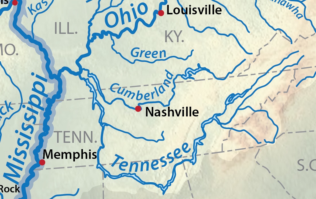
A river system map of Tennessee (Shannon1/Wikipedia)

This map shows the six physical regions of Tennessee. (Sherrie Collier map)l
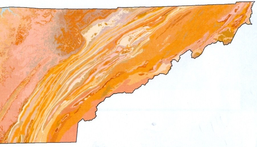
Contour map of East Tennessee
Below are maps, some of which were printed in the workbook. Click on them to see much larger.
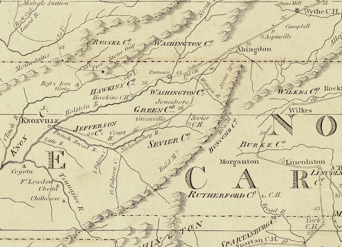
This map depicts what is now East Tennessee in about 1780 (TN State Library and Archives)
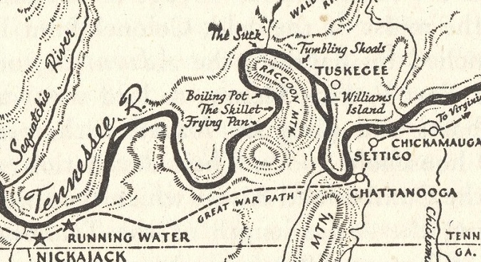
Donald Davidson map
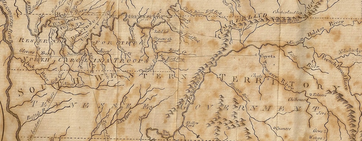
Low’s Encyclopedia map showing present-day Tennessee in the 1790s, during the Southwest Territory era.

Bureau of American Ethnology map that shows the land owned by the United States and various Indian nations as a result of the Treaty of the Holston.
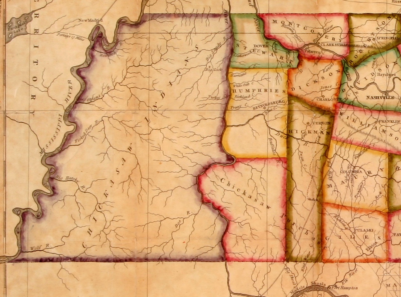
The map shown on page 30, above, was created in 1818 by the Scottish cartographer John Melish. (TN State Library and Archives)