Teacher’s Guide to Long March to Tennessee (2027 edition)
Welcome to the teacher’s guide to the 5th grade Tennessee History for Kids workbook Long March to Tennessee [2027 edition]. This web page contains further information to help teachers who use this the workbook.
TN History for Kids sells these workbooks as inexpensively as it does and prints them on non-glossy paper because we want students to write in them and keep them.
If you would like the answers to the quiz questions, email orders@tnhistoryforkids.org from your school email address. We have also created a final exam for this workbook and the following one (Work for Freedom). Click here to download it. If you’d like the final exam answer key, email orders@tnhistoryforkids.org from your school email address.
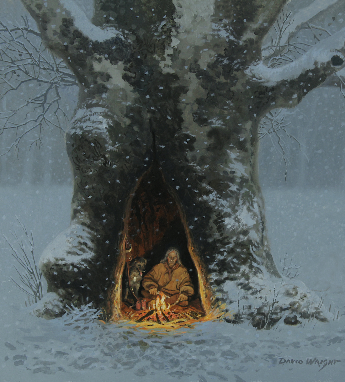
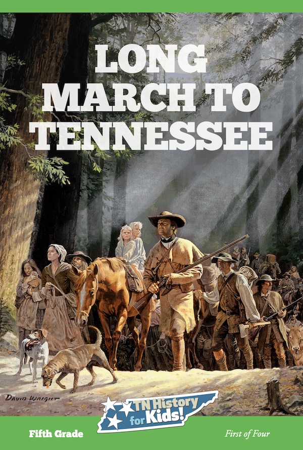
David Wright painting
Chapter One: Wild and Free
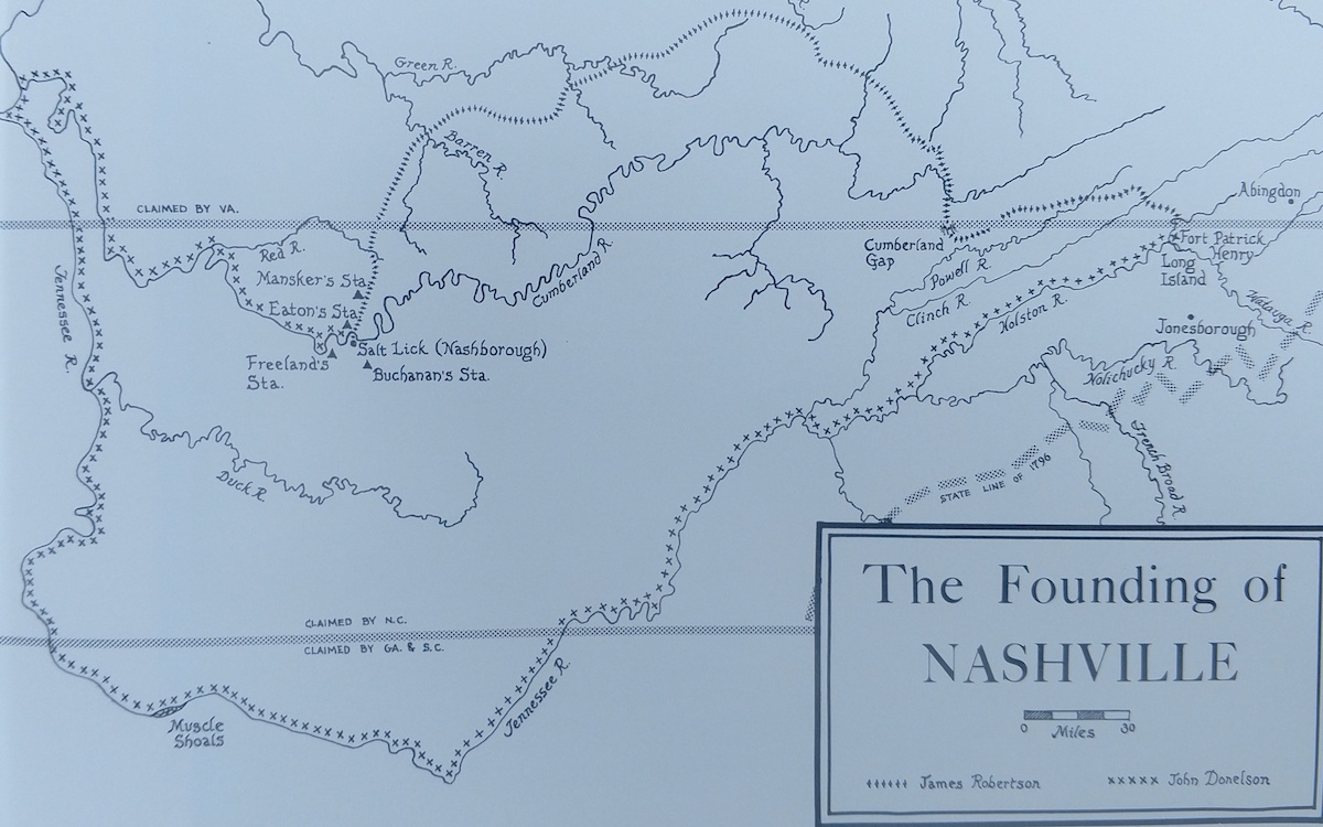
Standard 5.04: Examine how longhunters (e.g. Daniel Boone and William Bean) created interest in land west of the Appalachian Mountains.
Standard 5.05: Explain how the Cumberland Gap and Wilderness Road influenced migration into the Tennessee region following the Proclamation of 1763.
There are a couple of videos that will help bring this chapter to life for students. Click here to see one called “Journey Through The Gap” and here to see one called “Trek Across Tennessee.”
Click here to be taken to the Jackson County history page, where you can read more about Fort Blount.
There is a wonderful geography section of this website. Click here for part of it that makes reference to some of the same concepts that appear in this chapter.
I’ve written many Tennessee Magazine columns about the content in this chapter. These columns weren’t necessarily written at a fifth grade level, but your students might enjoy them anyway. Click here to read one of them, about Nickajack Cave, The Suck and Joseph Brown.
Part of the “Social Studies Practice” section of the Tennessee Social Studies Standards suggests that teachers expose their students to multiple sources and “frame appropriate questions for further investigation” (SSP.003).
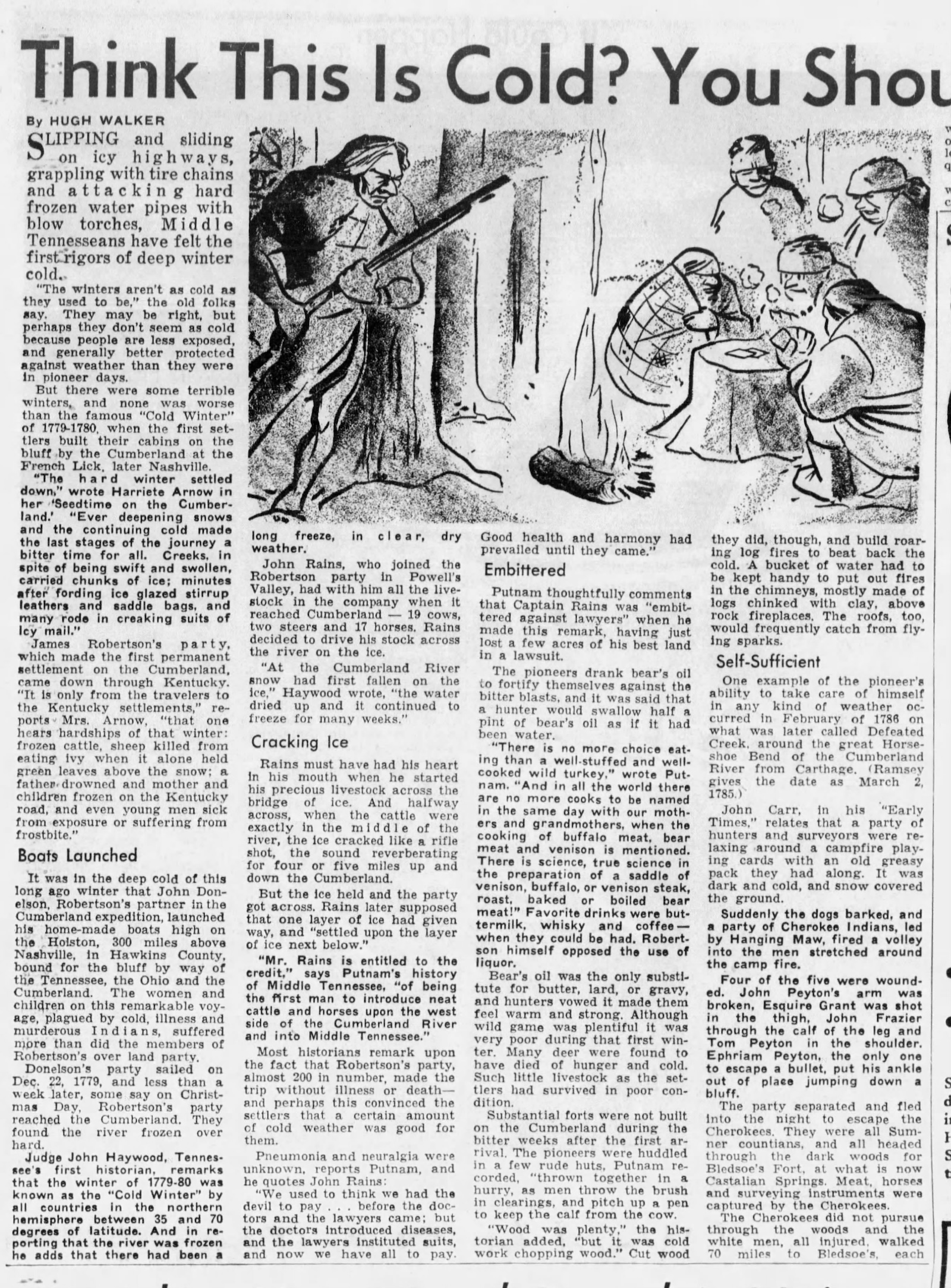
On page 3 of Long March to Tennessee, there is a reference to the use of bear oil as an insect repellant and lamp fuel.
 To the left and right is a long article that historian Hugh Walker published in the Tennessean on January 14, 1962.
Have your students read it, decide for themselves what they think about BEAR OIL, and write down three things in Hugh Walker’s article about bear oil that is not in Long March to Tennessee.
Chapter Two: Digging in the Dirt
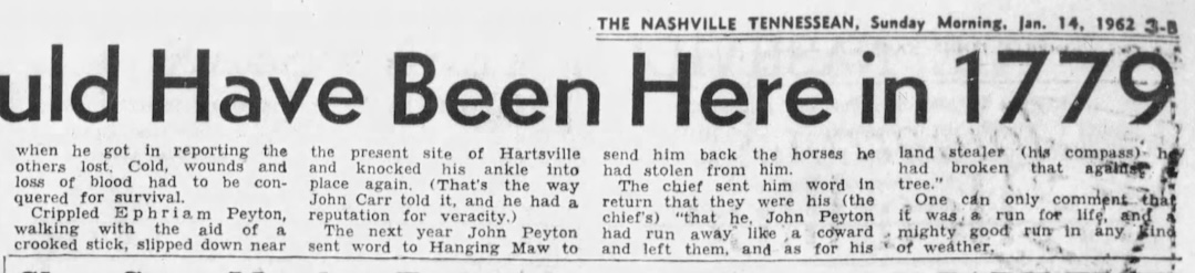
Standard 5.02: Identify the cultures of Paleo, Archaic, Woodland and Mississippian peoples based on archaeological evidence found in Tennessee sites (for example, Old Stone Fort, Pinson Mounds and Chucalissa Indian Village).
State prehistoric archaeologist Aaron Deter-Wolf appears in a video we did for this chapter called “Digging Up Old Garbage.” Click here to see it. (Sadly, Dr. Kevin Smith passed away in 2025; click here to read his obituary.)
Saul’s Mound at Pinson Mounds (THFK photo)
It needs to be pointed out that there is not universal agreement within archaeologists and textbooks about the various prehistoric time periods. The Archaic Period came at different times in different parts of the world, and therein lies part of the confusion. With this chapter, we went with the dates and eras as explained by Deter-Wolf.
On this website you will find many virtual tours about the sites mentioned in this chapter. Click here for a virtual tour of Old Stone Fort; here for a tour of Sellar’s Farm; and here for a tour of Pinson Mounds.
Chapter Three: Summer House and Stickball
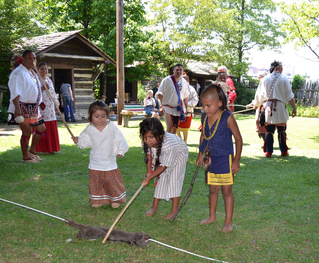
THFK photo
Standard 5.03: Identify the pre-colonial American Indian tribes and residing in Tennessee (for example, Cherokee, Chickasaw, Creek and Shawnee) and compare their various customs and traditions.
The video “Three Sisters and the Little Brother of War” goes great with this chapter. Click here to see it.
Click here for a virtual tour of the Museum of the Cherokee People in Cherokee, North Carolina.
The most important Cherokee sites in Tennessee are in Monroe County. Click here to see some of them.
Click here to see a virtual tour “In Search of the Chickasaw Nation” and here to visit the website of the Chickasaw Cultural Center in Oklahoma.
Not a lot of people know this, but there is a very small Choctaw Indian Reservation in Lauderdale County. Click here to read a column by “History Bill” about it.
Chapter Four: Longhunters and the Gap
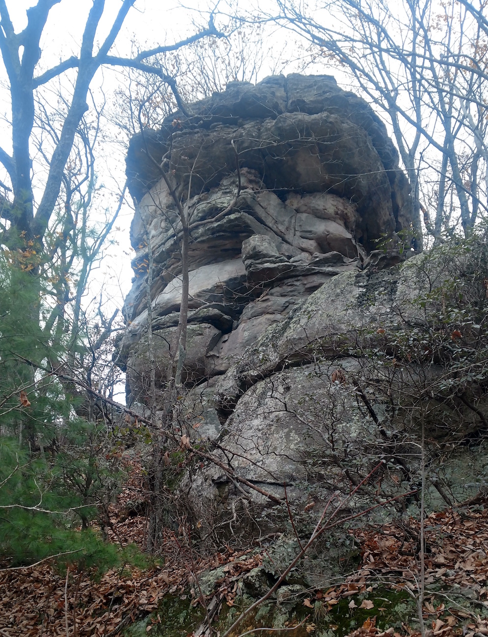
THFK photo
Standard 5.04: Examine how longhunters (e.g. Daniel Boone and William Bean) created interest in land west of the Appalachian Mountains.
Standard 5.05: Explain how the Cumberland Gap and Wilderness Road influenced migration into the Tennessee region following the Proclamation of 1763.
Click here for a Tennessee History for Kids virtual tour “In Search of de Soto,” which took us to Bradenton, Florida.

THFK photo of the Cumberland Gap
Longhunters are a fascinating subject within the world of Tennessee history–especially in light of the popularity of recent “survival skills” shows. I will also admit that Thomas “Big Foot” Spencer is of special interest because of the stories about him, because there is a creek near my house named for him, and because this rock in Cumberland County is supposedly where he was killed.
Click on the image above and to the right, and show it to your students on a big screen. Is it just me, or does the rock LOOK LIKE a man’s face?
Click here to read a column that “History Bill” wrote about Big Foot Spencer for Tennessee Magazine in 2012. I need to point out that Bill Carey WROTE THIS, in spite of the fact that other people have claimed that they wrote it.
Also, click here for a virtual tour of Cumberland Gap National Park, which is one of the most overlooked historical sites in Tennessee.
It was at this national park, of course, where we filmed this amusing video, starring the late Wayne Milton as Daniel Boone.
Chapter Five: Dangerous Example
Standard 5.04: Examine how longhunters (e.g. Daniel Boone and William Bean) created interest in land west of the Appalachian Mountains.
Standard 5.06: Explain the significance of the Watauga Settlement and Watauga Compact.
Standard 5.08: Identify the contribution of leaders and groups during the early settlement of Tennessee, including John Sevier, John Donelson, Nancy Ward, Dragging Canoe, James Robertson and Overmountain Men.
What happened at Fort Loudoun is important background for this chapter. Click here to see a video on this subject starring History Bill. (Special thanks to Jeff Wells, Rob Rambo and Jerry Wooten for appearing in the video.)
Click here to go “In Search of Henry Timberlake.”
Click here for the Monroe County website, which talks a bit about Chota.
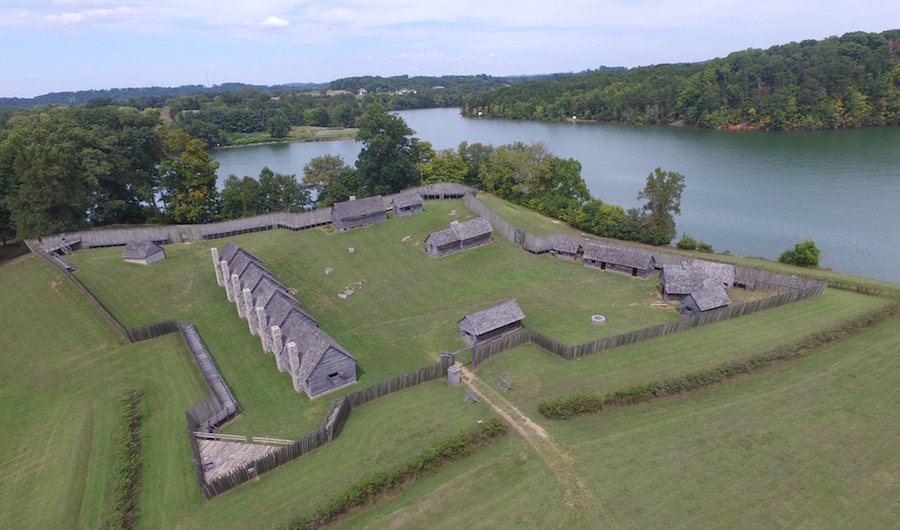
Chapter Six: Bloody Ground

Harold Jerrell’s remarkable photograph
Standard 5.05: Explain how the Cumberland Gap and Wilderness Road influenced migration into the Tennessee region following the Proclamation of 1763.
Standard 5.08: Identify the contribution of leaders and groups during the early settlement of Tennessee, including John Sevier, John Donelson, Nancy Ward, Dragging Canoe, James Robertson and Overmountain Men.
The photograph on page 28 is the one of the best reenacting photographs of the colonial era that I have ever seen. Thanks to Harold Jerrell for taking it and letting us use it!
Click here for a virtual tour of Sycamore Shoals State Park, which was the scene of many of the events described in this part of Long March to Tennessee.
Chapter Seven: Marks on Trees
Standard 5.05: Explain how the Cumberland Gap and Wilderness Road influenced migration into the Tennessee region following the Proclamation of 1763.
Standard 5.07: Describe the founding of the Cumberland Settlements, the creation of early roads (e.g. Natchez Trace, Emery Road and other roads across the Cumberland Plateau) and the obstacles face with their establishment including the Battle of the Bluffs.
Standard 5.08: Identify the contribution of leaders and groups during the early settlement of Tennessee, including John Sevier, John Donelson, Nancy Ward, Dragging Canoe, James Robertson and Overmountain Men.
A BIG thank you to artist David Wright for letting us use images of his paintings, such as the cover photo of this workbook and also the painting on page 33.
In my view, the Donelson Party journey is the greatest story in all of Tennessee history. In this booklet, because of space constraints, I was not able to do it justice. Click here to read a column I wrote on the subject in 2006.
The map on page 33 is not easy to see in the booklet. Click here (to the right) to make it bigger, so you can show it to your class.
The Donelson Party is covered on the Sullivan and Davidson County history pages.
Part of the “Social Studies Practice” section of the Tennessee Social Studies Standards suggests that students “gather information from a variety of primary and secondary source, including printed” material. (SSP.001) With this in mind, click here for the actual Donelson Party Journal — one of the most remarkable primary sources in American history.
In 2017, a photographer named John Guider retraced the Donelson Party’s journey using a 14-foot rowboat/sailboat and later published a book about his adventure. Click here to read this remarkable story.
Lloyd Branson’s wonderful painting
Chapter Eight: Overmountain Men
Standard 5.08: Identify the contribution of leaders and groups during the early settlement of Tennessee, including John Sevier, John Donelson, Nancy Ward, Dragging Canoe, James Robertson and Overmountain Men.
Click on the right for a much larger version of the wonderful Lloyd Branson painting that appears on page 37. The original painting was destroyed in a fire. Very sad!
Click here for a TN History for Kids style virtual tour of Kings Mountain Battlefield.
Also, click here to see out a entertaining (and accurate) 43-minute video about the Battle of Kings Mountain which is shown at Kings Mountain National Military Park.
THFK photo
Chapter Nine: Franklin/Southwest Territory
Standard 5:10: Sequence event that led to Tennessee statehood, including the “Lost State of Franklin,” the Southwest Territory (i.e. Territory South of the River Ohio), and the U.S. Constitutional requirements Tennessee met to become a state.
Click here for a Tennessee History for Kids tour “In Search of the Lost State of Franklin.”
There is a lot of supplemental information from the website that goes with this chapter, including on the Knox and Sullivan County websites.
William Blount and the matter of statehood appear in the virtual tour of historic Philadelphia, found here.
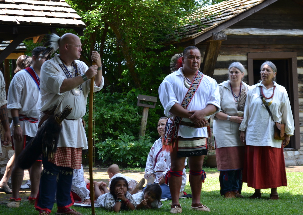
Sidebar: Yuchi, Cherokee and Tanase
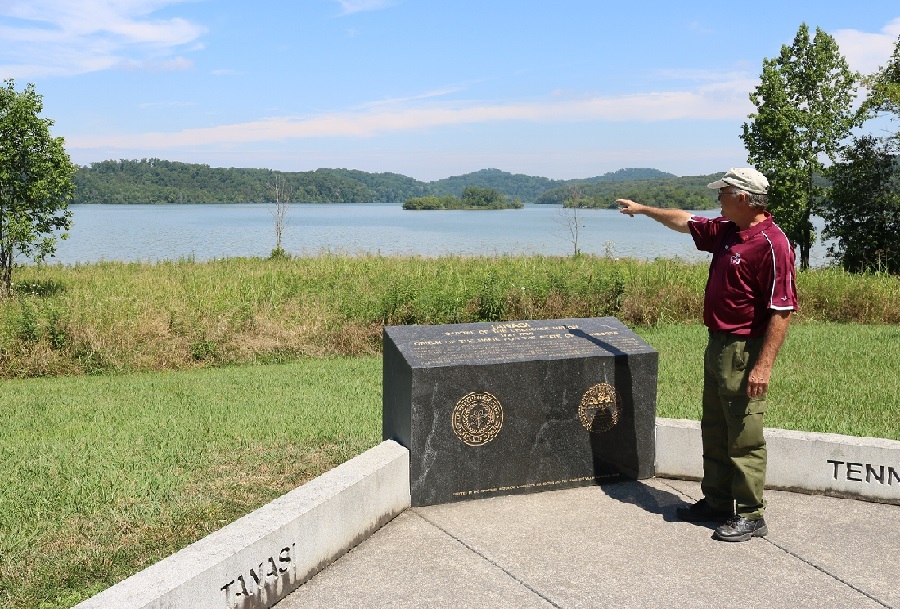
Charlie Rhodarmer of the Sequoyah Birthplace Museum stands at the Tanasi memorial and points to the former location of the village.
Standard 5.03: Identify the pre-colonial American Indian tribes and residing in Tennessee (for example, Cherokee, Chickasaw, Creek and Shawnee) and compare their various customs and traditions.
I consulted at length with Dr. Jason Jackson at Indiana University and with Mary Linn at the Smithsonian Center for Folklore and Cultural Heritage before I wrote this content. Both are experts on the specialized topic of the Yuchi language (which, by the way, is a “critically endangered” language.) Both made it clear to me that no one really knows whether “tanase” was a Cherokee or Yuchi word. And both told me that no one knows what the original meaning of the word “tanase” was.
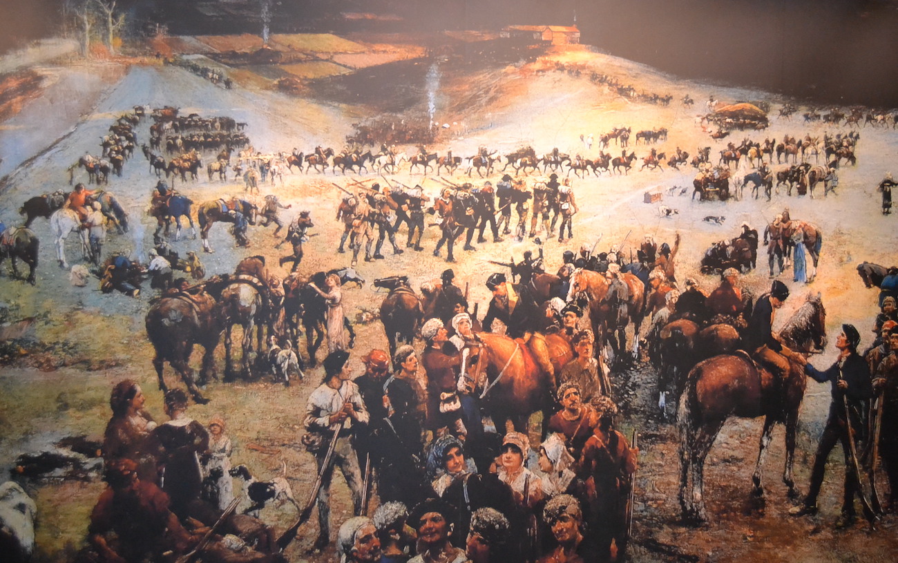
Chapter 10: Nickajack and Statehood

THFK photo
Standard 5.10: Sequence event that led to Tennessee statehood, including the “Lost State of Franklin,” the Southwest Territory (i.e. Territory South of the River Ohio), and the U.S. Constitutional requirements Tennessee met to become a state.
Standard 5.11: Identify the year Tennessee became state, it first governor and its original capital.
Nickajack Cave and the area around it SHOULD be turned into a state historical site, with a full-time staff, interpreters and living history events. For now, it is owned and overseen by the Tennessee Wildlife Resources Agency, which — last time I checked — only occasionally shows up to empty the trash can.
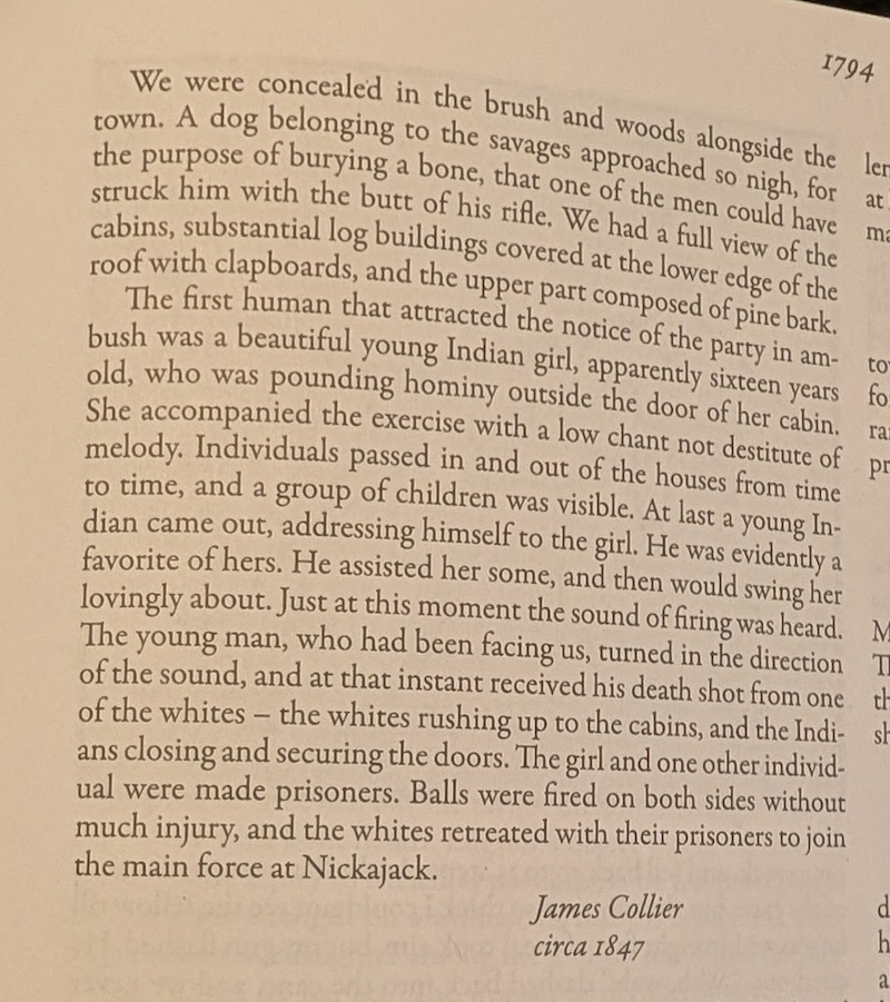
From Chronicles of the Cumberland Settlements by Paul Clements
Part of the “Social Studies Practice” section of the Tennessee Social Studies Standards suggests that students “gather information from a variety of primary and secondary source, including printed” material. (SSP.001)
The Nickajack Expedition is very well documented. There are several first-person accounts of the Nickajack Expedition in Paul Clement’s massive tome called Chronicles of the Cumberland Settlements. To you’d like to read one of those first-person accounts, read the account on the left. (WARNING: SOME OF YOUR STUDENTS MAY FIND THE LANGUAGE TOO DATED AND THE DETAILS TOO VIOLENT.)
Click here for the Marion County history page, which tells you more about the content in this chapter.
And click here for a Tennessee Magazine column about the history of Nickajack Cave.
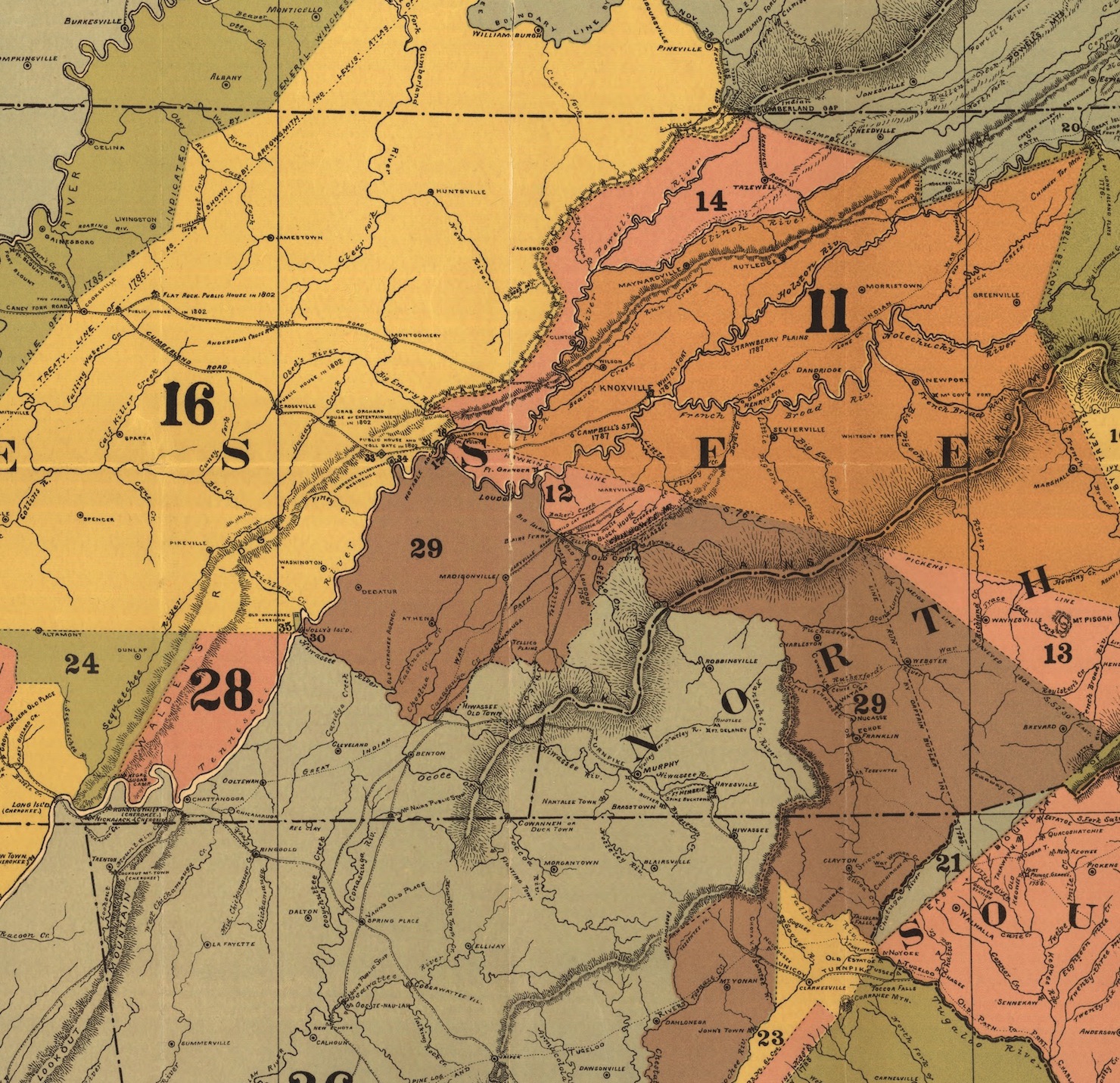
Sidebar: Not Much of a State

Bureau of American Ethnology Map
Standard 5.11: Identify the year Tennessee became state, it first governor and its original capital.
This map (on the right) is not included in Long March to Tennessee, but is a remarkable map which illustrates the point made in this sidebar.
When Tennessee first became a state, it consisted entirely of the blue parts and the green part shown on the map. The orange sections of the map were all still Cherokee or Chickasaw territory!
Meanwhile, I’m told that Fort Southwest Point, which until now was a park run by the city of Kingston, will now become a state park. When it does, we will certainly include a virtual tour of it on the Tennessee History for Kids website!
Chapter 11: Dirt Roads
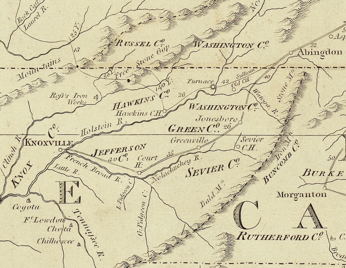
Tennessee State Library and Archives map
Standard 5.07: Describe the founding of the Cumberland Settlements, the creation of early roads (e.g. Natchez Trace, Emery Road and other roads across the Cumberland Plateau) and the obstacles face with their establishment including the Battle of the Bluffs.
INSIDE STORY: There was a lot of discussion on the Social Studies Standards Review Committee in August 2023 as to which road was Tennessee’s first. I, who was not on the committee, was called upon, and argued that Tennessee’s “first road” was the one that led from Abington, Virginia, to Greenville and Rogersville (then called Hawkins Courthouse), Tennessee.
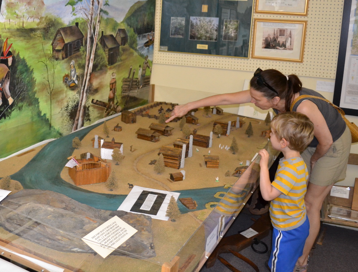
You can see a model of Fort Blount at the Jackson County History Museum in Gainesboro.
Others argued that either the Emery Road or the Fort Blount Road was Tennessee’s “first road.” In any case, it was out of this friendly argument that chapter 11 was created.
Look for more information for this chapter on the Roane, Jackson and Cumberland County history pages.
Also, click here for a Tennessee Magazine column I wrote on this subject in January 2017.
Chapter 12: Slavery in Tennessee
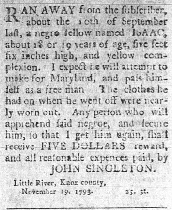
An ad in the October 19, 1793, Knoxville Gazette
Standard 5.09: Describe life on the Tennessee frontier for different groups, including settlers, American Indians, indentured servants and enslaved persons.
Standard 5.16: Examine the issue of enslavement in the three grand divisions and the impact their differences had on Tennessee’ secession from the Union.
This chapter covers some pretty serious material. Please take care in making your lesson plans for it.
This website contains a 28-minute KidsInar that covers some of the material covered here. When I made it I had 8th grade students in mind, but I do recommend that all teachers who cover the topic of slavery watch it as well. Click here to see it.
Tennessee History for Kids has a remarkable data base of newspaper advertisements related to slavery, published in every part of the state. If you’d like to see what we have for your part of the state, click here and I’ll send you one from your area.
Chapter 13: Revenge of the Dirty Shirts
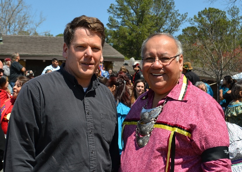
History Bill with the Chief of the Muskogee Indian nation
Standard 5.12: Describe Tennessee’s involvement in the War of 1812, including Andrew Jackson, the Tennessee Volunteers, and the Battle of Horseshoe Bend.
Click here for a virtual tour of Horseshoe Bend, in Alabama, and here for a tour of Chalmette Battlefield, near New Orleans.
On the 200th anniversary of the Battle of Horseshoe Bend, History Bill was the only person from Tennessee who was actually ON the battlefield. I was there along with several hundred Muskogee (Creek) Indian visitors from Oklahoma, and it was a memorable day.
Chapter 14: Shakes to Grand Division
1818 Melish Map
Standard 5.13: Explain how the western boundary of Tennessee was expanded with the Jackson Purchase.
Standard 5.16: Examine the issue of enslavement in the three grand divisions and the impact their differences had on Tennessee’ secession from the Union.
Click on this image to the right to see the 1818 Melish map of West Tennessee more clearly.
Part of the “Social Studies Practice” section of the Tennessee Social Studies Standards suggests that teachers expose their students to multiple sources and “frame appropriate questions for further investigation” (SSP.003). Click here for a virtual tour “In Search of the New Madrid Earthquakes,” which contains many first-person accounts of the earthquake.
Click here for a virtual tour of Randolph, Tipton County’s “ghost town” on the Mississippi.
Click here for the Shelby County history page.
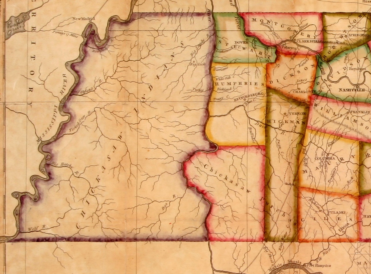
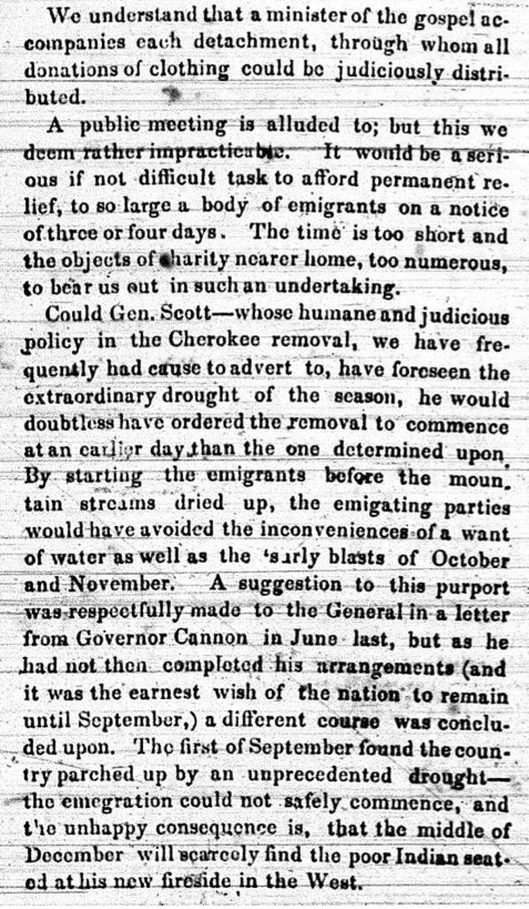
Chapter 15: Place Where They Cried
C.C. Royce map, 1884
Standard 5.14: Analyze the impact of Andrew Jackson’s presidency on the American Indian population of Tennessee, including the Indian Removal Act, Trail of Tears, Treaty of Echota and John Ross.
Standard 5.15: Identify the impact of important Tennesseans prior to the Civil War, including David Crockett, President James K. Polk, Sam Houston and Sequoyah.
There are two virtual tours on the Tennessee History for Kids website that cover material in this chapter–the Red Clay tour and the New Echota tour.
Also, this map (to the right), though very complicated, can be used to illustrate just how many treaties there were between the Cherokee nation and the U.S. government, and how each treaty resulting into the taking of Cherokee land. Each number on the map (12, 16, 28, etc) indicates land that went along with a particular treaty.
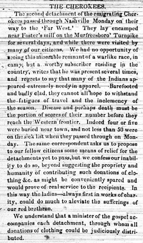
SIDEBAR: B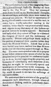 arefoot and Badly Clad
Standard 5.14: Analyze the impact of Andrew Jackson’s presidency on the American Indian population of Tennessee, including the Indian Removal Act, Trail of Tears, Treaty of Echota and John Ross.
Part of the “Social Studies Practice” section of the Tennessee Social Studies Standards suggests teachers expose their students to a primary or secondary source and “summarize significant information,” “distinguish between fact and opinion,” and “recognize the authors purpose, point of view and reliability.” (SSP.002)
Page 75 is a heavily abridged newspaper article that appeared in the Nashville Whig on October 24, 1838. Click on the image to the right to see the first half of the actual article, and click on the image to the left to read the second half.
If you like, have your students read the actual articles and ask themselves the following questions about it:
ONE: Is this a primary or a secondary source?
TWO: What is the point of the view of the person who wrote it? Was he sympathetic to the Cherokee or did the blame the Cherokee?
THREE: How reliable was the author of this article?
FOUR: What did the author of this article hope to achieve through writing it?
FIVE: What did the author of this article predict was going to happen to the “migrating” Cherokee?
Chapter 16: Old Hickory, Young Hickory
Standard 5.14: Analyze the impact of Andrew Jackson’s presidency on the American Indian population of Tennessee, including the Indian Removal Act, Trail of Tears, Treaty of Echota and John Ross.
Standard 5.15: Identify the impact of important Tennesseans prior to the Civil War, including David Crockett, President James K. Polk, Sam Houston and Sequoyah.
PHOTO: George Eastman House, International Museum of Photography and Film
When it comes to Andrew Jackson and James K. Polk, it is important to remember that both were born in the Carolinas, migrated west, and moved throughout their lives. To understand their stories, you have to go to various homes, battlefields, to the Tennessee State Capitol, and even to Washington D.C.
Click here for a virtual tour “In Search of Andrew Jackson” and here for a tour “In Search of James K. Polk.”
Click here for a video filmed at The Hermitage called “Encounter with Old Hickory.”
Also, “History Bill” wrote an entire column about the fascinating photograph on page 80, shown on the right. Click here to read it.
Fayetteville Village Messenger, 1823
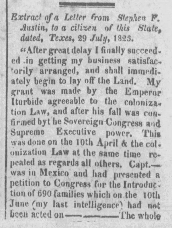
SIDEBAR: Gone to Texas
Standard 5.15: Identify the impact of important Tennesseans prior to the Civil War, including David Crockett, President James K. Polk, Sam Houston and Sequoyah.
Click here to see a Tennessee History for Kids virtual tour of the Alamo and here see a video we filmed there.
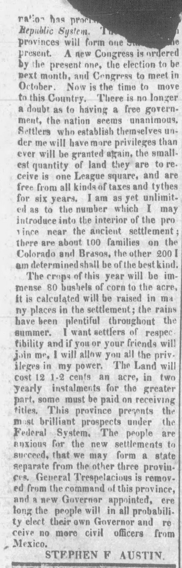
Part of the “Social Studies Practice” section of the Tennessee Social Studies Standards suggests teachers expose their students to a primary or secondary source and “summarize significant information,” “distinguish between fact and opinion,” and “recognize the authors purpose, point of view and reliability.” (SSP.002)
That being the case, click on the left and right to see the letter that Stephen F. Austin wrote in 1823 to try to encourage Tennessee citizens to move to Texas, which was published in the Fayetteville Village Messenger on November 19, 1823.
Students should be able to understand that this is a primary source. They also may be able to understand the significant information in this letter and understand Austin’s purpose in writing it.
Chapter 17: Tunnel Through the Mountain
Standard 5.16: Examine the issue of enslavement in the three grand divisions and the impact their differences had on Tennessee’ secession from the Union.

Library of Congress photo
Read more about how railroads changed the Tennessee landscape on the Franklin, Rhea and Obion County history pages.
Part of the “Social Studies Practice” section of the Tennessee Social Studies Standards suggests teachers expose their students to a primary or secondary source and “summarize significant information,” “distinguish between fact and opinion,” and “recognize the authors purpose, point of view and reliability.” (SSP.002)
The Library of Congress photograph on page 84 that shows a train depot in Nashville during the Civil War is a wonderful PRIMARY source. Click on the right to see it in more detail.
If you have ability to do so, show this photo on the classroom wall, using a projector. Ask your students the following questions:
ONE: How many locomotives can they find in this photo?
TWO: How many people?
THREE: What can you tell about the people in the photo?
FOUR: What is the building that appeared in the top right of this photo?
Chapter 18: Laws and Rebellions
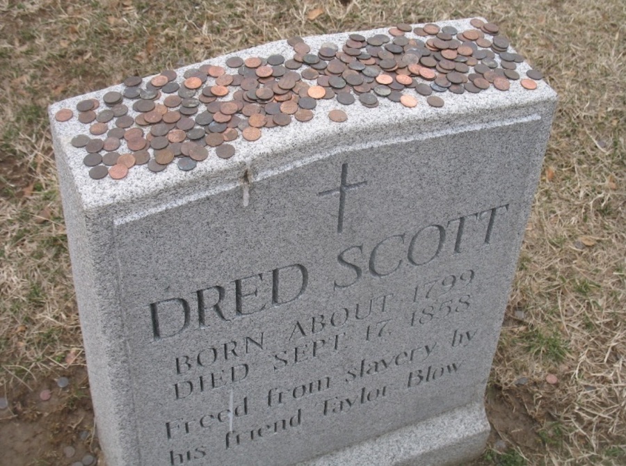
Visitors traditionally place pennies atop Dred Scott’s grave in St. Louis, Missouri.
Standard 5.16: Examine the issue of enslavement in the three grand divisions and the impact their differences had on Tennessee’ secession from the Union.
Click here for a Tennessee History for Kids virtual tour “In Search of Dred Scott.”
Click here for a column in Tennessee Magazine about Alanson Billings, a bookseller who was arrested, jailed and tried for violating Tennessee’s “anti-abolitionist” law.
Field Trips
The fall of fifth grade is a great time to take students on a Tennessee history field trip.
Among the field trip destinations your students will love, and that will increase their interest and knowledge of the subjects presented in this workbook are these (in order of time period):
The McClung Museum of Natural History and Culture, Knox County
Discovery Park of America, Obion County
Pinson Mounds State Archaeological Park, Madison County
Old Stone Fort State Archaeological Park, Coffee County
Sellers Farm State Archaeological Area, Wilson County
The Museum of the Cherokee People, North Carolina
C.H. Nash Museum at Chucalissa, Shelby County
Cumberland Gap National Historical Park, Claiborne County
Fort Loudoun State Historic Park, Monroe County
Sycamore Shoals State Historic Park, Carter County
James White’s Fort, Knox County
Blount Mansion, Knox County
Fort Southwest Point, Roane County
Sequoyah Birthplace Museum, Monroe County
The Museum of East Tennessee, Knox County
The Tennessee State Museum, Davidson County
Red Clay State Historic Park, Bradley County
The Hermitage, Davidson County
James K. Polk Home and Museum, Maury County